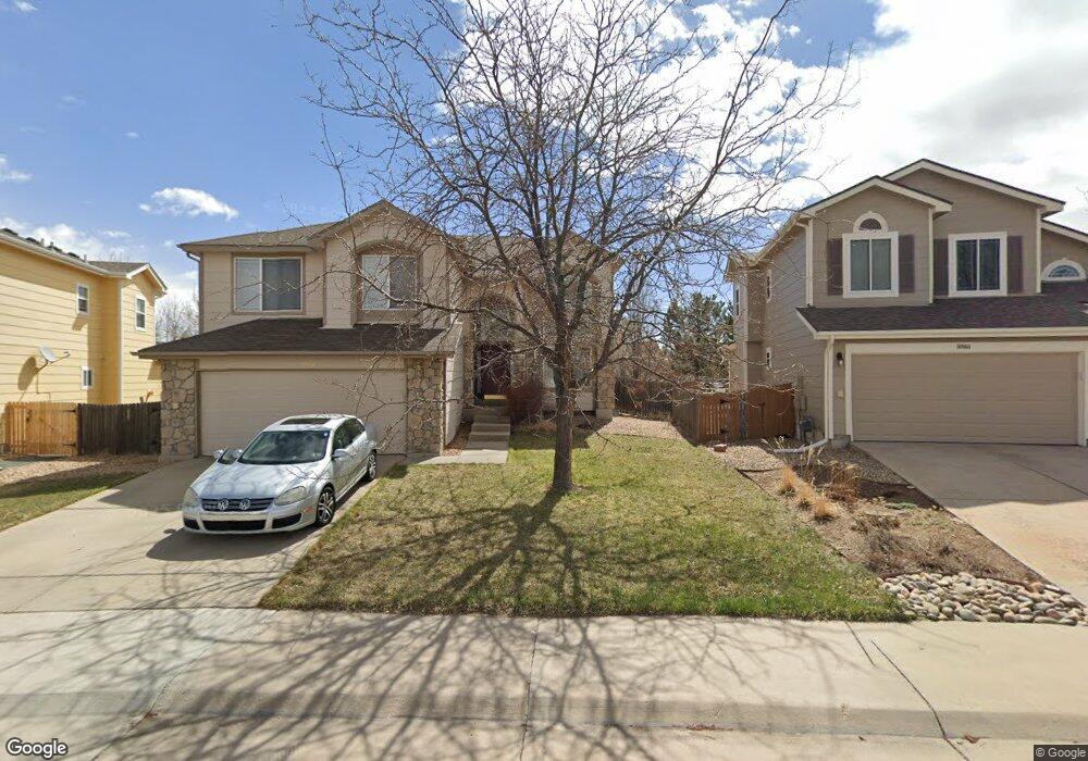
10862 Bullock Ct Parker, CO 80134
Bradbury Ranch NeighborhoodEstimated Value: $596,497 - $609,000
3
Beds
3
Baths
2,100
Sq Ft
$288/Sq Ft
Est. Value
About This Home
This home is located at 10862 Bullock Ct, Parker, CO 80134 and is currently estimated at $604,874, approximately $288 per square foot. 10862 Bullock Ct is a home located in Douglas County with nearby schools including Prairie Crossing Elementary School, Sierra Middle School, and Chaparral High School.
Ownership History
Date
Name
Owned For
Owner Type
Purchase Details
Closed on
Dec 30, 1999
Sold by
D R Horton Inc
Bought by
Castro Homer
Current Estimated Value
Home Financials for this Owner
Home Financials are based on the most recent Mortgage that was taken out on this home.
Original Mortgage
$172,000
Outstanding Balance
$51,692
Interest Rate
7.12%
Estimated Equity
$553,182
Purchase Details
Closed on
Jul 31, 1998
Sold by
Amrepco Inc
Bought by
Dr Horton Inc
Create a Home Valuation Report for This Property
The Home Valuation Report is an in-depth analysis detailing your home's value as well as a comparison with similar homes in the area
Home Values in the Area
Average Home Value in this Area
Purchase History
| Date | Buyer | Sale Price | Title Company |
|---|---|---|---|
| Castro Homer | $215,077 | North American Title | |
| Dr Horton Inc | $616,000 | -- |
Source: Public Records
Mortgage History
| Date | Status | Borrower | Loan Amount |
|---|---|---|---|
| Open | Castro Homer | $172,000 |
Source: Public Records
Tax History Compared to Growth
Tax History
| Year | Tax Paid | Tax Assessment Tax Assessment Total Assessment is a certain percentage of the fair market value that is determined by local assessors to be the total taxable value of land and additions on the property. | Land | Improvement |
|---|---|---|---|---|
| 2024 | $3,292 | $41,380 | $8,500 | $32,880 |
| 2023 | $3,332 | $41,380 | $8,500 | $32,880 |
| 2022 | $2,562 | $29,630 | $5,840 | $23,790 |
| 2021 | $2,667 | $29,630 | $5,840 | $23,790 |
| 2020 | $2,621 | $29,610 | $6,460 | $23,150 |
| 2019 | $2,638 | $29,610 | $6,460 | $23,150 |
| 2018 | $2,293 | $25,090 | $5,810 | $19,280 |
| 2017 | $2,128 | $25,090 | $5,810 | $19,280 |
| 2016 | $2,011 | $23,280 | $5,010 | $18,270 |
| 2015 | $1,024 | $23,280 | $5,010 | $18,270 |
| 2014 | $950 | $19,250 | $5,010 | $14,240 |
Source: Public Records
Map
Nearby Homes
- 16116 Martingale Dr
- 10818 Mcclellan Rd
- 16135 Peregrine Dr
- 11029 Grouse Ct
- 10834 Snowdon St
- 10828 Snowdon St
- 15902 Stringhalt Way
- 10896 Snowdon St
- 16181 White Hawk Dr
- 16641 Martingale Dr
- 10832 Tundra Top Dr
- 15733 Mccauley Dr
- 10968 Snowdon St
- 10849 Tundra Top Dr
- 10873 Tundra Top Dr
- 10858 Willow Reed Cir E
- 10730 Tomboy Dr
- Pinnacle Plan at Newlin Crossing - The Pioneer Collection
- Graham Plan at Newlin Crossing - The Monarch Collection
- Ashbrook Plan at Newlin Crossing - The Monarch Collection
- 10864 Bullock Ct
- 10854 Bullock Ct
- 16275 Peregrine Dr
- 10872 Bullock Ct
- 10852 Bullock Ct
- 16269 Peregrine Dr
- 16285 Peregrine Dr
- 10863 Bullock Ct
- 10853 Bullock Ct
- 10874 Bullock Ct
- 16239 Peregrine Dr
- 16265 Peregrine Dr
- 16295 Peregrine Dr
- 10883 Bullock Ct
- 16235 Peregrine Dr
- 16255 Peregrine Dr
- 16245 Peregrine Dr
- 10868 Mcclellan Rd
- 10858 Mcclellan Rd
- 16117 Martingale Dr