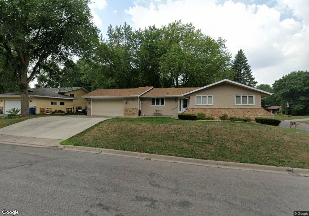
1087 2nd Ave N Sauk Rapids, MN 56379
Estimated Value: $256,000 - $302,000
5
Beds
2
Baths
1,388
Sq Ft
$196/Sq Ft
Est. Value
About This Home
This home is located at 1087 2nd Ave N, Sauk Rapids, MN 56379 and is currently estimated at $271,802, approximately $195 per square foot. 1087 2nd Ave N is a home located in Benton County with nearby schools including Pleasant View Elementary School, Sauk Rapids-Rice Middle School, and Sauk Rapids-Rice Senior High School.
Ownership History
Date
Name
Owned For
Owner Type
Purchase Details
Closed on
Nov 25, 2019
Sold by
Brudwick John S and Theisen Brudwick Konie M
Bought by
Vogel John M
Current Estimated Value
Home Financials for this Owner
Home Financials are based on the most recent Mortgage that was taken out on this home.
Original Mortgage
$185,250
Outstanding Balance
$163,325
Interest Rate
3.6%
Mortgage Type
New Conventional
Estimated Equity
$108,477
Create a Home Valuation Report for This Property
The Home Valuation Report is an in-depth analysis detailing your home's value as well as a comparison with similar homes in the area
Home Values in the Area
Average Home Value in this Area
Purchase History
| Date | Buyer | Sale Price | Title Company |
|---|---|---|---|
| Vogel John M | $195,000 | Tri County Abstract |
Source: Public Records
Mortgage History
| Date | Status | Borrower | Loan Amount |
|---|---|---|---|
| Open | Vogel John M | $185,250 |
Source: Public Records
Tax History
| Year | Tax Paid | Tax Assessment Tax Assessment Total Assessment is a certain percentage of the fair market value that is determined by local assessors to be the total taxable value of land and additions on the property. | Land | Improvement |
|---|---|---|---|---|
| 2025 | $2,618 | $235,000 | $32,600 | $202,400 |
| 2024 | $2,624 | $225,900 | $32,600 | $193,300 |
| 2023 | $2,526 | $229,600 | $32,600 | $197,000 |
| 2022 | $2,382 | $204,600 | $29,600 | $175,000 |
| 2021 | $2,192 | $178,900 | $29,600 | $149,300 |
| 2018 | $1,748 | $111,400 | $23,276 | $88,124 |
| 2017 | $1,748 | $103,700 | $22,857 | $80,843 |
| 2016 | $1,724 | $127,700 | $28,500 | $99,200 |
| 2015 | $1,728 | $94,200 | $22,261 | $71,939 |
| 2014 | -- | $89,900 | $21,974 | $67,926 |
| 2013 | -- | $92,100 | $22,113 | $69,987 |
Source: Public Records
Map
Nearby Homes
- 143 Frontier Ct
- 1043 2nd Ave N
- 709 N Benton Dr
- 365 13th St N
- TBD N Benton Dr
- 1401 4 1/2 Ave N
- 18th 18th
- 390 18th Street Ct NW
- 32608 River Vista Ln
- 870 18th St NW
- 820 18th St NW
- 720 3rd Ave N
- 405 16th St N
- 616 2nd Ave N
- 720 12th St N
- 1914 N Benton Dr
- 1954 W Highview Dr
- 1227 8th Ave N
- 1804 Oak Pond Dr
- 1806 Oak Pond Dr
- 1081 2nd Ave N
- 124 10th St N
- 203 10th St N
- 129 10th St N
- 1092 2nd Ave N
- 149 Frontier Ct
- 121 10th St N
- 120 10th St N
- 1092 4 1/2 Ave N
- 202 10th St N
- 211 10th St N
- 1098 2nd Ave N
- 1098 4 1/2 Ave N
- 1098 1098 2nd-Avenue-n
- 111 10th St N
- 137 Frontier Ct
- 128 11th St N
- 104 10th St N
- 210 10th St N
- 120 11th St N
Your Personal Tour Guide
Ask me questions while you tour the home.