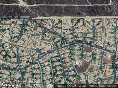
10879 Tackstem St Rancho Cucamonga, CA 91737
Estimated Value: $2,344,966 - $2,980,000
6
Beds
7
Baths
5,892
Sq Ft
$438/Sq Ft
Est. Value
About This Home
This home is located at 10879 Tackstem St, Rancho Cucamonga, CA 91737 and is currently estimated at $2,578,992, approximately $437 per square foot. 10879 Tackstem St is a home located in San Bernardino County with nearby schools including Hermosa Elementary, Vineyard Junior High, and Los Osos High.
Ownership History
Date
Name
Owned For
Owner Type
Purchase Details
Closed on
Aug 20, 2010
Sold by
Toll Ca Iv Lp
Bought by
Morris Michael Eugene and Morris Trena Dianne
Current Estimated Value
Home Financials for this Owner
Home Financials are based on the most recent Mortgage that was taken out on this home.
Original Mortgage
$136,500
Interest Rate
4.35%
Mortgage Type
Credit Line Revolving
Purchase Details
Closed on
Feb 23, 2009
Sold by
Toll Ca Iv Lp
Bought by
Toll Ca Iv Lp
Create a Home Valuation Report for This Property
The Home Valuation Report is an in-depth analysis detailing your home's value as well as a comparison with similar homes in the area
Home Values in the Area
Average Home Value in this Area
Purchase History
| Date | Buyer | Sale Price | Title Company |
|---|---|---|---|
| Morris Michael Eugene | $1,237,000 | Westminster Title | |
| Toll Ca Iv Lp | -- | Fidelity-Riverside |
Source: Public Records
Mortgage History
| Date | Status | Borrower | Loan Amount |
|---|---|---|---|
| Open | Morris Michael Eugene | $1,000,000 | |
| Closed | Morris Michael Eugene | $136,500 | |
| Closed | Morris Michael Eugene | $1,100,000 |
Source: Public Records
Tax History Compared to Growth
Tax History
| Year | Tax Paid | Tax Assessment Tax Assessment Total Assessment is a certain percentage of the fair market value that is determined by local assessors to be the total taxable value of land and additions on the property. | Land | Improvement |
|---|---|---|---|---|
| 2024 | $17,910 | $1,618,777 | $543,600 | $1,075,177 |
| 2023 | $17,508 | $1,587,036 | $532,941 | $1,054,095 |
| 2022 | $17,466 | $1,555,917 | $522,491 | $1,033,426 |
| 2021 | $17,461 | $1,525,409 | $512,246 | $1,013,163 |
| 2020 | $16,743 | $1,509,768 | $506,994 | $1,002,774 |
| 2019 | $16,936 | $1,480,165 | $497,053 | $983,112 |
| 2018 | $16,558 | $1,451,142 | $487,307 | $963,835 |
| 2017 | $15,804 | $1,422,688 | $477,752 | $944,936 |
| 2016 | $15,376 | $1,394,792 | $468,384 | $926,408 |
| 2015 | $15,279 | $1,373,840 | $461,348 | $912,492 |
| 2014 | $14,850 | $1,346,929 | $452,311 | $894,618 |
Source: Public Records
Map
Nearby Homes
- 4947 Buckskin Ct
- 4950 Paddock Place
- 10817 Carriage Dr
- 10839 Carriage Dr
- 11090 Hiddentrail Dr
- 5219 Mesada St
- 5453 Canistel Ave
- 5528 Morning Star Dr
- 5088 Mayberry Ave
- 5064 Solitude Ct
- 0 Haven Unit CV23204402
- 0 Haven Unit CV23204391
- 0 Haven Unit CV23204371
- 5020 Solitude Ct
- 10154 Sun Valley Dr
- 5404 Ridgeview Ave
- 5218 Rocky Mountain Place
- 10139 Sun Valley Dr
- 10154 Whispering Forest Dr
- 10320 Snowdrop Rd
- 10879 Tackstem St
- 10863 Tackstem St
- 5025 Rodeo Rd
- 5024 Rodeo Rd
- 4966 Buckskin Ct
- 4965 Roan Ct
- 4956 Buckskin Ct
- 4947 Roan Ct
- 5023 Corral Ct
- 4931 Sundowner Ct
- 5035 Rodeo Rd
- 5036 Rodeo Rd
- 4940 Buckskin Ct
- 5011 Corral Ct
- 5045 Rodeo Rd
- 5000 Morgan Place
- 4964 Roan Ct
- 5048 Rodeo Rd
- 4921 Sundowner Ct
- 4926 Buckskin Ct
