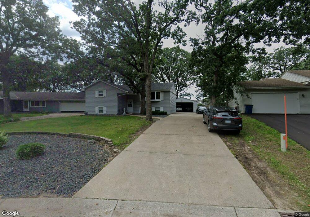
10891 133rd Cir N Champlin, MN 55316
Estimated Value: $327,000
4
Beds
2
Baths
1,224
Sq Ft
$267/Sq Ft
Est. Value
About This Home
This home is located at 10891 133rd Cir N, Champlin, MN 55316 and is currently priced at $327,000, approximately $267 per square foot. 10891 133rd Cir N is a home located in Hennepin County with nearby schools including Dayton Elementary School, Jackson Middle School, and Champlin Park High School.
Ownership History
Date
Name
Owned For
Owner Type
Purchase Details
Closed on
Dec 13, 2019
Sold by
Scioto Properties Sp 16 Llc
Bought by
Sbf2019 1 Properties Llc
Current Estimated Value
Home Financials for this Owner
Home Financials are based on the most recent Mortgage that was taken out on this home.
Original Mortgage
$44,746,000
Interest Rate
3.74%
Mortgage Type
Commercial
Purchase Details
Closed on
Oct 18, 2017
Sold by
Oliver John
Bought by
Scioto Properties Sp 16 Llc
Create a Home Valuation Report for This Property
The Home Valuation Report is an in-depth analysis detailing your home's value as well as a comparison with similar homes in the area
Home Values in the Area
Average Home Value in this Area
Purchase History
| Date | Buyer | Sale Price | Title Company |
|---|---|---|---|
| Sbf2019 1 Properties Llc | -- | None Available | |
| Scioto Properties Sp 16 Llc | -- | None Available |
Source: Public Records
Mortgage History
| Date | Status | Borrower | Loan Amount |
|---|---|---|---|
| Previous Owner | Sbf2019 1 Properties Llc | $44,746,000 |
Source: Public Records
Tax History
| Year | Tax Paid | Tax Assessment Tax Assessment Total Assessment is a certain percentage of the fair market value that is determined by local assessors to be the total taxable value of land and additions on the property. | Land | Improvement |
|---|---|---|---|---|
| 2022 | $3,394 | $300,000 | $82,000 | $218,000 |
| 2021 | $2,818 | $251,000 | $68,000 | $183,000 |
| 2020 | $2,748 | $235,000 | $59,000 | $176,000 |
| 2019 | $2,628 | $225,000 | $61,000 | $164,000 |
| 2018 | $2,488 | $213,000 | $52,000 | $161,000 |
| 2017 | $2,190 | $178,000 | $38,000 | $140,000 |
| 2016 | $2,092 | $166,000 | $44,000 | $122,000 |
| 2015 | $2,245 | $161,000 | $39,000 | $122,000 |
| 2014 | -- | $149,000 | $42,000 | $107,000 |
Source: Public Records
Map
Nearby Homes
- 13348 Linwood Forest Cir
- 13360 Wellington Cir
- 13451 Yorktown Ln N
- 12972 Bauer Dr N
- 11134 Balsam Pointe Trail
- 11186 Balsam Pointe Trail
- 11121 Balsam Pointe Trail
- 11117 Balsam Pointe Trail
- 11205 Balsam Pointe Trail
- 10300 Parkview Ln
- 701 Parkview Ln
- 11841 132nd Ave N
- 1021 Fremont St
- 413 Orleans Ct N
- 1167 Benton St
- 516 Dayton Rd
- 706 Benton St
- XXXXX Jonquil Ln N
- 719 Keniston St N
- 12411 Pineridge Way N
- 10881 133rd Cir N
- 10901 133rd Cir N
- 13331 Linwood Forest Cir
- 10871 133rd Cir N
- 10900 133rd Cir N
- 10880 133rd Cir N
- 13325 Linwood Forest Cir
- 10890 133rd Cir N
- 13332 Linwood Forest Cir
- 13356 Linwood Forest Cir
- 13156 Bauer Dr N
- 13319 Linwood Forest Cir
- 13324 Linwood Forest Cir
- 13355 Linwood Forest Cir
- 11001 134th Cir N
- 13362 Linwood Forest Cir
- 13144 Bauer Dr N
- 11011 134th Cir N
- 13233 Valley Forge Ln N
- 13313 Linwood Forest Cir