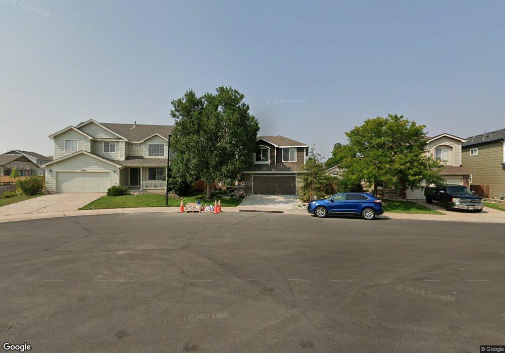
10897 Bullock Ct Parker, CO 80134
Bradbury Ranch NeighborhoodEstimated Value: $602,899 - $613,000
3
Beds
3
Baths
2,099
Sq Ft
$290/Sq Ft
Est. Value
About This Home
This home is located at 10897 Bullock Ct, Parker, CO 80134 and is currently estimated at $608,225, approximately $289 per square foot. 10897 Bullock Ct is a home located in Douglas County with nearby schools including Prairie Crossing Elementary School, Sierra Middle School, and Chaparral High School.
Ownership History
Date
Name
Owned For
Owner Type
Purchase Details
Closed on
May 28, 2024
Sold by
Ewing Steven J and Ewing Christina L
Bought by
Ewing Family Trust
Current Estimated Value
Purchase Details
Closed on
Mar 30, 2000
Sold by
D R Horton Inc
Bought by
Ewing Steven J and Ewing Christina L
Home Financials for this Owner
Home Financials are based on the most recent Mortgage that was taken out on this home.
Original Mortgage
$178,800
Interest Rate
6.87%
Purchase Details
Closed on
Jul 31, 1998
Sold by
Amrepco Inc
Bought by
Dr Horton Inc
Create a Home Valuation Report for This Property
The Home Valuation Report is an in-depth analysis detailing your home's value as well as a comparison with similar homes in the area
Home Values in the Area
Average Home Value in this Area
Purchase History
| Date | Buyer | Sale Price | Title Company |
|---|---|---|---|
| Ewing Family Trust | -- | None Listed On Document | |
| Ewing Steven J | $216,863 | North American Title | |
| Dr Horton Inc | $616,000 | -- |
Source: Public Records
Mortgage History
| Date | Status | Borrower | Loan Amount |
|---|---|---|---|
| Previous Owner | Ewing Steven J | $178,800 |
Source: Public Records
Tax History Compared to Growth
Tax History
| Year | Tax Paid | Tax Assessment Tax Assessment Total Assessment is a certain percentage of the fair market value that is determined by local assessors to be the total taxable value of land and additions on the property. | Land | Improvement |
|---|---|---|---|---|
| 2024 | $3,383 | $42,410 | $8,910 | $33,500 |
| 2023 | $3,424 | $42,410 | $8,910 | $33,500 |
| 2022 | $2,614 | $30,230 | $6,070 | $24,160 |
| 2021 | $2,722 | $30,230 | $6,070 | $24,160 |
| 2020 | $2,673 | $30,190 | $6,690 | $23,500 |
| 2019 | $2,689 | $30,190 | $6,690 | $23,500 |
| 2018 | $2,344 | $25,650 | $6,030 | $19,620 |
| 2017 | $2,175 | $25,650 | $6,030 | $19,620 |
| 2016 | $2,042 | $23,640 | $5,010 | $18,630 |
| 2015 | $1,040 | $23,640 | $5,010 | $18,630 |
| 2014 | $976 | $19,790 | $5,010 | $14,780 |
Source: Public Records
Map
Nearby Homes
- 16116 Martingale Dr
- 16135 Peregrine Dr
- 10818 Mcclellan Rd
- 10834 Snowdon St
- 10828 Snowdon St
- 11029 Grouse Ct
- 15902 Stringhalt Way
- 10896 Snowdon St
- 10832 Tundra Top Dr
- 16181 White Hawk Dr
- 15733 Mccauley Dr
- 10968 Snowdon St
- 10849 Tundra Top Dr
- 10873 Tundra Top Dr
- 10730 Tomboy Dr
- Pinnacle Plan at Newlin Crossing - The Pioneer Collection
- Graham Plan at Newlin Crossing - The Monarch Collection
- Ashbrook Plan at Newlin Crossing - The Monarch Collection
- Evans Plan at Newlin Crossing - The Pioneer Collection
- Stonehaven Plan at Newlin Crossing - The Monarch Collection
- 10895 Bullock Ct
- 10899 Bullock Ct
- 16127 Martingale Dr
- 10893 Bullock Ct
- 16121 Martingale Dr
- 16131 Martingale Dr
- 16117 Martingale Dr
- 10883 Bullock Ct
- 16137 Martingale Dr
- 10894 Bullock Ct
- 10898 Bullock Ct
- 10856 Hayloft St
- 10892 Bullock Ct
- 10863 Bullock Ct
- 10848 Hayloft St
- 10842 Hayloft St
- 10853 Bullock Ct
- 10884 Bullock Ct
- 16141 Martingale Dr
- 16120 Martingale Dr