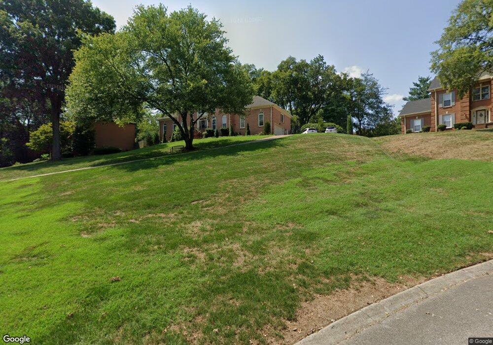
109 Brookline Ct Franklin, TN 37069
Estimated Value: $886,532 - $1,030,000
--
Bed
4
Baths
3,291
Sq Ft
$298/Sq Ft
Est. Value
About This Home
This home is located at 109 Brookline Ct, Franklin, TN 37069 and is currently estimated at $981,883, approximately $298 per square foot. 109 Brookline Ct is a home located in Williamson County with nearby schools including Grassland Elementary School, Grassland Middle School, and Franklin High School.
Ownership History
Date
Name
Owned For
Owner Type
Purchase Details
Closed on
Nov 1, 2024
Sold by
Leuzinger Christopher J and Leuzinger Mary E
Bought by
Christopher And Mary Leuzinger Living Trust and Leuzinger
Current Estimated Value
Purchase Details
Closed on
Sep 29, 2000
Sold by
Mosley David H and Mosley Anne T
Bought by
Leuzinger Christopher J and Leuzinger Mary E
Home Financials for this Owner
Home Financials are based on the most recent Mortgage that was taken out on this home.
Original Mortgage
$100,000
Interest Rate
7.79%
Purchase Details
Closed on
May 16, 1994
Sold by
John Anderson and John Cheryl C
Bought by
David Mosley and David Anne H
Create a Home Valuation Report for This Property
The Home Valuation Report is an in-depth analysis detailing your home's value as well as a comparison with similar homes in the area
Home Values in the Area
Average Home Value in this Area
Purchase History
| Date | Buyer | Sale Price | Title Company |
|---|---|---|---|
| Christopher And Mary Leuzinger Living Trust | -- | None Listed On Document | |
| Leuzinger Christopher J | $291,000 | Bankers Title & Escrow Corp | |
| David Mosley | $269,000 | -- |
Source: Public Records
Mortgage History
| Date | Status | Borrower | Loan Amount |
|---|---|---|---|
| Previous Owner | Leuzinger Christopher J | $100,000 |
Source: Public Records
Tax History Compared to Growth
Tax History
| Year | Tax Paid | Tax Assessment Tax Assessment Total Assessment is a certain percentage of the fair market value that is determined by local assessors to be the total taxable value of land and additions on the property. | Land | Improvement |
|---|---|---|---|---|
| 2024 | $2,555 | $135,925 | $31,250 | $104,675 |
| 2023 | $2,555 | $135,925 | $31,250 | $104,675 |
| 2022 | $2,555 | $135,925 | $31,250 | $104,675 |
| 2021 | $2,555 | $135,925 | $31,250 | $104,675 |
| 2020 | $2,425 | $109,250 | $23,750 | $85,500 |
| 2019 | $2,425 | $109,250 | $23,750 | $85,500 |
| 2018 | $2,349 | $109,250 | $23,750 | $85,500 |
| 2017 | $2,349 | $109,250 | $23,750 | $85,500 |
| 2016 | $2,349 | $109,250 | $23,750 | $85,500 |
| 2015 | -- | $92,250 | $21,250 | $71,000 |
| 2014 | -- | $92,250 | $21,250 | $71,000 |
Source: Public Records
Map
Nearby Homes
- 6211 Temple Rd
- 238 Saint Andrews Dr
- 405 Wexford Ct
- 159 N Berwick Ln
- 156 N Berwick Ln
- 162 N Berwick Ln
- 123 Saint Andrews Dr
- 230 Temple Crest Trail
- 137 Timberline Dr
- 424 Sandcastle Rd
- 412 Sandcastle Rd
- 6521 Stableford Ln
- 416 Winchester Dr
- 212 Timberline Ct
- 720 Wild Timber Ct
- 809 Sneed Rd W
- 808 Carsten St
- 917 Dauphine St
- 6613 Hastings Ln
- 210 Green Rd
- 105 Brookline Ct
- 113 Brookline Ct
- 218 Augusta National Ct
- 117 Brookline Ct
- 212 Augusta National Ct
- 104 Brookline Ct
- 108 Brookline Ct
- 278 Saint Andrews Dr
- 284 Saint Andrews Dr
- 208 Augusta National Ct
- 112 Brookline Ct
- 116 Brookline Ct
- 221 Augusta National Ct
- 266 Saint Andrews Dr
- 200 Augusta National Ct
- 262 Saint Andrews Dr
- 258 Saint Andrews Dr
- 217 Augusta National Ct
- 285 Saint Andrews Dr
- 213 Augusta National Ct