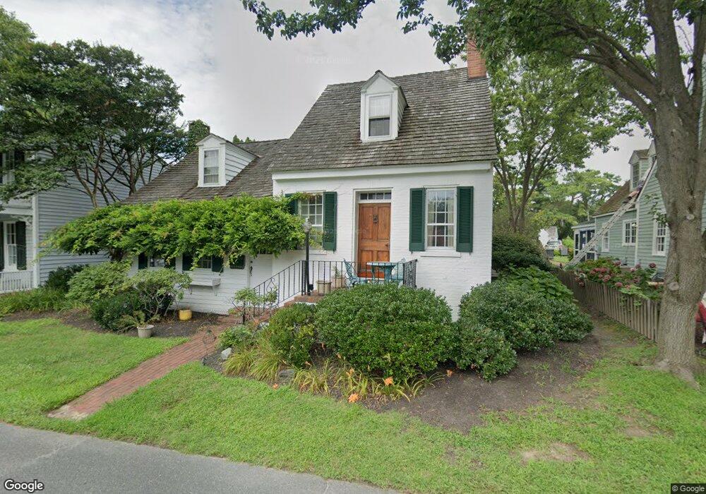
109 Green St Saint Michaels, MD 21663
Estimated Value: $694,000 - $925,000
3
Beds
3
Baths
2,025
Sq Ft
$396/Sq Ft
Est. Value
About This Home
This home is located at 109 Green St, Saint Michaels, MD 21663 and is currently estimated at $802,147, approximately $396 per square foot. 109 Green St is a home located in Talbot County with nearby schools including St. Michaels Elementary School, St. Michaels Middle/High School, and Easton High School.
Ownership History
Date
Name
Owned For
Owner Type
Purchase Details
Closed on
Jan 22, 2020
Sold by
Allen Judith J and The Theodore M Allen Trust
Bought by
Regan Nathan Kayne and Fregiato Christopher J
Current Estimated Value
Home Financials for this Owner
Home Financials are based on the most recent Mortgage that was taken out on this home.
Original Mortgage
$286,000
Outstanding Balance
$253,323
Interest Rate
3.73%
Mortgage Type
New Conventional
Estimated Equity
$548,824
Purchase Details
Closed on
Sep 29, 2003
Sold by
Allen Theodore M
Bought by
Allen Theodore M and Allen Judith J Trustees Etal
Purchase Details
Closed on
Jun 2, 2003
Sold by
Allen Theodore Trustee
Bought by
Allen Theodore M and Allen Donald T T
Create a Home Valuation Report for This Property
The Home Valuation Report is an in-depth analysis detailing your home's value as well as a comparison with similar homes in the area
Home Values in the Area
Average Home Value in this Area
Purchase History
| Date | Buyer | Sale Price | Title Company |
|---|---|---|---|
| Regan Nathan Kayne | $357,500 | Eastern Shore Title Company | |
| Allen Theodore M | -- | -- | |
| Allen Theodore M | -- | -- |
Source: Public Records
Mortgage History
| Date | Status | Borrower | Loan Amount |
|---|---|---|---|
| Open | Regan Nathan Kayne | $286,000 |
Source: Public Records
Tax History Compared to Growth
Tax History
| Year | Tax Paid | Tax Assessment Tax Assessment Total Assessment is a certain percentage of the fair market value that is determined by local assessors to be the total taxable value of land and additions on the property. | Land | Improvement |
|---|---|---|---|---|
| 2025 | $6,412 | $536,300 | $377,000 | $159,300 |
| 2024 | $6,412 | $519,300 | $0 | $0 |
| 2023 | $5,965 | $502,300 | $0 | $0 |
| 2022 | $5,564 | $485,300 | $320,500 | $164,800 |
| 2021 | $5,251 | $468,267 | $0 | $0 |
| 2020 | $5,125 | $451,233 | $0 | $0 |
| 2019 | $4,932 | $434,200 | $265,400 | $168,800 |
| 2018 | $4,735 | $428,500 | $0 | $0 |
| 2017 | $4,138 | $422,800 | $0 | $0 |
| 2016 | $4,014 | $417,100 | $0 | $0 |
| 2015 | $5,108 | $417,100 | $0 | $0 |
| 2014 | $5,108 | $417,100 | $0 | $0 |
Source: Public Records
Map
Nearby Homes
- 100 Grace St
- 107 E Chestnut St
- 222 E Chestnut St
- 102 Gloria Ave
- 216 E Chew Ave
- 25500 Chance Farm Rd
- 408 Spinnaker Ln
- 207 Dodson Ave
- 0 Grace St Unit MDTA2012346
- 209 Webb Ln
- 704 Meadow St
- Lot 16A Meadow St
- 300 Perry St
- 105 Seymour Ave
- 216 Brooks Ln
- 807 Radcliff Ave
- 912 Calvert Ave
- 228 Tyler Ave
- 24390 Oakwood Park Rd
- 9171 Deepwater Point Rd