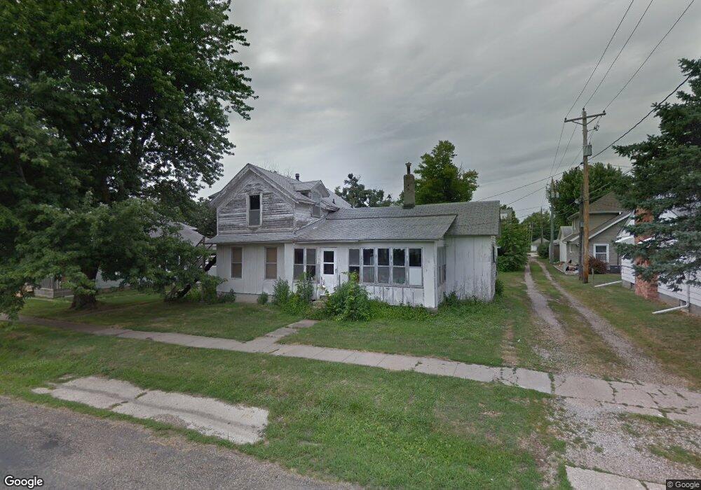
109 W Franklin St Monroe, IA 50170
Estimated Value: $138,000 - $162,000
2
Beds
1
Bath
960
Sq Ft
$155/Sq Ft
Est. Value
About This Home
This home is located at 109 W Franklin St, Monroe, IA 50170 and is currently estimated at $148,752, approximately $154 per square foot. 109 W Franklin St is a home with nearby schools including PCM High School.
Ownership History
Date
Name
Owned For
Owner Type
Purchase Details
Closed on
Jul 31, 2023
Sold by
Firm Foundations Inc
Bought by
Pendroy Lauren
Current Estimated Value
Home Financials for this Owner
Home Financials are based on the most recent Mortgage that was taken out on this home.
Original Mortgage
$127,500
Outstanding Balance
$124,518
Interest Rate
6.67%
Mortgage Type
New Conventional
Estimated Equity
$24,234
Purchase Details
Closed on
Jun 1, 2022
Sold by
Vanryswyk and Kay
Bought by
Firm Foundations Inc
Create a Home Valuation Report for This Property
The Home Valuation Report is an in-depth analysis detailing your home's value as well as a comparison with similar homes in the area
Home Values in the Area
Average Home Value in this Area
Purchase History
| Date | Buyer | Sale Price | Title Company |
|---|---|---|---|
| Pendroy Lauren | $134,875 | None Listed On Document | |
| Firm Foundations Inc | $20,000 | Abendroth Russell Barnett Law |
Source: Public Records
Mortgage History
| Date | Status | Borrower | Loan Amount |
|---|---|---|---|
| Open | Pendroy Lauren | $127,500 |
Source: Public Records
Tax History Compared to Growth
Tax History
| Year | Tax Paid | Tax Assessment Tax Assessment Total Assessment is a certain percentage of the fair market value that is determined by local assessors to be the total taxable value of land and additions on the property. | Land | Improvement |
|---|---|---|---|---|
| 2025 | $1,986 | $137,890 | $12,800 | $125,090 |
| 2024 | $1,986 | $123,450 | $12,800 | $110,650 |
| 2023 | $194 | $86,850 | $12,800 | $74,050 |
| 2022 | $194 | $10,240 | $10,240 | $0 |
| 2021 | $138 | $10,240 | $10,240 | $0 |
| 2020 | $138 | $6,570 | $6,570 | $0 |
| 2019 | $132 | $5,970 | $0 | $0 |
| 2018 | $132 | $5,970 | $0 | $0 |
| 2017 | $408 | $18,620 | $0 | $0 |
| 2016 | $408 | $18,620 | $0 | $0 |
| 2015 | $386 | $21,790 | $0 | $0 |
| 2014 | $434 | $24,030 | $0 | $0 |
Source: Public Records
Map
Nearby Homes
- 601 N Commerce St
- 413 N Buchanan St
- 313 E Lincoln St
- 410 E Washington St
- 701 W Washington St
- 606 W South St
- 203 W Pleasant St
- 302 Big Bluestem Dr
- 104 Meadowlark Dr
- 309 Coneflower Ct
- 305-307 Coneflower Ct
- 206 Beverly Cir
- 202 Meadowlark Dr
- 424 Newton St
- 9327 Highway F70 W
- 108 Terrace Dr
- 1818 Elk Horn Ct
- 7404 Sioux Ave
- 502 E Kayla Ln
- 803 Carly Ln
- 107 W Franklin St
- 113 W Franklin St
- 110 W Franklin St
- 402 York St
- 406 N Commerce St
- 105 W Franklin St
- 110 W Lincoln St
- 314 N Commerce St
- 114 W Lincoln St
- 414 N Commerce St
- 312 N Commerce St
- 410 N York St
- 314 N York St
- 109 W Iowa St
- 305 N Commerce St
- 401 N Commerce St
- 414 N York St
- 306 N York St
- 315 N Commerce St
- 301 N York St