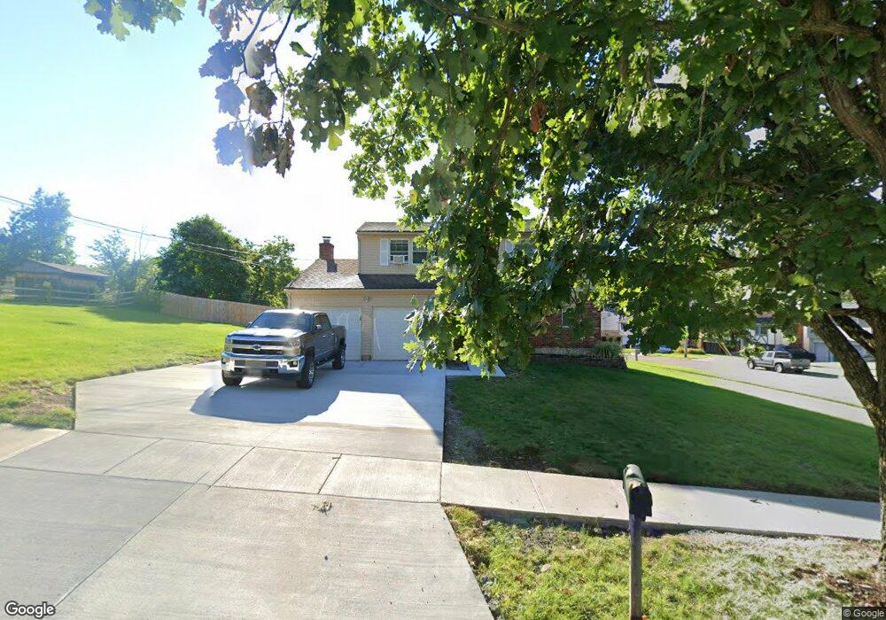
1090 Bandanna Dr Cincinnati, OH 45238
Central Delhi NeighborhoodEstimated Value: $258,184 - $303,000
4
Beds
2
Baths
1,600
Sq Ft
$177/Sq Ft
Est. Value
About This Home
This home is located at 1090 Bandanna Dr, Cincinnati, OH 45238 and is currently estimated at $282,546, approximately $176 per square foot. 1090 Bandanna Dr is a home located in Hamilton County with nearby schools including C.O. Harrison Elementary School, Rapid Run Middle School, and Oak Hills High School.
Ownership History
Date
Name
Owned For
Owner Type
Purchase Details
Closed on
Oct 30, 2002
Sold by
Sierra Shawn E and Sierra Kimberly S
Bought by
Biggs Randy and Biggs Jennifer
Current Estimated Value
Home Financials for this Owner
Home Financials are based on the most recent Mortgage that was taken out on this home.
Original Mortgage
$110,000
Outstanding Balance
$46,277
Interest Rate
6.08%
Estimated Equity
$236,269
Purchase Details
Closed on
Apr 10, 2002
Sold by
Paolo David
Bought by
Sierra Shawn E
Home Financials for this Owner
Home Financials are based on the most recent Mortgage that was taken out on this home.
Original Mortgage
$103,570
Interest Rate
6.93%
Purchase Details
Closed on
Jan 9, 2002
Sold by
Avtar Gill and Avtar Suzanne
Bought by
Paolo David
Create a Home Valuation Report for This Property
The Home Valuation Report is an in-depth analysis detailing your home's value as well as a comparison with similar homes in the area
Home Values in the Area
Average Home Value in this Area
Purchase History
| Date | Buyer | Sale Price | Title Company |
|---|---|---|---|
| Biggs Randy | $150,000 | -- | |
| Sierra Shawn E | $89,800 | -- | |
| Paolo David | $70,000 | -- |
Source: Public Records
Mortgage History
| Date | Status | Borrower | Loan Amount |
|---|---|---|---|
| Open | Biggs Randy | $110,000 | |
| Previous Owner | Sierra Shawn E | $103,570 | |
| Closed | Biggs Randy | $32,500 |
Source: Public Records
Tax History Compared to Growth
Tax History
| Year | Tax Paid | Tax Assessment Tax Assessment Total Assessment is a certain percentage of the fair market value that is determined by local assessors to be the total taxable value of land and additions on the property. | Land | Improvement |
|---|---|---|---|---|
| 2024 | $4,191 | $68,709 | $10,255 | $58,454 |
| 2023 | $4,128 | $68,709 | $10,255 | $58,454 |
| 2022 | $3,383 | $50,117 | $9,135 | $40,982 |
| 2021 | $3,379 | $50,117 | $9,135 | $40,982 |
| 2020 | $3,345 | $50,117 | $9,135 | $40,982 |
| 2019 | $3,222 | $43,204 | $7,875 | $35,329 |
| 2018 | $3,224 | $43,204 | $7,875 | $35,329 |
| 2017 | $2,954 | $43,204 | $7,875 | $35,329 |
| 2016 | $3,179 | $46,089 | $8,313 | $37,776 |
| 2015 | $3,140 | $46,089 | $8,313 | $37,776 |
| 2014 | $3,139 | $46,089 | $8,313 | $37,776 |
| 2013 | $3,113 | $48,514 | $8,750 | $39,764 |
Source: Public Records
Map
Nearby Homes
- 5435 Lariat Dr
- 5312 Panther Ct
- 5449 Dengail Dr
- 949 Anderson Ferry Rd
- 5271 Highview Dr
- 784 Woodyhill Dr
- 5341 Carefree Ct
- 5176 Dundas Dr
- 5152 Highview Dr
- 1650 Colonial Dr
- 1015 Woodbriar Ln
- 5140 Willnet Dr
- 1818 Linneman Rd
- 1833 Leona Dr
- 1141 Covedale Ave
- 553 Starling Ct
- 5114 Cleves Warsaw Pike
- 815 Neeb Rd
- 5318 Sidney Rd
- 5132 Ralph Ave
- 5442 Casual Ct
- 5445 Boutique Ct
- 5436 Casual Ct
- 5449 Casual Ct
- 5437 Boutique Ct
- 5443 Casual Ct
- 5430 Casual Ct
- 1087 Bandanna Dr
- 1095 Bandanna Dr
- 1079 Bandanna Dr
- 5437 Casual Ct
- 1103 Bandanna Dr
- 1071 Bandanna Dr
- 5433 Boutique Ct
- 5431 Casual Ct
- 1060 Bandanna Dr
- 1119 Bandanna Dr
- 1111 Bandanna Dr
- 5424 Casual Ct
- 1063 Bandanna Dr