Estimated Value: $614,000 - $653,000
4
Beds
3
Baths
2,338
Sq Ft
$272/Sq Ft
Est. Value
About This Home
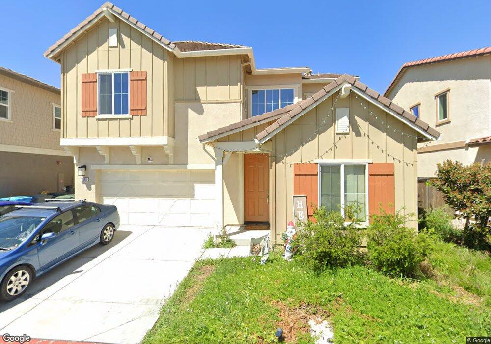
This home is located at 1090 St Olaf Ct, Dixon, CA 95620 and is currently estimated at $635,042, approximately $271 per square foot. 1090 St Olaf Ct is a home with nearby schools including Anderson (Linford L.) Elementary School, Dixon High School, and Dixon Montessori Charter.
Ownership History
Date
Name
Owned For
Owner Type
Purchase Details
Closed on
Aug 11, 2020
Sold by
D R Horton Ca2 Inc
Bought by
Lotspeich Kevon E and Albino Maria Isabel
Current Estimated Value
Home Financials for this Owner
Home Financials are based on the most recent Mortgage that was taken out on this home.
Original Mortgage
$506,748
Outstanding Balance
$448,683
Interest Rate
2.9%
Mortgage Type
VA
Estimated Equity
$186,359
Purchase Details
Closed on
Nov 25, 2019
Sold by
Forestar Usa Real Estate Group Inc
Bought by
D R Horton Ca2 Inc
Purchase Details
Closed on
Oct 16, 2019
Sold by
Brookfield Dixon Llc
Bought by
Forestar Real Estate Group Inc
Create a Home Valuation Report for This Property
The Home Valuation Report is an in-depth analysis detailing your home's value as well as a comparison with similar homes in the area
Home Values in the Area
Average Home Value in this Area
Purchase History
| Date | Buyer | Sale Price | Title Company |
|---|---|---|---|
| Lotspeich Kevon E | $495,500 | First American Title Company | |
| D R Horton Ca2 Inc | $1,217,000 | First American Title Company | |
| Forestar Real Estate Group Inc | $4,800,000 | First American Title |
Source: Public Records
Mortgage History
| Date | Status | Borrower | Loan Amount |
|---|---|---|---|
| Open | Lotspeich Kevon E | $506,748 |
Source: Public Records
Tax History Compared to Growth
Tax History
| Year | Tax Paid | Tax Assessment Tax Assessment Total Assessment is a certain percentage of the fair market value that is determined by local assessors to be the total taxable value of land and additions on the property. | Land | Improvement |
|---|---|---|---|---|
| 2025 | $8,771 | $536,127 | $162,364 | $373,763 |
| 2024 | $8,771 | $525,616 | $159,181 | $366,435 |
| 2023 | $8,701 | $515,310 | $156,060 | $359,250 |
| 2022 | $8,553 | $505,206 | $153,000 | $352,206 |
| 2021 | $8,438 | $495,300 | $150,000 | $345,300 |
| 2020 | $4,172 | $121,680 | $121,680 | $0 |
| 2019 | $336 | $15,575 | $15,575 | $0 |
| 2018 | $330 | $15,270 | $15,270 | $0 |
| 2017 | $714 | $14,971 | $14,971 | $0 |
Source: Public Records
Map
Nearby Homes
- 1090 Davidson Ct
- 1100 Davidson Ct
- 570 Syracuse Ln
- 1225 Columbia Dr
- 440 Vanderbilt Dr
- 1225 Dartmouth Cir
- 1235 Baylor Way
- 1320 Cornell Dr
- 205 W Cherry St
- 1305 Valley Glen Dr
- 241 S 1st St
- 1565 Halsey Ct
- 865 Camelia Dr
- 650 Marvin Way
- 700 W A St
- 970 Camelia Dr
- 720 E Creekside Cir
- 755 East Ct
- 741 W D St S
- 255 Alderglen Dr
- 1100 St Olaf Ct
- 1095 Swarthmore Ct
- 1085 Swarthmore Ct
- 1095 St Olaf Ct
- 1070 Saint Olaf Ct
- 1085 St Olaf Ct
- 1105 St Olaf Ct
- 1075 Swarthmore Ct
- 1060 St Olaf Ct
- 1065 Swarthmore Ct Unit 1065 Swarthmore Ct
- 1065 Swarthmore Ct
- 1065 St Olaf Ct
- 550 Syracuse Ln
- 1090 Swarthmore Ct
- 540 Syracuse Ln
- 1080 Swarthmore Ct
- 1100 Swarthmore Ct
- 560 Syracuse Ln
- 530 Syracuse Ln