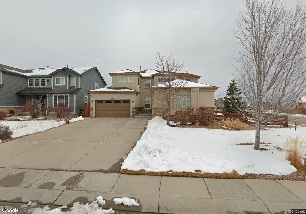
10907 Huron Peak Place Peyton, CO 80831
Falcon NeighborhoodEstimated Value: $597,168 - $684,000
5
Beds
5
Baths
2,857
Sq Ft
$223/Sq Ft
Est. Value
About This Home
This home is located at 10907 Huron Peak Place, Peyton, CO 80831 and is currently estimated at $638,292, approximately $223 per square foot. 10907 Huron Peak Place is a home located in El Paso County with nearby schools including Meridian Ranch International School, Falcon Middle School, and Falcon High School.
Ownership History
Date
Name
Owned For
Owner Type
Purchase Details
Closed on
Nov 29, 2007
Sold by
Lennar Colorado Llc
Bought by
Madsen Jason S
Current Estimated Value
Home Financials for this Owner
Home Financials are based on the most recent Mortgage that was taken out on this home.
Original Mortgage
$315,065
Outstanding Balance
$200,759
Interest Rate
6.43%
Mortgage Type
VA
Estimated Equity
$437,533
Create a Home Valuation Report for This Property
The Home Valuation Report is an in-depth analysis detailing your home's value as well as a comparison with similar homes in the area
Home Values in the Area
Average Home Value in this Area
Purchase History
| Date | Buyer | Sale Price | Title Company |
|---|---|---|---|
| Madsen Jason S | $305,000 | North American Title |
Source: Public Records
Mortgage History
| Date | Status | Borrower | Loan Amount |
|---|---|---|---|
| Open | Madsen Jason S | $315,065 |
Source: Public Records
Tax History Compared to Growth
Tax History
| Year | Tax Paid | Tax Assessment Tax Assessment Total Assessment is a certain percentage of the fair market value that is determined by local assessors to be the total taxable value of land and additions on the property. | Land | Improvement |
|---|---|---|---|---|
| 2025 | $4,109 | $43,050 | -- | -- |
| 2024 | $3,976 | $43,780 | $7,200 | $36,580 |
| 2022 | $3,020 | $29,920 | $5,910 | $24,010 |
| 2021 | $3,130 | $30,780 | $6,080 | $24,700 |
| 2020 | $3,245 | $29,590 | $5,510 | $24,080 |
| 2019 | $3,227 | $29,590 | $5,510 | $24,080 |
| 2018 | $2,901 | $26,330 | $5,040 | $21,290 |
| 2017 | $2,744 | $26,330 | $5,040 | $21,290 |
| 2016 | $2,899 | $28,490 | $5,570 | $22,920 |
| 2015 | $2,749 | $27,000 | $5,570 | $21,430 |
| 2014 | $2,531 | $24,550 | $4,780 | $19,770 |
Source: Public Records
Map
Nearby Homes
- 10932 Huron Peak Place
- 10965 Long Summer Ct
- 10973 Torreys Peak Way
- 10853 Torreys Peak Way
- 12692 Clark Peak Ct
- 12708 Sunrise Ridge Dr
- 12756 Sunrise Ridge Dr
- 13027 Sunrise Ridge Dr
- 12698 Culebra Peak Dr
- 10603 Ross Lake Dr
- 12804 Clark Peak Ct
- 12667 Wheeler Peak Dr
- 10751 Shavano Peak Ct
- 11134 Lobo Peak Dr
- 12695 Black Hills Dr
- 10677 Greenbelt Dr
- 10433 Capital Peak Way
- 10641 Greenbelt Dr
- 12150 Fox Brush Dr
- 10601 Rainbow Bridge Dr
- 10915 Huron Peak Place
- 10987 Mount Evans Dr
- 10923 Huron Peak Place
- 10891 Huron Peak Place
- 10977 Mount Evans Dr
- 10905 Long Summer Ct
- 10906 Long Summer Ct
- 10908 Huron Peak Place
- 10931 Huron Peak Place
- 10916 Huron
- 10916 Huron Peak Place
- 10892 Huron Peak Place
- 10875 Huron Peak Place
- 10967 Mount Evans Dr
- 10968 Mount Evans Dr
- 10924 Huron Peak Place
- 10935 Long Summer Ct
- 10884 Huron Peak Place
- 10936 Long Summer Ct
- 10939 Huron Peak Place