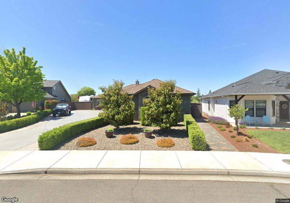
1091 Oak Grove Ct Eagle Point, OR 97524
Estimated Value: $678,000 - $760,000
4
Beds
3
Baths
2,658
Sq Ft
$267/Sq Ft
Est. Value
About This Home
This home is located at 1091 Oak Grove Ct, Eagle Point, OR 97524 and is currently estimated at $710,750, approximately $267 per square foot. 1091 Oak Grove Ct is a home located in Jackson County with nearby schools including Eagle Point Middle School, White Mountain Middle School, and Eagle Point High School.
Ownership History
Date
Name
Owned For
Owner Type
Purchase Details
Closed on
Jan 22, 2025
Sold by
Neussl Paul R and Neussl Judy K
Bought by
Neussl Living Trust and Neussl
Current Estimated Value
Purchase Details
Closed on
Feb 24, 2005
Sold by
Eagle Ridge Building & Design Inc
Bought by
Eagle Ridge Building & Design Inc
Purchase Details
Closed on
Jul 5, 2001
Sold by
Eagle Point Developments Llc
Bought by
Eagle Ridge Building & Design Inc and Ljungren David A
Create a Home Valuation Report for This Property
The Home Valuation Report is an in-depth analysis detailing your home's value as well as a comparison with similar homes in the area
Home Values in the Area
Average Home Value in this Area
Purchase History
| Date | Buyer | Sale Price | Title Company |
|---|---|---|---|
| Neussl Living Trust | -- | None Listed On Document | |
| Eagle Ridge Building & Design Inc | $147,000 | Lawyers Title Ins | |
| Eagle Ridge Building & Design Inc | $77,310 | Jackson County Title |
Source: Public Records
Tax History
| Year | Tax Paid | Tax Assessment Tax Assessment Total Assessment is a certain percentage of the fair market value that is determined by local assessors to be the total taxable value of land and additions on the property. | Land | Improvement |
|---|---|---|---|---|
| 2026 | $6,263 | $431,330 | $128,000 | $303,330 |
| 2025 | $6,116 | $446,930 | $115,700 | $331,230 |
| 2024 | $6,116 | $433,920 | $112,330 | $321,590 |
| 2023 | $5,908 | $421,290 | $109,060 | $312,230 |
| 2022 | $5,747 | $421,290 | $109,060 | $312,230 |
| 2021 | $5,577 | $409,020 | $105,880 | $303,140 |
| 2020 | $5,924 | $397,110 | $102,790 | $294,320 |
| 2019 | $5,834 | $374,330 | $96,890 | $277,440 |
| 2018 | $5,723 | $363,430 | $94,060 | $269,370 |
| 2017 | $5,582 | $363,430 | $94,060 | $269,370 |
| 2016 | $4,642 | $290,510 | $81,540 | $208,970 |
| 2015 | $1,245 | $336,760 | $81,540 | $255,220 |
| 2014 | $1,198 | $76,860 | $76,860 | $0 |
Source: Public Records
Map
Nearby Homes
- 888 Arrowhead Trail
- 964 Pumpkin Ridge
- 936 Arrowhead Trail
- 995 Pumpkin Ridge
- 131 Spanish Bay Ct
- 997 Arrowhead Trail
- 621 S Shasta Ave
- 235 Prairie Landing Dr
- 1043 Arrowhead Trail
- 19 Pine Ct
- 522 Meadow Ln
- 0 Echo Way Unit Tax Lot 902
- 0 Echo Way Unit 220215112
- 0 Echo Way Unit Tax Lot 901
- 0 Echo Way Unit Tax Lot 900
- 407 S Shasta Ave
- 421 Stevens Rd Unit 20
- 421 Stevens Rd Unit 14
- 421 Stevens Rd Unit 52
- 74 Eagle View Dr
- 1097 Oak Grove Ct
- 1085 Oak Grove Ct
- 1099 Oak Grove Ct
- 1094 Oak Grove Ct
- 840 St Andrews Way
- 848 St Andrews Way
- 839 Saint Andrews Way
- 834 St Andrews Way
- 833 St Andrews Way
- 845 St Andrews Way
- 851 St Andrews Way
- 854 St Andrews Way
- 828 St Andrews Lot 139 Way
- 828 St Andrews Way
- 827 St Andrews Way
- 827 Saint Andrews Way
- 857 St Andrews Way
- 35 Aspen Ct
- 860 St Andrews Way
- 41 Aspen Ct
Your Personal Tour Guide
Ask me questions while you tour the home.