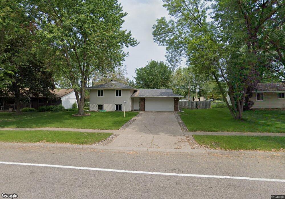
1091 Whitney Dr Saint Paul, MN 55124
Old Town NeighborhoodEstimated Value: $346,000 - $377,000
4
Beds
2
Baths
872
Sq Ft
$415/Sq Ft
Est. Value
About This Home
This home is located at 1091 Whitney Dr, Saint Paul, MN 55124 and is currently estimated at $362,246, approximately $415 per square foot. 1091 Whitney Dr is a home located in Dakota County with nearby schools including Southview Elementary School, Valley Middle School, and Apple Valley Senior High School.
Ownership History
Date
Name
Owned For
Owner Type
Purchase Details
Closed on
Sep 14, 2011
Sold by
Fannie Mae
Bought by
Nagano Marco
Current Estimated Value
Home Financials for this Owner
Home Financials are based on the most recent Mortgage that was taken out on this home.
Original Mortgage
$7,087
Outstanding Balance
$4,843
Interest Rate
4.14%
Mortgage Type
Unknown
Estimated Equity
$357,403
Purchase Details
Closed on
Aug 27, 1996
Sold by
Donahue Amy B
Bought by
Pietrzak Jason D and Pietrzak Ann L
Create a Home Valuation Report for This Property
The Home Valuation Report is an in-depth analysis detailing your home's value as well as a comparison with similar homes in the area
Home Values in the Area
Average Home Value in this Area
Purchase History
| Date | Buyer | Sale Price | Title Company |
|---|---|---|---|
| Nagano Marco | -- | Rels Title | |
| Pietrzak Jason D | $108,000 | -- |
Source: Public Records
Mortgage History
| Date | Status | Borrower | Loan Amount |
|---|---|---|---|
| Open | Nagano Marco | $7,087 | |
| Open | Nagano Marco | $143,175 |
Source: Public Records
Tax History Compared to Growth
Tax History
| Year | Tax Paid | Tax Assessment Tax Assessment Total Assessment is a certain percentage of the fair market value that is determined by local assessors to be the total taxable value of land and additions on the property. | Land | Improvement |
|---|---|---|---|---|
| 2024 | $3,412 | $311,500 | $87,100 | $224,400 |
| 2023 | $3,412 | $308,300 | $87,300 | $221,000 |
| 2022 | $2,952 | $308,000 | $87,000 | $221,000 |
| 2021 | $2,776 | $263,900 | $75,600 | $188,300 |
| 2020 | $2,748 | $244,600 | $73,300 | $171,300 |
| 2019 | $2,417 | $235,800 | $69,800 | $166,000 |
| 2018 | $2,320 | $219,400 | $66,500 | $152,900 |
| 2017 | $2,284 | $203,400 | $63,300 | $140,100 |
| 2016 | $2,272 | $191,700 | $60,300 | $131,400 |
| 2015 | $2,183 | $168,661 | $52,768 | $115,893 |
| 2014 | -- | $163,211 | $50,587 | $112,624 |
| 2013 | -- | $154,055 | $46,260 | $107,795 |
Source: Public Records
Map
Nearby Homes
- 15813 Garden View Dr
- 1516 Rushmore Dr
- 15931 Hyland Pointe Ct
- 15964 Hyland Dr
- 892 Redwell Ln
- 249 Elm Dr
- 148 Spruce Dr
- 921 Cortland Dr S
- 15979 Harwell Ave
- 1101 Lavon Ln
- 889 Whitney Dr
- 15505 Logarto Ln
- 14709 White Oak Dr
- 16187 Hawthorn Path
- 141 Strese Ln
- 16125 Crystal Hills Dr
- 841 Cortland Dr
- 1010 E 157th St
- 8090 159th St W
- 14825 Haven Dr
- 1095 Whitney Dr
- 1083 Whitney Dr
- 1104 Rome Ct
- 875 Redwood Dr
- 1099 Whitney Dr
- 1100 Rome Ct
- 1088 Whitney Dr
- 1096 Whitney Dr
- 879 Redwood Dr
- 1079 Whitney Dr
- 1084 Whitney Dr
- 1100 Whitney Dr
- 1108 Rome Ct
- 883 Redwood Dr
- 1096 Rome Ct
- 1080 Whitney Dr
- 1075 Whitney Dr
- 870 Redwood Dr
- 15775 Highview Dr
- 15779 Highview Dr