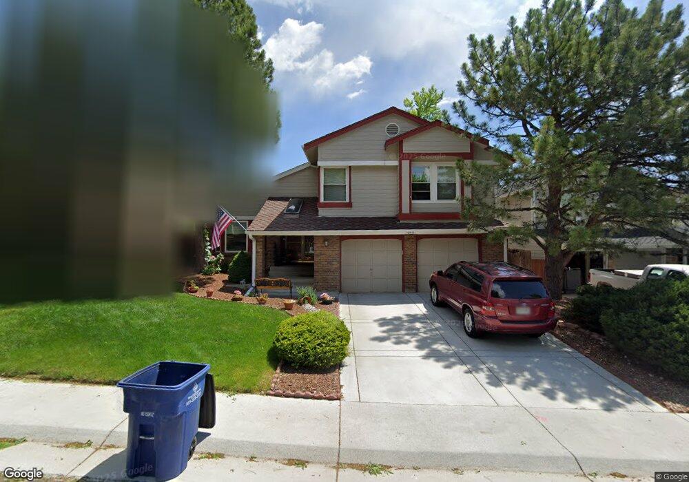
10911 Main Range Trail Littleton, CO 80127
Estimated Value: $727,363 - $806,000
3
Beds
5
Baths
2,318
Sq Ft
$331/Sq Ft
Est. Value
About This Home
This home is located at 10911 Main Range Trail, Littleton, CO 80127 and is currently estimated at $766,591, approximately $330 per square foot. 10911 Main Range Trail is a home located in Jefferson County with nearby schools including Shaffer Elementary School, Falcon Bluffs Middle School, and Chatfield High School.
Ownership History
Date
Name
Owned For
Owner Type
Purchase Details
Closed on
Nov 3, 2010
Sold by
Alfano Anthony M
Bought by
Piszkin Thomas and Piszkin Nancy
Current Estimated Value
Home Financials for this Owner
Home Financials are based on the most recent Mortgage that was taken out on this home.
Original Mortgage
$250,200
Outstanding Balance
$165,834
Interest Rate
4.36%
Mortgage Type
New Conventional
Estimated Equity
$600,757
Purchase Details
Closed on
Sep 27, 1995
Sold by
Alfano Anthony M and Alfano Marie E
Bought by
Alfano Anthony M and Alfano Marie E
Home Financials for this Owner
Home Financials are based on the most recent Mortgage that was taken out on this home.
Original Mortgage
$143,550
Interest Rate
7.76%
Purchase Details
Closed on
Nov 12, 1993
Sold by
Alfano Anthony M and Alfano Marie E
Bought by
Alfano Anthony M and Alfano Marie E
Create a Home Valuation Report for This Property
The Home Valuation Report is an in-depth analysis detailing your home's value as well as a comparison with similar homes in the area
Home Values in the Area
Average Home Value in this Area
Purchase History
| Date | Buyer | Sale Price | Title Company |
|---|---|---|---|
| Piszkin Thomas | $278,000 | Land Title Guarantee Company | |
| Alfano Anthony M | -- | Land Title Guarantee Company | |
| Alfano Anthony M | -- | -- | |
| Alfano Anthony M | -- | -- |
Source: Public Records
Mortgage History
| Date | Status | Borrower | Loan Amount |
|---|---|---|---|
| Open | Piszkin Thomas | $250,200 | |
| Previous Owner | Alfano Anthony M | $143,550 |
Source: Public Records
Tax History Compared to Growth
Tax History
| Year | Tax Paid | Tax Assessment Tax Assessment Total Assessment is a certain percentage of the fair market value that is determined by local assessors to be the total taxable value of land and additions on the property. | Land | Improvement |
|---|---|---|---|---|
| 2024 | $4,427 | $41,351 | $10,126 | $31,225 |
| 2023 | $4,427 | $41,351 | $10,126 | $31,225 |
| 2022 | $3,657 | $33,406 | $8,244 | $25,162 |
| 2021 | $3,713 | $34,367 | $8,481 | $25,886 |
| 2020 | $3,246 | $30,141 | $6,609 | $23,532 |
| 2019 | $3,207 | $30,141 | $6,609 | $23,532 |
| 2018 | $2,913 | $26,440 | $6,867 | $19,573 |
| 2017 | $2,709 | $26,440 | $6,867 | $19,573 |
| 2016 | $2,881 | $26,610 | $8,429 | $18,181 |
| 2015 | $2,652 | $26,610 | $8,429 | $18,181 |
| 2014 | $2,652 | $23,083 | $6,685 | $16,398 |
Source: Public Records
Map
Nearby Homes
- 7825 Sand Mountain
- 10645 W Sundance Mountain
- 11235 San Joaquin Ridge
- 8140 S Storm King Peak
- 8196 S Spring Creek Pass
- 10866 W Half Moon Pass
- 10685 W Apishapa Pass
- 7646 S Bear Mountain
- 10606 Park Mountain W
- 11673 Elk Head Range Rd
- 7462 S Quail Cir Unit 426
- 10328 W Crestone Mountain
- 7433 S Quail Cir Unit 1924
- 10355 Red Mountain E
- 11710 Elk Head Range Rd
- 11703 Elk Head Range Rd
- 7413 S Quail Cir Unit 1422
- 7413 S Quail Cir Unit 1435
- 8242 S Pierson St
- 11872 Elk Head Range Rd
- 10921 Main Range Trail
- 10901 Main Range Trail
- 10931 Main Range Trail
- 10941 Main Range Trail
- 10912 Main Range Trail
- 10922 Main Range Trail
- 10902 Main Range Trail
- 10932 Main Range Trail
- 10706 W Devils Head
- 10942 Main Range Trail
- 10951 Main Range Trail
- 10741 W Dakan Mountain
- 7816 Cathedral Peak
- 10952 Main Range Trail
- 7817 Cathedral Peak
- 7826 Cathedral Peak
- 7760 Crystal Peak
- 7770 Crystal Peak
- 7780 Crystal Peak
- 7708 Gunsight Pass