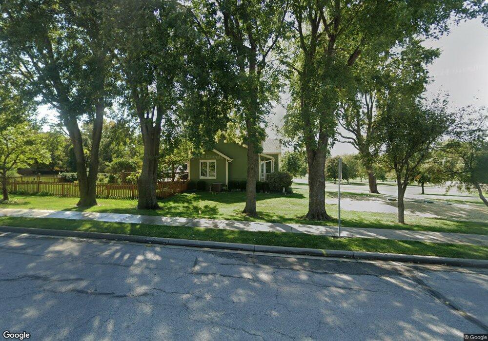
10911 NE Blackwell Rd Lees Summit, MO 64086
Estimated Value: $389,000 - $420,000
4
Beds
3
Baths
1,783
Sq Ft
$228/Sq Ft
Est. Value
About This Home
This home is located at 10911 NE Blackwell Rd, Lees Summit, MO 64086 and is currently estimated at $405,982, approximately $227 per square foot. 10911 NE Blackwell Rd is a home located in Jackson County with nearby schools including Highland Park Elementary School, Bernard C. Campbell Middle School, and Lee's Summit North High School.
Ownership History
Date
Name
Owned For
Owner Type
Purchase Details
Closed on
Jun 14, 2007
Sold by
Branch Karin Lee and Cummins Karin Lee
Bought by
Cummins Daniel Alvin
Current Estimated Value
Home Financials for this Owner
Home Financials are based on the most recent Mortgage that was taken out on this home.
Original Mortgage
$185,000
Outstanding Balance
$113,016
Interest Rate
6.16%
Mortgage Type
Purchase Money Mortgage
Estimated Equity
$292,966
Purchase Details
Closed on
Feb 6, 1998
Sold by
Scroggin Patrick D and Scroggin Patricia
Bought by
Cummins Daniel A and Cummins Karin L
Home Financials for this Owner
Home Financials are based on the most recent Mortgage that was taken out on this home.
Original Mortgage
$132,000
Interest Rate
6.91%
Mortgage Type
Purchase Money Mortgage
Create a Home Valuation Report for This Property
The Home Valuation Report is an in-depth analysis detailing your home's value as well as a comparison with similar homes in the area
Home Values in the Area
Average Home Value in this Area
Purchase History
| Date | Buyer | Sale Price | Title Company |
|---|---|---|---|
| Cummins Daniel Alvin | -- | None Available | |
| Cummins Daniel A | -- | Coffelt Land Title Inc |
Source: Public Records
Mortgage History
| Date | Status | Borrower | Loan Amount |
|---|---|---|---|
| Open | Cummins Daniel Alvin | $185,000 | |
| Previous Owner | Cummins Daniel A | $132,000 |
Source: Public Records
Tax History Compared to Growth
Tax History
| Year | Tax Paid | Tax Assessment Tax Assessment Total Assessment is a certain percentage of the fair market value that is determined by local assessors to be the total taxable value of land and additions on the property. | Land | Improvement |
|---|---|---|---|---|
| 2025 | $3,472 | $49,752 | $17,408 | $32,344 |
| 2024 | $3,472 | $49,797 | $9,595 | $40,202 |
| 2023 | $3,436 | $49,797 | $9,595 | $40,202 |
| 2022 | $2,950 | $37,620 | $3,629 | $33,991 |
| 2021 | $2,821 | $37,620 | $3,629 | $33,991 |
| 2020 | $2,568 | $32,961 | $3,629 | $29,332 |
| 2019 | $2,509 | $32,961 | $3,629 | $29,332 |
| 2018 | $2,684 | $32,743 | $6,065 | $26,678 |
| 2017 | $2,684 | $32,743 | $6,065 | $26,678 |
| 2016 | $2,641 | $31,922 | $5,523 | $26,399 |
| 2014 | $2,700 | $31,922 | $5,523 | $26,399 |
Source: Public Records
Map
Nearby Homes
- 2504 NE Woodland Oak Cir
- 304 SE Wood Ln
- 514 NE Viewpark Dr
- 354 SE Wood Ln
- 321 SE Golden Ln
- 214 SE Windsboro Ct
- 2809 SE Jennifer Dr
- 23808 E Langsford Rd
- 2901 SE Bingham Dr
- 201 SE Somerset Dr
- 2312 NE Sweet Water Dr
- 2504 NE Dale Hunter Trail
- 2313 NE Old Paint Rd
- 2505 NE Dale Hunter Trail
- 416 SE Stillwater Ct
- 258 SE Topaz Cir
- 10705 Wildflower Dr
- 2112 SE 3rd St
- 2403 SE 5th Terrace
- 2433 SE 6th St
- 3024 NE Legacy Wood Dr
- 3100 NE Legacy Wood Dr
- 10917 NE Blackwell Rd
- 3104 Legacy Wood Dr
- 3032 Legacy Wood Dr
- 3028 Legacy Wood Dr
- 3116 Legacy Wood Dr
- 3108 Legacy Wood Dr
- 3128 Legacy Wood Dr
- 2702 NE Legacy Wood Dr
- 2706 NE Legacy Wood Dr
- 416 NE Blackwood Dr
- 10923 NE Blackwell Rd
- 412 NE Blackwood Dr
- 500 NE Parkview Place
- 10901 NE Blackwell Rd
- 2700 NE Wood Creek Ln
- 408 NE Blackwood Dr
- 504 NE Parkview Place
- 10912 NE Blackwell Rd