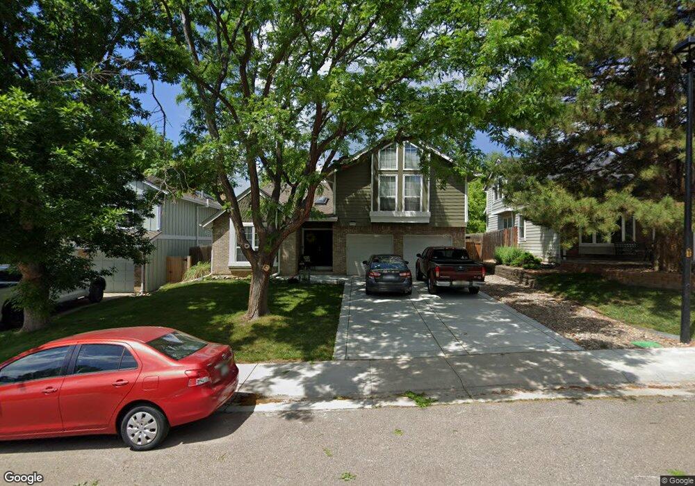
10922 Main Range Trail Littleton, CO 80127
Estimated Value: $794,000 - $884,000
4
Beds
3
Baths
3,876
Sq Ft
$214/Sq Ft
Est. Value
About This Home
This home is located at 10922 Main Range Trail, Littleton, CO 80127 and is currently estimated at $828,759, approximately $213 per square foot. 10922 Main Range Trail is a home located in Jefferson County with nearby schools including Shaffer Elementary School, Falcon Bluffs Middle School, and Chatfield High School.
Ownership History
Date
Name
Owned For
Owner Type
Purchase Details
Closed on
Jul 30, 2014
Sold by
Besaw Greg and Besaw Debbie
Bought by
Nash Scott L and Surek Nash Shoshana
Current Estimated Value
Home Financials for this Owner
Home Financials are based on the most recent Mortgage that was taken out on this home.
Original Mortgage
$373,117
Outstanding Balance
$280,623
Interest Rate
3.75%
Mortgage Type
FHA
Estimated Equity
$548,136
Purchase Details
Closed on
Mar 14, 2007
Sold by
Simpson Mark Steven and Simpson Linda Ann
Bought by
Besaw Greg and Besaw Debbie
Home Financials for this Owner
Home Financials are based on the most recent Mortgage that was taken out on this home.
Original Mortgage
$266,250
Interest Rate
6.32%
Mortgage Type
Purchase Money Mortgage
Purchase Details
Closed on
Feb 27, 2006
Sold by
Hart Delene
Bought by
Simpson Mark Steven and Simpson Linda Ann
Home Financials for this Owner
Home Financials are based on the most recent Mortgage that was taken out on this home.
Original Mortgage
$235,200
Interest Rate
2%
Mortgage Type
Fannie Mae Freddie Mac
Purchase Details
Closed on
Jan 12, 2004
Sold by
Hart Delene M
Bought by
Hart Delene
Home Financials for this Owner
Home Financials are based on the most recent Mortgage that was taken out on this home.
Original Mortgage
$217,000
Interest Rate
5.9%
Mortgage Type
New Conventional
Purchase Details
Closed on
Jun 25, 2003
Sold by
Hart Stephen D
Bought by
Hart Delene M
Purchase Details
Closed on
Feb 24, 1998
Sold by
Eickel Terry C and Eickel Diane N
Bought by
Hart Stephen D
Home Financials for this Owner
Home Financials are based on the most recent Mortgage that was taken out on this home.
Original Mortgage
$182,700
Interest Rate
6.91%
Purchase Details
Closed on
May 23, 1994
Sold by
Wool Steven Marc and Wool Linda S
Bought by
Eickel Terry C and Eickel Diane N
Home Financials for this Owner
Home Financials are based on the most recent Mortgage that was taken out on this home.
Original Mortgage
$139,650
Interest Rate
5.37%
Create a Home Valuation Report for This Property
The Home Valuation Report is an in-depth analysis detailing your home's value as well as a comparison with similar homes in the area
Home Values in the Area
Average Home Value in this Area
Purchase History
| Date | Buyer | Sale Price | Title Company |
|---|---|---|---|
| Nash Scott L | $380,000 | None Available | |
| Besaw Greg | $355,000 | Fahtco | |
| Simpson Mark Steven | $294,000 | Fahtco | |
| Hart Delene | -- | -- | |
| Hart Delene M | -- | -- | |
| Hart Stephen D | $203,000 | North American Title | |
| Eickel Terry C | $147,000 | First American Heritage Titl |
Source: Public Records
Mortgage History
| Date | Status | Borrower | Loan Amount |
|---|---|---|---|
| Open | Nash Scott L | $373,117 | |
| Previous Owner | Besaw Greg | $266,250 | |
| Previous Owner | Simpson Mark Steven | $235,200 | |
| Previous Owner | Hart Delene | $217,000 | |
| Previous Owner | Hart Stephen D | $182,700 | |
| Previous Owner | Eickel Terry C | $139,650 |
Source: Public Records
Tax History Compared to Growth
Tax History
| Year | Tax Paid | Tax Assessment Tax Assessment Total Assessment is a certain percentage of the fair market value that is determined by local assessors to be the total taxable value of land and additions on the property. | Land | Improvement |
|---|---|---|---|---|
| 2024 | $4,637 | $43,310 | $9,919 | $33,391 |
| 2023 | $4,637 | $43,310 | $9,919 | $33,391 |
| 2022 | $4,040 | $36,904 | $8,109 | $28,795 |
| 2021 | $4,102 | $37,967 | $8,343 | $29,624 |
| 2020 | $3,593 | $33,365 | $6,316 | $27,049 |
| 2019 | $3,550 | $33,365 | $6,316 | $27,049 |
| 2018 | $3,320 | $30,131 | $7,001 | $23,130 |
| 2017 | $3,087 | $30,131 | $7,001 | $23,130 |
| 2016 | $3,243 | $29,953 | $8,429 | $21,524 |
| 2015 | $2,950 | $29,953 | $8,429 | $21,524 |
| 2014 | $2,950 | $25,670 | $6,685 | $18,985 |
Source: Public Records
Map
Nearby Homes
- 7825 Sand Mountain
- 11235 San Joaquin Ridge
- 8140 S Storm King Peak
- 10645 W Sundance Mountain
- 8196 S Spring Creek Pass
- 10866 W Half Moon Pass
- 7646 S Bear Mountain
- 10685 W Apishapa Pass
- 11673 Elk Head Range Rd
- 10606 Park Mountain W
- 7462 S Quail Cir Unit 426
- 7433 S Quail Cir Unit 1924
- 11710 Elk Head Range Rd
- 11703 Elk Head Range Rd
- 10328 W Crestone Mountain
- 7413 S Quail Cir Unit 1422
- 7413 S Quail Cir Unit 1435
- 10355 Red Mountain E
- 11872 Elk Head Range Rd
- 8242 S Pierson St
- 10912 Main Range Trail
- 10932 Main Range Trail
- 7760 Crystal Peak
- 10942 Main Range Trail
- 10902 Main Range Trail
- 7770 Crystal Peak
- 10911 Main Range Trail
- 10921 Main Range Trail
- 10952 Main Range Trail
- 7780 Crystal Peak
- 7708 Gunsight Pass
- 7750 Crystal Peak
- 10901 Main Range Trail
- 10931 Main Range Trail
- 7714 Gunsight Pass
- 10941 Main Range Trail
- 7724 Gunsight Pass
- 7751 Crystal Peak
- 7817 Cathedral Peak
- 7728 Gunsight Pass