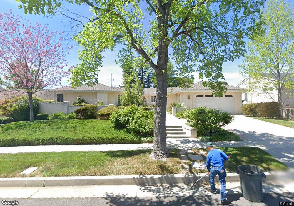
10927 Nestle Ave Porter Ranch, CA 91326
Porter Ranch NeighborhoodEstimated Value: $1,251,377 - $1,330,000
4
Beds
3
Baths
2,702
Sq Ft
$475/Sq Ft
Est. Value
About This Home
This home is located at 10927 Nestle Ave, Porter Ranch, CA 91326 and is currently estimated at $1,283,094, approximately $474 per square foot. 10927 Nestle Ave is a home located in Los Angeles County with nearby schools including Darby Avenue Elementary, Patrick Henry Middle School, and Valley Academy of Arts & Sciences.
Ownership History
Date
Name
Owned For
Owner Type
Purchase Details
Closed on
Nov 21, 2023
Sold by
Kasner Kenneth B
Bought by
Kenneth And Judith Kasner Family Trust and Kasner
Current Estimated Value
Purchase Details
Closed on
Oct 10, 1996
Sold by
Kasner Kenneth B
Bought by
Kasner Kenneth B and Kasner Judith K
Home Financials for this Owner
Home Financials are based on the most recent Mortgage that was taken out on this home.
Original Mortgage
$198,750
Interest Rate
8.37%
Purchase Details
Closed on
Jul 17, 1996
Sold by
Kasner Kenneth B
Bought by
Kasner Kenneth B and Kasner Judith K
Create a Home Valuation Report for This Property
The Home Valuation Report is an in-depth analysis detailing your home's value as well as a comparison with similar homes in the area
Home Values in the Area
Average Home Value in this Area
Purchase History
| Date | Buyer | Sale Price | Title Company |
|---|---|---|---|
| Kenneth And Judith Kasner Family Trust | -- | None Listed On Document | |
| Kasner Kenneth B | -- | Provident Title | |
| Kasner Kenneth B | -- | -- | |
| Kasner Kenneth B | -- | -- |
Source: Public Records
Mortgage History
| Date | Status | Borrower | Loan Amount |
|---|---|---|---|
| Previous Owner | Kasner Kenneth B | $198,750 |
Source: Public Records
Tax History Compared to Growth
Tax History
| Year | Tax Paid | Tax Assessment Tax Assessment Total Assessment is a certain percentage of the fair market value that is determined by local assessors to be the total taxable value of land and additions on the property. | Land | Improvement |
|---|---|---|---|---|
| 2025 | $2,821 | $200,061 | $35,512 | $164,549 |
| 2024 | $2,821 | $196,139 | $34,816 | $161,323 |
| 2023 | $2,774 | $192,294 | $34,134 | $158,160 |
| 2022 | $2,660 | $188,524 | $33,465 | $155,059 |
| 2021 | $2,614 | $184,828 | $32,809 | $152,019 |
| 2019 | $2,543 | $179,348 | $31,837 | $147,511 |
| 2018 | $2,395 | $175,832 | $31,213 | $144,619 |
| 2016 | $2,262 | $169,005 | $30,001 | $139,004 |
| 2015 | $2,232 | $166,468 | $29,551 | $136,917 |
| 2014 | $2,249 | $163,208 | $28,973 | $134,235 |
Source: Public Records
Map
Nearby Homes
- 18301 Ludlow St
- 18352 Ludlow St
- 18308 Lahey St
- 18351 San Fernando Mission Blvd
- 10861 Lindley Ave
- 18371 Lahey St
- 17916 Ludlow St
- 10811 Amigo Ave
- 11158 Newcastle Ave
- 11180 Bertrand Ave
- 10535 Reseda Blvd
- 18741 Hillsboro Rd
- 11144 Viking Ave
- 11410 Reseda Blvd
- 11129 White Oak Ave
- 10526 Balcom Ave
- 17641 Los Alimos St
- 11223 White Oak Ave
- 17623 Clymer St
- 17558 Lahey St
- 10935 Nestle Ave
- 10919 Nestle Ave
- 10926 Etiwanda Ave
- 10913 Nestle Ave Unit 10913
- 10934 Etiwanda Ave
- 10918 Etiwanda Ave
- 10909 Nestle Ave
- 10945 Nestle Ave
- 10930 Nestle Ave
- 10920 Nestle Ave
- 10944 Etiwanda Ave
- 10908 Etiwanda Ave
- 10940 Nestle Ave
- 10912 Nestle Ave
- 10946 Etiwanda Ave
- 10953 Nestle Ave
- 10901 Nestle Ave
- 10948 Nestle Ave
- 10952 Etiwanda Ave
- 10900 Etiwanda Ave