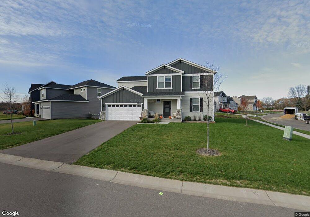
10940 Territorial Trail Maple Grove, MN 55369
Estimated Value: $536,448 - $652,000
4
Beds
3
Baths
3,658
Sq Ft
$160/Sq Ft
Est. Value
About This Home
This home is located at 10940 Territorial Trail, Maple Grove, MN 55369 and is currently estimated at $586,612, approximately $160 per square foot. 10940 Territorial Trail is a home located in Hennepin County with nearby schools including Fernbrook Elementary School, Osseo Middle School, and Maple Grove Senior High School.
Ownership History
Date
Name
Owned For
Owner Type
Purchase Details
Closed on
Feb 11, 2021
Sold by
Guimond Matthew and Gardner Leah L
Bought by
Shellenberg Whitney Lee
Current Estimated Value
Home Financials for this Owner
Home Financials are based on the most recent Mortgage that was taken out on this home.
Original Mortgage
$460,750
Outstanding Balance
$411,375
Interest Rate
2.6%
Mortgage Type
New Conventional
Estimated Equity
$175,237
Purchase Details
Closed on
Feb 27, 2020
Sold by
Pulte Homes Of Minnesota Llc
Bought by
Guimond Matthew and Guimond Leah L
Home Financials for this Owner
Home Financials are based on the most recent Mortgage that was taken out on this home.
Original Mortgage
$265,736
Interest Rate
3.6%
Mortgage Type
New Conventional
Create a Home Valuation Report for This Property
The Home Valuation Report is an in-depth analysis detailing your home's value as well as a comparison with similar homes in the area
Home Values in the Area
Average Home Value in this Area
Purchase History
| Date | Buyer | Sale Price | Title Company |
|---|---|---|---|
| Shellenberg Whitney Lee | $475,000 | All American Title Co Inc | |
| Guimond Matthew | $457,169 | Pgp Title Inc |
Source: Public Records
Mortgage History
| Date | Status | Borrower | Loan Amount |
|---|---|---|---|
| Open | Shellenberg Whitney Lee | $460,750 | |
| Previous Owner | Guimond Matthew | $265,736 |
Source: Public Records
Tax History
| Year | Tax Paid | Tax Assessment Tax Assessment Total Assessment is a certain percentage of the fair market value that is determined by local assessors to be the total taxable value of land and additions on the property. | Land | Improvement |
|---|---|---|---|---|
| 2024 | $6,281 | $497,500 | $89,300 | $408,200 |
| 2023 | $6,580 | $495,000 | $91,200 | $403,800 |
| 2022 | $5,680 | $463,000 | $84,000 | $379,000 |
| 2021 | $2,560 | $414,000 | $76,000 | $338,000 |
| 2020 | $1,385 | $179,000 | $76,000 | $103,000 |
| 2019 | $1,305 | $76,000 | $76,000 | $0 |
| 2018 | $981 | $68,600 | $68,600 | $0 |
| 2017 | $0 | $0 | $0 | $0 |
Source: Public Records
Map
Nearby Homes
- 16430 110th Ave N
- 16440 110th Ave N
- 16450 Comstock Ln N
- 16460 Comstock Ln N
- 11080 Comstock Ln N
- 16320 Comstock Ln N
- 16330 Comstock Ln N
- 16340 Comstock Ln N
- 16611 Territorial Trail
- 16471 Territorial Trail
- 16755 106th Place N
- 15650 112th Ave N
- 000 110th Ave N
- 15531 111th Ave N
- 15450 110th Ave N
- 15440 110th Ave N
- 15350 110th Ave N
- 15351 110th Ave N
- 15613 116th Ave N
- 15261 110th Ave N
- 10930 Territorial Trail
- 16761 110th Ave N
- 10920 Territorial Trail
- 10920 Territorial Trail
- 11010 Territorial Trail
- 11010 Territorial Trail
- 16691 110th Ave N
- 16771 110th Ave N
- 10941 Territorial Trail
- 10910 Territorial Trail
- 10910 Territorial Trail
- 10931 Territorial Trail
- 11020 Territorial Trail
- 11020 Territorial Trail
- 10921 Territorial Trail
- 16690 110th Ave N
- 16671 110th Ave N
- 16781 110th Ave N
- 16770 110th Ave N
- 10911 Territorial Trail
Your Personal Tour Guide
Ask me questions while you tour the home.