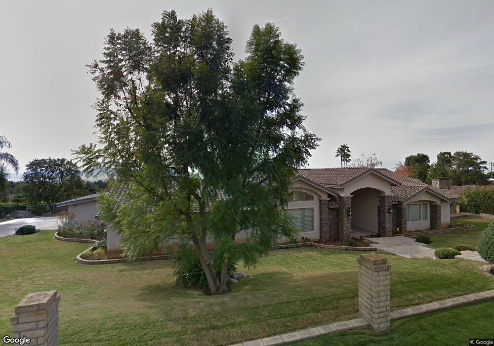
1096 W 25th St Upland, CA 91784
San Antonio Heights NeighborhoodEstimated Value: $1,640,000 - $1,799,000
4
Beds
4
Baths
5,163
Sq Ft
$329/Sq Ft
Est. Value
About This Home
This home is located at 1096 W 25th St, Upland, CA 91784 and is currently estimated at $1,701,035, approximately $329 per square foot. 1096 W 25th St is a home located in San Bernardino County with nearby schools including Valencia Elementary, Pioneer Junior High School, and Upland High School.
Ownership History
Date
Name
Owned For
Owner Type
Purchase Details
Closed on
Jul 19, 2013
Sold by
Lamb Roger A and Lamb Betty J
Bought by
The Lamb Family Trust
Current Estimated Value
Home Financials for this Owner
Home Financials are based on the most recent Mortgage that was taken out on this home.
Original Mortgage
$375,000
Interest Rate
3.98%
Mortgage Type
New Conventional
Create a Home Valuation Report for This Property
The Home Valuation Report is an in-depth analysis detailing your home's value as well as a comparison with similar homes in the area
Home Values in the Area
Average Home Value in this Area
Purchase History
| Date | Buyer | Sale Price | Title Company |
|---|---|---|---|
| The Lamb Family Trust | -- | First American Title Company | |
| Lamb Roger A | -- | First American Title Company |
Source: Public Records
Mortgage History
| Date | Status | Borrower | Loan Amount |
|---|---|---|---|
| Closed | Lamb Roger A | $375,000 |
Source: Public Records
Tax History
| Year | Tax Paid | Tax Assessment Tax Assessment Total Assessment is a certain percentage of the fair market value that is determined by local assessors to be the total taxable value of land and additions on the property. | Land | Improvement |
|---|---|---|---|---|
| 2025 | $8,176 | $749,180 | $103,598 | $645,582 |
| 2024 | $7,709 | $707,994 | $101,556 | $606,438 |
| 2023 | $7,594 | $694,112 | $99,565 | $594,547 |
| 2022 | $7,432 | $680,502 | $97,613 | $582,889 |
| 2021 | $7,425 | $667,159 | $95,699 | $571,460 |
| 2020 | $7,224 | $660,318 | $94,718 | $565,600 |
| 2019 | $7,383 | $647,371 | $92,861 | $554,510 |
| 2018 | $7,023 | $634,677 | $91,040 | $543,637 |
| 2017 | $6,821 | $622,232 | $89,255 | $532,977 |
| 2016 | $6,581 | $610,031 | $87,505 | $522,526 |
| 2015 | $6,432 | $600,868 | $86,191 | $514,677 |
| 2014 | $6,261 | $589,098 | $84,503 | $504,595 |
Source: Public Records
Map
Nearby Homes
- 1098 W 25th St
- 2415 Park Blvd
- 2499 Sierra Dr
- 1257 Citrus St
- 2360 N Mountain Ave
- 2368 N Vallejo Way
- 2337 N San Antonio Ave
- 1435 Highpoint St
- 2335 N San Antonio Ave
- 1279 Moss St
- 937 Emerson St
- 2489 Burt St
- 1435 Lookout Ct
- 2252 Verbena Ave
- 475 W 26th St
- 2326 Fairfield Way
- 2257 Poppy Ave
- 2183 Paris Cir
- 2166 Malati Cir
- 785 W Dalton Ct
- 1080 W 25th St
- 2468 Ocean View Dr
- 2470 Ocean View Dr
- 2466 Ocean View Dr
- 2474 Ocean View Dr
- 1040 W 25th St
- 1095 W 25th St
- 2464 Ocean View Dr
- 2499 Mesa Terrace
- 1075 W 25th St
- 1010 W 25th St
- 2489 Mesa Terrace
- 2505 Mesa Terrace
- 2462 Ocean View Dr
- 2495 Mesa Terrace
- 2485 Mesa Terrace
- 1055 W 25th St
- 2467 Ocean View Dr
- 2471 Ocean View Dr
- 2465 Ocean View Dr
Your Personal Tour Guide
Ask me questions while you tour the home.