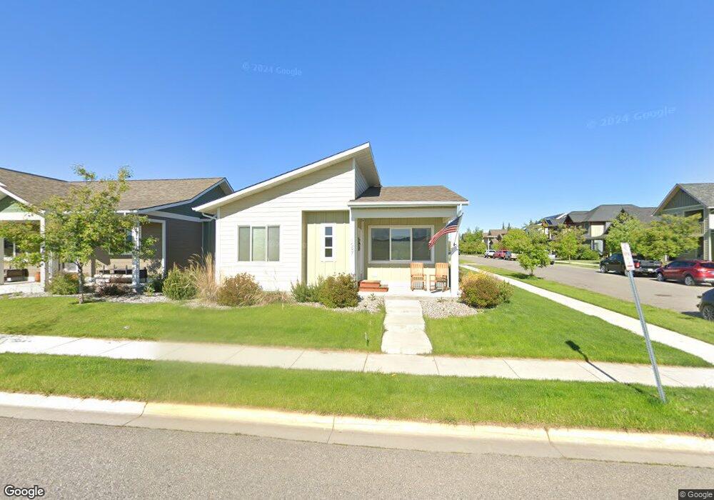
1097 N 12th Ave Bozeman, MT 59715
North Bozeman NeighborhoodEstimated Value: $675,000 - $734,000
3
Beds
2
Baths
1,687
Sq Ft
$420/Sq Ft
Est. Value
About This Home
This home is located at 1097 N 12th Ave, Bozeman, MT 59715 and is currently estimated at $708,848, approximately $420 per square foot. 1097 N 12th Ave is a home with nearby schools including Whittier School, Chief Joseph Middle School, and Bozeman High School.
Ownership History
Date
Name
Owned For
Owner Type
Purchase Details
Closed on
May 7, 2021
Sold by
Schelhammer Properties Llc
Bought by
Schelhammer Louise Deborah
Current Estimated Value
Home Financials for this Owner
Home Financials are based on the most recent Mortgage that was taken out on this home.
Original Mortgage
$308,000
Outstanding Balance
$279,125
Interest Rate
3.1%
Mortgage Type
New Conventional
Estimated Equity
$429,723
Purchase Details
Closed on
Mar 15, 2018
Sold by
Stean Builders Llc
Bought by
Schelhammer Properties Llc
Create a Home Valuation Report for This Property
The Home Valuation Report is an in-depth analysis detailing your home's value as well as a comparison with similar homes in the area
Home Values in the Area
Average Home Value in this Area
Purchase History
| Date | Buyer | Sale Price | Title Company |
|---|---|---|---|
| Schelhammer Louise Deborah | -- | Security Title Company | |
| Schelhammer Properties Llc | -- | Security Title Co |
Source: Public Records
Mortgage History
| Date | Status | Borrower | Loan Amount |
|---|---|---|---|
| Open | Schelhammer Louise Deborah | $308,000 |
Source: Public Records
Tax History
| Year | Tax Paid | Tax Assessment Tax Assessment Total Assessment is a certain percentage of the fair market value that is determined by local assessors to be the total taxable value of land and additions on the property. | Land | Improvement |
|---|---|---|---|---|
| 2025 | $3,077 | $673,300 | $0 | $0 |
| 2024 | $4,445 | $667,700 | $0 | $0 |
| 2023 | $4,300 | $667,700 | $0 | $0 |
| 2022 | $3,151 | $410,900 | $0 | $0 |
| 2021 | $3,477 | $410,900 | $0 | $0 |
| 2020 | $2,934 | $343,200 | $0 | $0 |
| 2019 | $3,000 | $343,200 | $0 | $0 |
| 2018 | $3,034 | $321,600 | $0 | $0 |
| 2017 | $617 | $70,078 | $0 | $0 |
| 2016 | $541 | $57,408 | $0 | $0 |
| 2015 | $541 | $57,408 | $0 | $0 |
| 2014 | $671 | $41,955 | $0 | $0 |
Source: Public Records
Map
Nearby Homes
- 1036 Oak Park Dr
- 1033 N 14th Ave
- 1460 Juniper St
- 854 Matheson Way
- 818 Matheson Way
- 1233 N 8th Ave
- 1232 N 8th Ave
- 1001 W Oak St Unit E
- 907 N 17th Ave
- 526 N 10th Ave
- 163 Wagon Train Trail
- TBD N 19th Ave
- 515 W Aspen St Unit 317
- 515 W Aspen St Unit 320
- 515 W Aspen St Unit 314
- 515 W Aspen St Unit 308
- 515 W Aspen St
- 617 N 5th Ave Unit L
- 316 N 10th Ave
- 928 Mountain Ash Ave
- 1083 N 12th Ave
- 1077 N 12th Ave
- Lot 7 Crabapple Dr
- Lot 1 Crabapple Dr
- 1065 N 12th Ave
- 1231 Crabapple Dr
- 1207 Crabapple Dr
- 1215 Crabapple Dr
- 1096 Oak Park Dr
- 1082 Oak Park Dr
- 1059 N 12th Ave
- 1251 Crabapple Dr
- 1078 Oak Park Dr
- 1064 Oak Park Dr
- 1261 Crabapple Dr
- 1041 N 12th Ave
- 1019 N 12th Ave
- 1283 Crabapple Dr
- 1297 Crabapple Dr
- 1204 Manzanita Dr