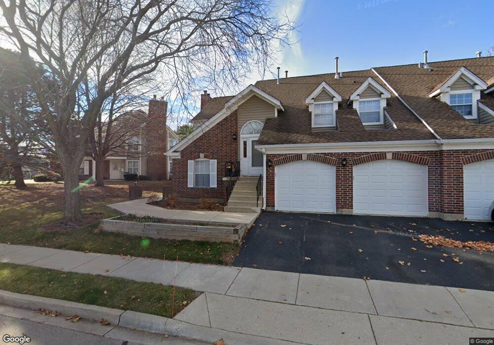
1097 Saint Andrews Ct Unit 294 Algonquin, IL 60102
Estimated Value: $249,431 - $288,000
3
Beds
2
Baths
1,649
Sq Ft
$166/Sq Ft
Est. Value
About This Home
This home is located at 1097 Saint Andrews Ct Unit 294, Algonquin, IL 60102 and is currently estimated at $273,358, approximately $165 per square foot. 1097 Saint Andrews Ct Unit 294 is a home located in McHenry County with nearby schools including Westfield Community School, Kenneth E Neubert Elementary School, and Harry D Jacobs High School.
Ownership History
Date
Name
Owned For
Owner Type
Purchase Details
Closed on
Jul 24, 2004
Sold by
Woloshyn John
Bought by
Koch Donald J and Koch Judith A
Current Estimated Value
Home Financials for this Owner
Home Financials are based on the most recent Mortgage that was taken out on this home.
Original Mortgage
$90,000
Outstanding Balance
$41,331
Interest Rate
5%
Mortgage Type
Purchase Money Mortgage
Estimated Equity
$232,027
Create a Home Valuation Report for This Property
The Home Valuation Report is an in-depth analysis detailing your home's value as well as a comparison with similar homes in the area
Home Values in the Area
Average Home Value in this Area
Purchase History
| Date | Buyer | Sale Price | Title Company |
|---|---|---|---|
| Koch Donald J | $163,000 | Pntn |
Source: Public Records
Mortgage History
| Date | Status | Borrower | Loan Amount |
|---|---|---|---|
| Open | Koch Donald J | $90,000 |
Source: Public Records
Tax History Compared to Growth
Tax History
| Year | Tax Paid | Tax Assessment Tax Assessment Total Assessment is a certain percentage of the fair market value that is determined by local assessors to be the total taxable value of land and additions on the property. | Land | Improvement |
|---|---|---|---|---|
| 2024 | $5,799 | $74,135 | $15,898 | $58,237 |
| 2023 | $5,551 | $66,305 | $14,219 | $52,086 |
| 2022 | $5,345 | $62,329 | $22,054 | $40,275 |
| 2021 | $5,152 | $58,067 | $20,546 | $37,521 |
| 2020 | $5,029 | $56,012 | $19,819 | $36,193 |
| 2019 | $4,923 | $53,610 | $18,969 | $34,641 |
| 2018 | $4,545 | $47,678 | $17,523 | $30,155 |
| 2017 | $4,473 | $44,916 | $16,508 | $28,408 |
| 2016 | $4,430 | $42,127 | $15,483 | $26,644 |
| 2013 | -- | $46,232 | $14,444 | $31,788 |
Source: Public Records
Map
Nearby Homes
- 1405 Surrey Ln
- 1820 Crofton Dr
- 1 N Hubbard St
- SWC Talaga and Algonquin Rd
- 741 Regal Ln
- 700 Fairfield Ln
- 2043 Peach Tree Ln Unit 4122
- 000 County Line Rd
- 1801 Arbordale Ln
- 2233 Dawson Ln Unit 312
- 1900 Waverly Ln
- 30 Arbordale Ct Unit 4284
- 1235 Fairmont Ct
- 710 Braewood Dr
- 710 Sprucetree Ln
- 615 Harper Dr
- 305 Buckingham Dr
- Adams Plan at Algonquin Meadows - Single Family
- Sequoia Plan at Algonquin Meadows - Single Family
- Bryce Plan at Algonquin Meadows - Single Family
- 1093 Saint Andrews Ct Unit 293
- 1662 Edgewood Dr Unit 634
- 1091 Saint Andrews Ct Unit 291
- 1668 Edgewood Dr Unit 631
- 1093 St Andrews Ct
- 1666 Edgewood Dr Unit 632
- 1664 Edgewood Dr Unit 633
- 1071 Saint Andrews Ct Unit 301
- 1071 Saint Andrews Ct Unit 1071
- 1672 Edgewood Dr
- 1678 Edgewood Dr
- 1073 Saint Andrews Ct Unit 303
- 1075 Saint Andrews Ct Unit 302
- 1073 Saint Andrews Ct Unit 4
- 1075 Saint Andrews Ct Unit 1
- 1077 Saint Andrews Ct Unit 304
- 1653 Edgewood Dr Unit 183
- 1651 Edgewood Dr Unit 181
- 1655 Edgewood Dr
- 1657 Edgewood Dr Unit 18B