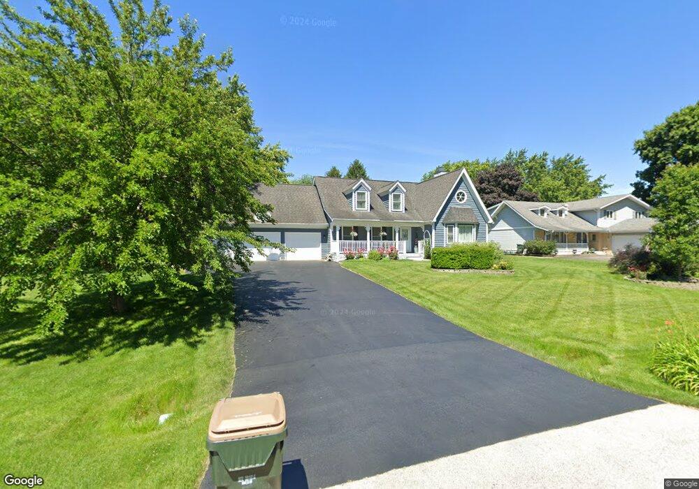
10S526 Curtis Ln Naperville, IL 60564
Springbrook Prairie NeighborhoodEstimated Value: $617,991 - $702,000
--
Bed
1
Bath
2,778
Sq Ft
$235/Sq Ft
Est. Value
About This Home
This home is located at 10S526 Curtis Ln, Naperville, IL 60564 and is currently estimated at $652,748, approximately $234 per square foot. 10S526 Curtis Ln is a home with nearby schools including Robert Clow Elementary School, Ellsworth Elementary School, and Gordon Gregory Middle School.
Ownership History
Date
Name
Owned For
Owner Type
Purchase Details
Closed on
Aug 5, 2020
Sold by
Lazarz John A and Lazarz Nancy M
Bought by
Lazarz John A and Lazarz Nancy J
Current Estimated Value
Purchase Details
Closed on
Jan 6, 1995
Sold by
Petersen John W and Petersen Jo Ann
Bought by
Lazarz John A and Lazarz Nancy M
Home Financials for this Owner
Home Financials are based on the most recent Mortgage that was taken out on this home.
Original Mortgage
$167,000
Interest Rate
8%
Mortgage Type
Purchase Money Mortgage
Create a Home Valuation Report for This Property
The Home Valuation Report is an in-depth analysis detailing your home's value as well as a comparison with similar homes in the area
Home Values in the Area
Average Home Value in this Area
Purchase History
| Date | Buyer | Sale Price | Title Company |
|---|---|---|---|
| Lazarz John A | -- | Attorney | |
| Lazarz John A | $222,000 | -- |
Source: Public Records
Mortgage History
| Date | Status | Borrower | Loan Amount |
|---|---|---|---|
| Closed | Lazarz John A | $167,000 |
Source: Public Records
Tax History Compared to Growth
Tax History
| Year | Tax Paid | Tax Assessment Tax Assessment Total Assessment is a certain percentage of the fair market value that is determined by local assessors to be the total taxable value of land and additions on the property. | Land | Improvement |
|---|---|---|---|---|
| 2024 | $11,199 | $187,305 | $25,941 | $161,364 |
| 2023 | $11,199 | $165,464 | $22,916 | $142,548 |
| 2022 | $9,709 | $146,783 | $21,679 | $125,104 |
| 2021 | $9,263 | $139,794 | $20,647 | $119,147 |
| 2020 | $9,099 | $137,579 | $20,320 | $117,259 |
| 2019 | $8,955 | $133,701 | $19,747 | $113,954 |
| 2018 | $9,106 | $133,146 | $19,312 | $113,834 |
| 2017 | $8,996 | $129,708 | $18,813 | $110,895 |
| 2016 | $8,984 | $126,916 | $18,408 | $108,508 |
| 2015 | $8,441 | $122,035 | $17,700 | $104,335 |
| 2014 | $8,441 | $111,070 | $17,700 | $93,370 |
| 2013 | $8,441 | $111,070 | $17,700 | $93,370 |
Source: Public Records
Map
Nearby Homes
- 2636 Salix Cir
- 28W555 Leverenz Rd
- 2949 Brossman St
- 2207 Sisters Ave
- 1305 Morningstar Ct Unit 1A
- 2736 Bluewater Cir
- 1329 Neskola Ct
- 2543 Dewes Ln
- 2301 Mecan Dr
- 1321 Galena Ct
- 2741 Gateshead Dr
- 1134 Gateshead Dr
- 1123 Thackery Ln
- 2866 Stonewater Dr Unit 102
- 2611 Cedar Glade Dr Unit 204
- 3432 Caine Dr
- 1116 Hollingswood Ave
- 2511 Sheehan Dr Unit 203
- 3616 Eliot Ln
- 3508 Tussell St
- 10S510 Curtis Ln
- 10S542 Curtis Ln
- 10S542 Curtis Ln Unit 10S542
- 10S542 Curtis Ln Unit 1
- 2624 Sutton Cir
- 10S494 Curtis Ln
- 10S558 Curtis Ln
- 2620 Sutton Cir
- 10S515 Curtis Ln
- 10S525 Curtis Ln
- 2632 Sutton Cir
- 10S574 Curtis Ln Unit 7
- 10S486 Curtis Ln
- 2616 Sutton Cir
- 10S533 Curtis Ln
- 10S472 Curtis Ln
- 28W721 Davidson Rd
- 10S588 Curtis Ln
- 2631 Sutton Cir
- 10S479 Curtis Ln