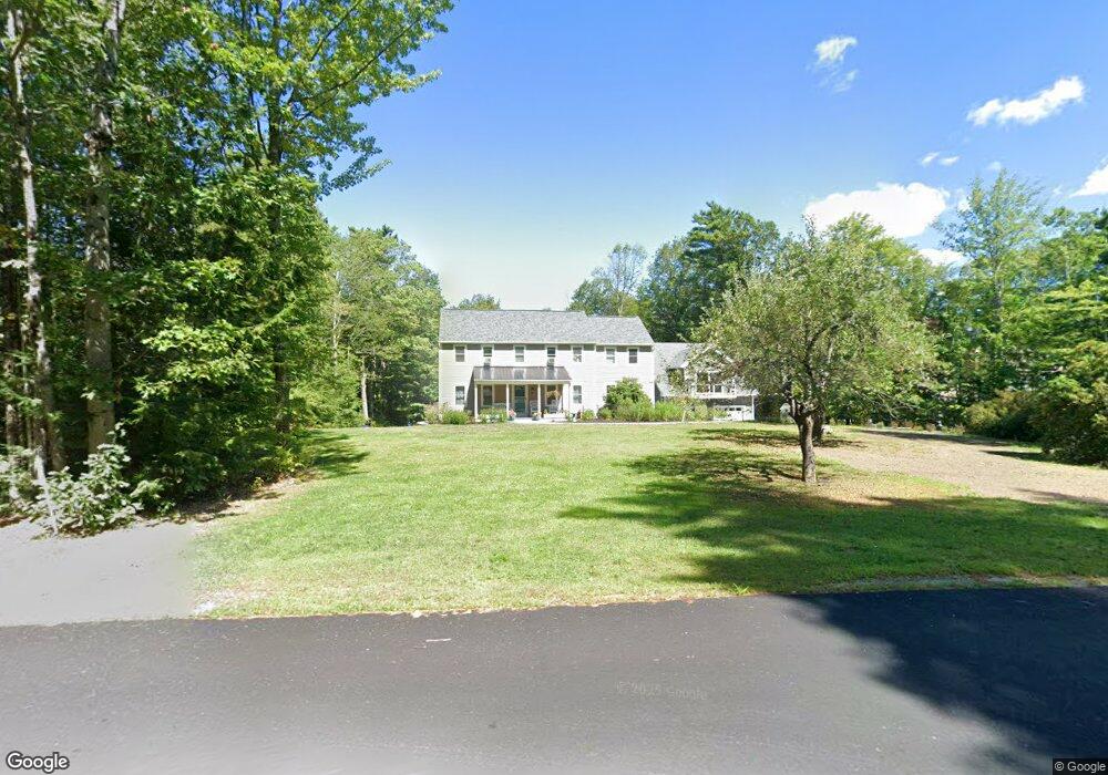
11 Birch Rd Peterborough, NH 03458
Estimated Value: $576,000 - $870,000
4
Beds
4
Baths
2,691
Sq Ft
$252/Sq Ft
Est. Value
About This Home
This home is located at 11 Birch Rd, Peterborough, NH 03458 and is currently estimated at $679,124, approximately $252 per square foot. 11 Birch Rd is a home with nearby schools including Peterborough Elementary School, South Meadow School, and Conval Regional High School.
Ownership History
Date
Name
Owned For
Owner Type
Purchase Details
Closed on
Apr 29, 2024
Sold by
Burgess Clinton and Burgess Maureen
Bought by
Maureen E Burgess Ret and Burgess
Current Estimated Value
Create a Home Valuation Report for This Property
The Home Valuation Report is an in-depth analysis detailing your home's value as well as a comparison with similar homes in the area
Home Values in the Area
Average Home Value in this Area
Purchase History
| Date | Buyer | Sale Price | Title Company |
|---|---|---|---|
| Maureen E Burgess Ret | -- | None Available | |
| Maureen E Burgess Ret | -- | None Available |
Source: Public Records
Tax History Compared to Growth
Tax History
| Year | Tax Paid | Tax Assessment Tax Assessment Total Assessment is a certain percentage of the fair market value that is determined by local assessors to be the total taxable value of land and additions on the property. | Land | Improvement |
|---|---|---|---|---|
| 2024 | $11,151 | $343,100 | $60,100 | $283,000 |
| 2023 | $8,832 | $313,300 | $60,100 | $253,200 |
| 2022 | $7,988 | $308,900 | $60,100 | $248,800 |
| 2021 | $7,957 | $308,900 | $60,100 | $248,800 |
| 2020 | $7,994 | $259,200 | $50,300 | $208,900 |
| 2019 | $7,711 | $259,200 | $50,300 | $208,900 |
| 2018 | $7,799 | $259,200 | $50,300 | $208,900 |
| 2017 | $8,120 | $258,100 | $47,500 | $210,600 |
| 2016 | $7,960 | $258,100 | $47,500 | $210,600 |
| 2015 | $7,668 | $258,100 | $47,500 | $210,600 |
| 2014 | $7,282 | $238,300 | $50,200 | $188,100 |
Source: Public Records
Map
Nearby Homes