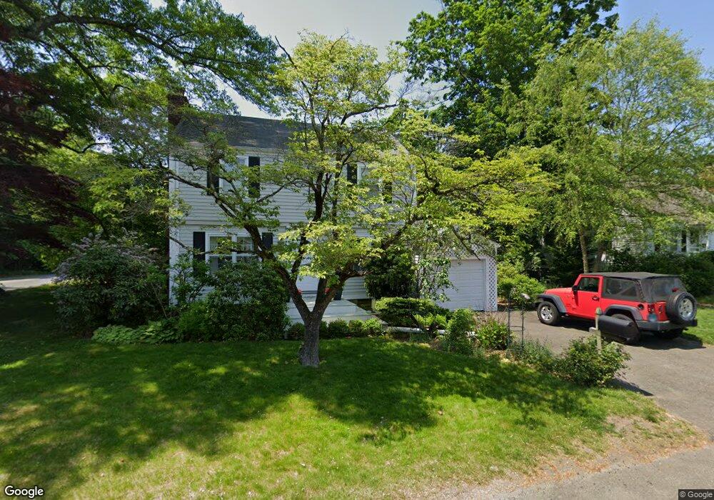
11 Campbell Rd Bridgeport, CT 06606
North End NeighborhoodEstimated Value: $340,000 - $460,000
2
Beds
2
Baths
1,386
Sq Ft
$300/Sq Ft
Est. Value
About This Home
This home is located at 11 Campbell Rd, Bridgeport, CT 06606 and is currently estimated at $416,473, approximately $300 per square foot. 11 Campbell Rd is a home located in Fairfield County with nearby schools including John Winthrop School, Central High School, and St Andrew School.
Ownership History
Date
Name
Owned For
Owner Type
Purchase Details
Closed on
Jun 1, 2001
Sold by
Chamarkhi Nancy and Chamarkhi Hicham
Bought by
Cunningham Sarah
Current Estimated Value
Purchase Details
Closed on
Jul 1, 1998
Sold by
Pianka Andrew J
Bought by
Mckiernan Nancy
Purchase Details
Closed on
May 2, 1997
Sold by
Padua David J and Padua Susan M
Bought by
Pianka Andrew J
Create a Home Valuation Report for This Property
The Home Valuation Report is an in-depth analysis detailing your home's value as well as a comparison with similar homes in the area
Home Values in the Area
Average Home Value in this Area
Purchase History
| Date | Buyer | Sale Price | Title Company |
|---|---|---|---|
| Cunningham Sarah | $185,000 | -- | |
| Cunningham Sarah | $185,000 | -- | |
| Mckiernan Nancy | $118,000 | -- | |
| Mckiernan Nancy | $118,000 | -- | |
| Pianka Andrew J | $105,000 | -- | |
| Pianka Andrew J | $105,000 | -- |
Source: Public Records
Mortgage History
| Date | Status | Borrower | Loan Amount |
|---|---|---|---|
| Open | Pianka Andrew J | $249,950 | |
| Closed | Pianka Andrew J | $252,550 |
Source: Public Records
Tax History Compared to Growth
Tax History
| Year | Tax Paid | Tax Assessment Tax Assessment Total Assessment is a certain percentage of the fair market value that is determined by local assessors to be the total taxable value of land and additions on the property. | Land | Improvement |
|---|---|---|---|---|
| 2025 | $6,301 | $145,026 | $70,496 | $74,530 |
| 2024 | $6,301 | $145,026 | $70,496 | $74,530 |
| 2023 | $6,301 | $145,026 | $70,496 | $74,530 |
| 2022 | $6,301 | $145,026 | $70,496 | $74,530 |
| 2021 | $6,301 | $145,026 | $70,496 | $74,530 |
| 2020 | $6,850 | $126,880 | $55,270 | $71,610 |
| 2019 | $6,850 | $126,880 | $55,270 | $71,610 |
| 2018 | $6,898 | $126,880 | $55,270 | $71,610 |
| 2017 | $6,898 | $126,880 | $55,270 | $71,610 |
| 2016 | $6,898 | $126,880 | $55,270 | $71,610 |
| 2015 | $6,509 | $154,230 | $60,610 | $93,620 |
| 2014 | $6,509 | $154,230 | $60,610 | $93,620 |
Source: Public Records
Map
Nearby Homes
- 81 Lance Cir
- 44 Lance Cir Unit 44
- 42 Wendy Rd
- 153 Seaver Cir
- 26 Wendy Rd
- 66 Loftus Cir
- 65 Dobson St
- 64 Dobson St
- lot 194 Prospect Ave
- 76 Hilary Cir Unit 76
- 2851 Old Town Rd
- 178 Autumn Ridge Rd
- 4293 Madison Ave
- 87 Parkway Dr
- 236 Edgemoor Rd Unit D
- 225 Edgemoor Rd Unit H
- 9 Patricia Rd Unit C
- 394 Anton Dr
- 2998 Madison Ave Unit C
- 2955 Madison Ave Unit 40
- 3750 Old Town Rd
- 27 Campbell Rd
- 12 Campbell Rd
- 41 Campbell Rd
- 3764 Old Town Rd
- 30 Maybrook Rd
- 40 Campbell Rd
- 3690 Old Town Rd
- 48 Maybrook Rd
- 55 Campbell Rd
- 3697 Old Town Rd
- 62 Maybrook Rd
- 125 Elmsford Rd
- 3685 Old Town Rd
- 3790 Old Town Rd
- 3670 Old Town Rd
- 3775 Old Town Rd
- 29 Maybrook Rd
- 152 Elmsford Rd
- 280 Doreen Dr