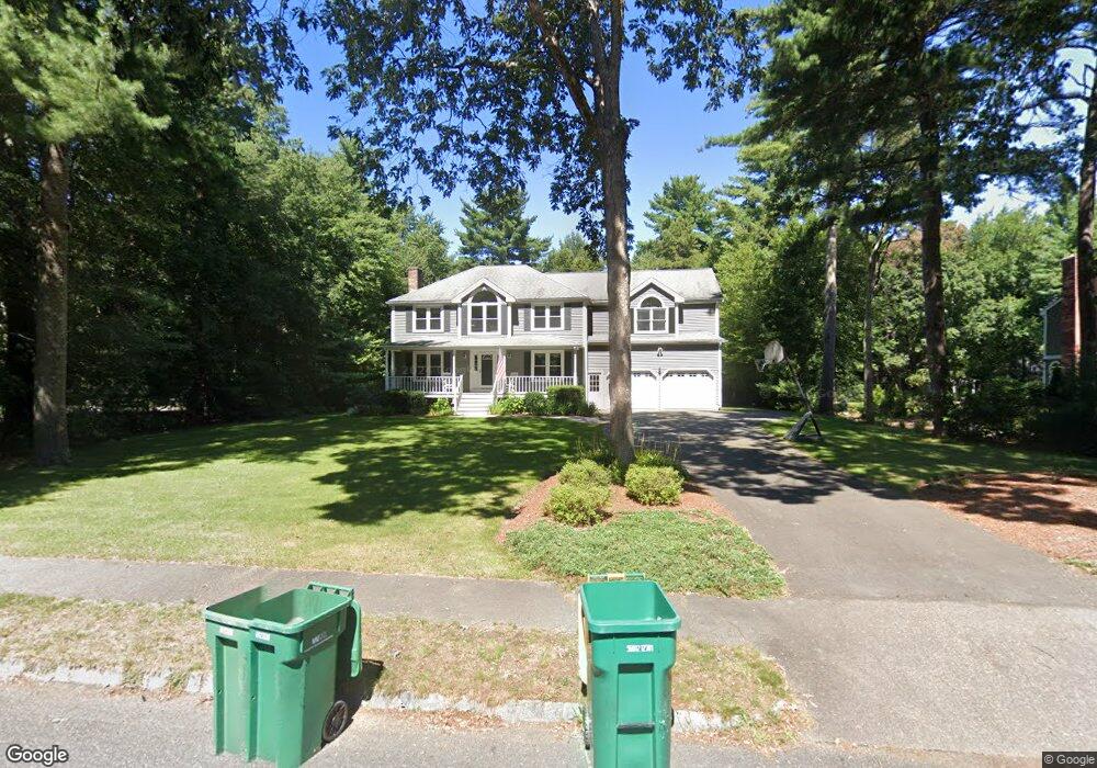
11 Deer Path Ln Mansfield, MA 02048
Estimated Value: $919,009 - $1,155,000
4
Beds
3
Baths
1,928
Sq Ft
$533/Sq Ft
Est. Value
About This Home
This home is located at 11 Deer Path Ln, Mansfield, MA 02048 and is currently estimated at $1,027,752, approximately $533 per square foot. 11 Deer Path Ln is a home located in Bristol County with nearby schools including Jordan/Jackson Elementary School, Everett W. Robinson Elementary School, and Harold L. Qualters Middle School.
Ownership History
Date
Name
Owned For
Owner Type
Purchase Details
Closed on
Apr 29, 1996
Sold by
Thorne Michael B and Thorne Margaret H
Bought by
Arnold Greogory T and Arnold Dianne M
Current Estimated Value
Home Financials for this Owner
Home Financials are based on the most recent Mortgage that was taken out on this home.
Original Mortgage
$199,750
Interest Rate
7.81%
Mortgage Type
Purchase Money Mortgage
Purchase Details
Closed on
Feb 8, 1994
Sold by
Obrien & Meeks Constr
Bought by
Thorne Michael B and Thorne Margaret H
Home Financials for this Owner
Home Financials are based on the most recent Mortgage that was taken out on this home.
Original Mortgage
$196,200
Interest Rate
6.96%
Create a Home Valuation Report for This Property
The Home Valuation Report is an in-depth analysis detailing your home's value as well as a comparison with similar homes in the area
Home Values in the Area
Average Home Value in this Area
Purchase History
| Date | Buyer | Sale Price | Title Company |
|---|---|---|---|
| Arnold Greogory T | $235,000 | -- | |
| Thorne Michael B | $218,000 | -- |
Source: Public Records
Mortgage History
| Date | Status | Borrower | Loan Amount |
|---|---|---|---|
| Open | Thorne Michael B | $275,000 | |
| Closed | Thorne Michael B | $199,750 | |
| Previous Owner | Thorne Michael B | $196,200 | |
| Previous Owner | Thorne Michael B | $196,200 |
Source: Public Records
Tax History Compared to Growth
Tax History
| Year | Tax Paid | Tax Assessment Tax Assessment Total Assessment is a certain percentage of the fair market value that is determined by local assessors to be the total taxable value of land and additions on the property. | Land | Improvement |
|---|---|---|---|---|
| 2025 | $11,376 | $863,800 | $279,600 | $584,200 |
| 2024 | $11,127 | $824,200 | $291,800 | $532,400 |
| 2023 | $10,721 | $760,900 | $291,800 | $469,100 |
| 2022 | $10,278 | $677,500 | $270,100 | $407,400 |
| 2021 | $9,780 | $636,700 | $225,100 | $411,600 |
| 2020 | $9,614 | $625,900 | $225,100 | $400,800 |
| 2019 | $9,076 | $596,300 | $187,500 | $408,800 |
| 2018 | $9,037 | $580,400 | $178,800 | $401,600 |
| 2017 | $8,479 | $564,500 | $173,800 | $390,700 |
| 2016 | $8,126 | $527,300 | $165,400 | $361,900 |
| 2015 | $7,893 | $509,200 | $165,400 | $343,800 |
Source: Public Records
Map
Nearby Homes
- 414 Branch St
- 442 Ware St
- 460 Ware St
- 28 Court St
- 631 East St Unit E203
- 212 Mill St
- 18 Columbine Rd
- 82 Brook St
- 22 Pleasant St Unit C
- 150 Rumford Ave Unit 110
- 15 Reservoir St Unit 44
- 15 Rock Ln
- Lot 3 Birch Ln
- 6 Erick Rd Unit 73
- 166 Chauncy St
- 0 Kensington Rd
- 16 Erick Rd Unit 34
- 21 Juniper Rd
- 28 Angell St
- 151 Stearns Ave
- 7 Deer Path Ln
- 15 Deer Path Ln
- 1 Deer Path Ln
- 10 Deer Path Ln
- 19 Deer Path Ln
- 14 Deer Path Ln
- 11 Fieldstone Dr
- 19 Fieldstone Dr
- 20 Deer Path Ln
- 303 Branch St
- 23 Fieldstone Dr
- 7 Fieldstone Dr
- 425 Branch St
- 311 Branch St
- 23 Deer Path Ln
- 27 Fieldstone Dr
- 3 Fieldstone Dr
- 10 Fieldstone Dr
- 28 Deer Path Ln
- 14 Fieldstone Dr