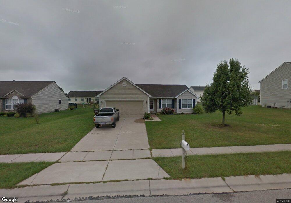
11 Meadowcrest Dr Franklin, OH 45005
Estimated Value: $280,000 - $294,000
3
Beds
2
Baths
1,506
Sq Ft
$192/Sq Ft
Est. Value
About This Home
This home is located at 11 Meadowcrest Dr, Franklin, OH 45005 and is currently estimated at $289,447, approximately $192 per square foot. 11 Meadowcrest Dr is a home located in Warren County with nearby schools including Franklin High School.
Ownership History
Date
Name
Owned For
Owner Type
Purchase Details
Closed on
Dec 26, 2006
Sold by
Morequity Inc
Bought by
Gabbard Michael D and Gabbard Rebecca L
Current Estimated Value
Home Financials for this Owner
Home Financials are based on the most recent Mortgage that was taken out on this home.
Original Mortgage
$100,000
Outstanding Balance
$59,859
Interest Rate
6.24%
Mortgage Type
Purchase Money Mortgage
Estimated Equity
$229,588
Purchase Details
Closed on
Apr 4, 2006
Sold by
Lawwill Victor R and Case #05Cv64918
Bought by
Morequity Inc
Purchase Details
Closed on
Apr 30, 2003
Sold by
The Cristo Group Inc
Bought by
Lawwill Victor R and Lawwill Rachel M
Home Financials for this Owner
Home Financials are based on the most recent Mortgage that was taken out on this home.
Original Mortgage
$129,143
Interest Rate
6.02%
Mortgage Type
FHA
Purchase Details
Closed on
Oct 10, 2002
Sold by
Scholl Rd Dev Co
Bought by
Cristo Group Inc
Create a Home Valuation Report for This Property
The Home Valuation Report is an in-depth analysis detailing your home's value as well as a comparison with similar homes in the area
Home Values in the Area
Average Home Value in this Area
Purchase History
| Date | Buyer | Sale Price | Title Company |
|---|---|---|---|
| Gabbard Michael D | $129,000 | Republic Title Agency Inc | |
| Morequity Inc | $110,000 | None Available | |
| Lawwill Victor R | $130,166 | Midland Title Froelke | |
| Cristo Group Inc | $399,500 | -- |
Source: Public Records
Mortgage History
| Date | Status | Borrower | Loan Amount |
|---|---|---|---|
| Open | Gabbard Michael D | $100,000 | |
| Previous Owner | Lawwill Victor R | $129,143 |
Source: Public Records
Tax History Compared to Growth
Tax History
| Year | Tax Paid | Tax Assessment Tax Assessment Total Assessment is a certain percentage of the fair market value that is determined by local assessors to be the total taxable value of land and additions on the property. | Land | Improvement |
|---|---|---|---|---|
| 2024 | $3,539 | $75,230 | $22,750 | $52,480 |
| 2023 | $2,997 | $57,134 | $12,390 | $44,744 |
| 2022 | $2,939 | $57,134 | $12,390 | $44,744 |
| 2021 | $2,786 | $57,134 | $12,390 | $44,744 |
| 2020 | $2,678 | $48,419 | $10,500 | $37,919 |
| 2019 | $2,435 | $48,419 | $10,500 | $37,919 |
| 2018 | $2,402 | $48,419 | $10,500 | $37,919 |
| 2017 | $2,311 | $41,979 | $9,247 | $32,732 |
| 2016 | $2,391 | $41,979 | $9,247 | $32,732 |
| 2015 | $2,389 | $41,979 | $9,247 | $32,732 |
| 2014 | $2,380 | $40,760 | $8,980 | $31,780 |
| 2013 | $1,990 | $47,670 | $10,500 | $37,170 |
Source: Public Records
Map
Nearby Homes
- 22 Green Meadow Ct
- 155 Green Knoll Dr
- 6801 Gorsuch Rd
- 6 Beal Rd
- 191 Lakeview Dr
- 995 E 4th St
- 16 Harding Ct
- 7657 Sharts Rd
- 718 Millard Dr
- 25 Copperhead Trail
- 590 Kristine Ln
- 445 Beam Dr
- 0 Kathy Ln Unit 1834240
- 0 Kathy Ln Unit 930066
- 388 Thomas Dr
- 4491 Michaels Dr
- 5554 State Route 123
- 5554 Ohio 123
- 760 David Blvd
- 747 David Blvd
- 1 Meadowcrest Dr
- 12 Long Meadow Dr
- 22 Long Meadow Dr
- 2 Long Meadow Dr
- 31 Meadowcrest Dr
- 12 Meadowcrest Dr
- 22 Meadowcrest Dr
- 2 Meadowcrest Dr
- 32 Long Meadow Dr
- 32 Meadowcrest Dr
- 41 Meadowcrest Dr
- 111 Hillsdale Dr
- 121 Hillsdale Dr
- 42 Long Meadow Dr
- 101 Hillsdale Dr
- 142 Hillsdale Dr
- 131 Hillsdale Dr
- 42 Meadowcrest Dr
- 11 Long Meadow Dr
- 21 Long Meadow Dr