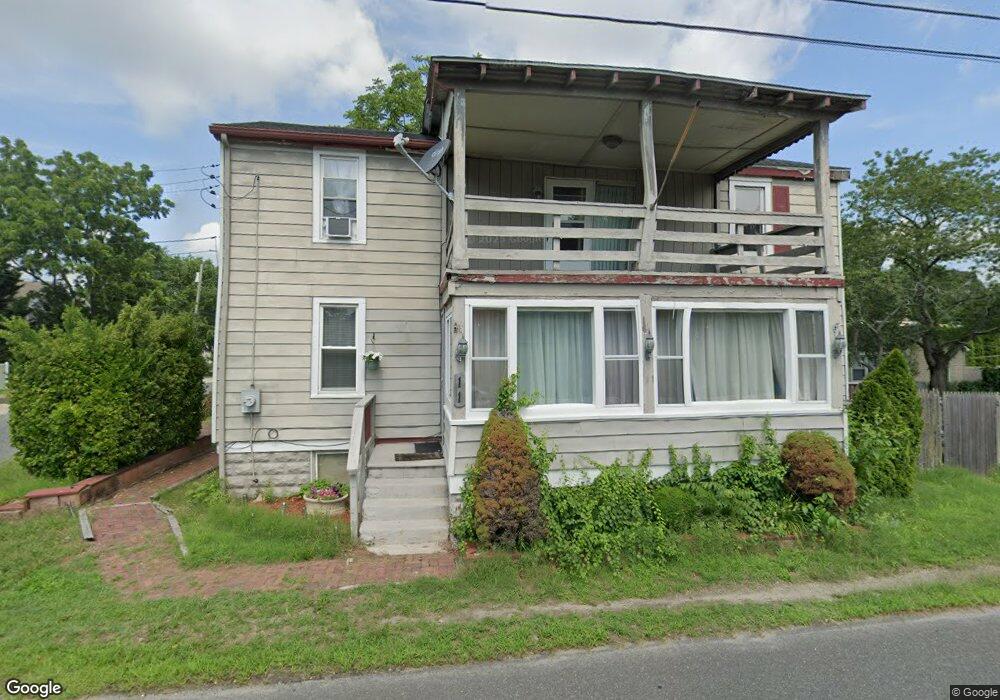
11 New Rd Linwood, NJ 08221
Estimated Value: $321,067 - $398,000
--
Bed
--
Bath
1,248
Sq Ft
$287/Sq Ft
Est. Value
About This Home
This home is located at 11 New Rd, Linwood, NJ 08221 and is currently estimated at $358,267, approximately $287 per square foot. 11 New Rd is a home located in Atlantic County with nearby schools including Seaview Elementary School, Belhaven Middle School, and Mainland Regional High School.
Ownership History
Date
Name
Owned For
Owner Type
Purchase Details
Closed on
Sep 18, 2000
Sold by
Feinstein Kurt
Bought by
Ferrin Robert A and Ferrin Margo
Current Estimated Value
Home Financials for this Owner
Home Financials are based on the most recent Mortgage that was taken out on this home.
Original Mortgage
$77,600
Interest Rate
7.89%
Mortgage Type
Purchase Money Mortgage
Purchase Details
Closed on
Apr 1, 2000
Sold by
Layton John Gary
Bought by
Feinstein Kurt
Purchase Details
Closed on
Mar 10, 2000
Sold by
Clayton Jody M
Bought by
Clayton John Gary
Purchase Details
Closed on
Dec 2, 1997
Sold by
Mcgettigan James
Bought by
Clayton John Gary and Clayton Jody M
Home Financials for this Owner
Home Financials are based on the most recent Mortgage that was taken out on this home.
Original Mortgage
$69,635
Interest Rate
7.14%
Create a Home Valuation Report for This Property
The Home Valuation Report is an in-depth analysis detailing your home's value as well as a comparison with similar homes in the area
Home Values in the Area
Average Home Value in this Area
Purchase History
| Date | Buyer | Sale Price | Title Company |
|---|---|---|---|
| Ferrin Robert A | $97,000 | The Title Company | |
| Feinstein Kurt | $54,000 | Mutual Title Agency | |
| Clayton John Gary | -- | -- | |
| Clayton John Gary | $43,100 | -- |
Source: Public Records
Mortgage History
| Date | Status | Borrower | Loan Amount |
|---|---|---|---|
| Closed | Ferrin Robert A | $77,600 | |
| Previous Owner | Clayton John Gary | $69,635 |
Source: Public Records
Tax History Compared to Growth
Tax History
| Year | Tax Paid | Tax Assessment Tax Assessment Total Assessment is a certain percentage of the fair market value that is determined by local assessors to be the total taxable value of land and additions on the property. | Land | Improvement |
|---|---|---|---|---|
| 2025 | $5,318 | $139,400 | $76,200 | $63,200 |
| 2024 | $5,318 | $139,400 | $76,200 | $63,200 |
| 2023 | $5,071 | $139,400 | $76,200 | $63,200 |
| 2022 | $5,071 | $139,400 | $76,200 | $63,200 |
| 2021 | $5,027 | $139,400 | $76,200 | $63,200 |
| 2020 | $4,957 | $139,400 | $76,200 | $63,200 |
| 2019 | $4,851 | $139,400 | $76,200 | $63,200 |
| 2018 | $4,742 | $139,400 | $76,200 | $63,200 |
| 2017 | $4,648 | $139,400 | $76,200 | $63,200 |
| 2016 | $4,491 | $139,400 | $76,200 | $63,200 |
| 2015 | $4,496 | $139,400 | $76,200 | $63,200 |
| 2014 | $4,340 | $159,400 | $76,200 | $83,200 |
Source: Public Records
Map
Nearby Homes
- 306 W Revere Ave
- 550 Central Ave Unit N-12
- 550 Central Ave Unit E-14
- 550 Central Ave Unit G-16 Constitution Ct
- 550 Central Ave Unit B1
- 550 Central Ave Unit G-14 Constitution Ct
- 550 Central Ave Unit 4
- 550 Central Ave Unit M3
- 208 W Glencove Ave
- 608 Revere Ave
- 301 Wabash Ave
- 14 Jefferson Ct Unit 414
- 205 Ridgewood Dr
- 207 Steven Dr
- 34 Crossing Dr
- 28 Crossing Dr
- 537 Ridgewood Dr
- 622 Central Ave
- 314 Steven Dr
- 14 Wexford Ln
- 402 W Vernon Ave
- 5 New Rd
- 0 New Rd Unit 379922
- 0 New Rd Unit 440558
- 410 W Vernon Ave
- 330 W Vernon Ave
- 410 W Oakcrest Ave
- 412 W Vernon Ave
- 332 W Oakcrest Ave
- 415 W Vernon Ave
- 412 W Oakcrest Ave
- 322 W Vernon Ave
- 328 W Oakcrest Ave
- 419 W Vernon Ave
- 422 W Vernon Ave
- 329 W Vernon Ave
- 326 W Oakcrest Ave
- 414 W Oakcrest Ave
- 2600 New Rd
- 320 W Vernon Ave