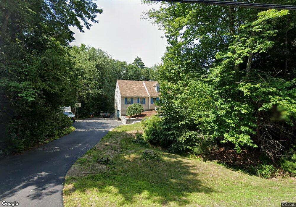
11 Nutt Rd Auburn, NH 03032
Estimated Value: $617,076 - $652,000
3
Beds
2
Baths
2,463
Sq Ft
$257/Sq Ft
Est. Value
About This Home
This home is located at 11 Nutt Rd, Auburn, NH 03032 and is currently estimated at $633,019, approximately $257 per square foot. 11 Nutt Rd is a home located in Rockingham County with nearby schools including Auburn Village School, Pinkerton Academy, and The Goddard School - Derry.
Ownership History
Date
Name
Owned For
Owner Type
Purchase Details
Closed on
Nov 10, 2020
Sold by
Shelley Dustin W and Shelley Kristina A
Bought by
Gates Kelsey T and Horne Jeffrey
Current Estimated Value
Home Financials for this Owner
Home Financials are based on the most recent Mortgage that was taken out on this home.
Original Mortgage
$395,700
Outstanding Balance
$352,117
Interest Rate
2.8%
Mortgage Type
FHA
Estimated Equity
$280,902
Purchase Details
Closed on
Oct 17, 2002
Sold by
Sharp James A and Sharp Joann A
Bought by
Shelley Dustin W and Shelley Kristina A
Home Financials for this Owner
Home Financials are based on the most recent Mortgage that was taken out on this home.
Original Mortgage
$225,000
Interest Rate
6.18%
Create a Home Valuation Report for This Property
The Home Valuation Report is an in-depth analysis detailing your home's value as well as a comparison with similar homes in the area
Home Values in the Area
Average Home Value in this Area
Purchase History
| Date | Buyer | Sale Price | Title Company |
|---|---|---|---|
| Gates Kelsey T | $403,000 | None Available | |
| Shelley Dustin W | $250,000 | -- |
Source: Public Records
Mortgage History
| Date | Status | Borrower | Loan Amount |
|---|---|---|---|
| Open | Gates Kelsey T | $395,700 | |
| Previous Owner | Shelley Dustin W | $196,500 | |
| Previous Owner | Shelley Dustin W | $75,000 | |
| Previous Owner | Shelley Dustin W | $225,000 |
Source: Public Records
Tax History Compared to Growth
Tax History
| Year | Tax Paid | Tax Assessment Tax Assessment Total Assessment is a certain percentage of the fair market value that is determined by local assessors to be the total taxable value of land and additions on the property. | Land | Improvement |
|---|---|---|---|---|
| 2024 | $6,918 | $513,600 | $198,600 | $315,000 |
| 2023 | $6,576 | $521,500 | $208,500 | $313,000 |
| 2022 | $6,171 | $345,700 | $162,400 | $183,300 |
| 2021 | $6,271 | $345,700 | $162,400 | $183,300 |
| 2020 | $6,389 | $345,700 | $162,400 | $183,300 |
| 2019 | $6,503 | $345,700 | $162,400 | $183,300 |
| 2018 | $5,898 | $345,700 | $162,400 | $183,300 |
| 2017 | $6,021 | $284,700 | $155,700 | $129,000 |
| 2016 | $5,765 | $284,700 | $155,700 | $129,000 |
| 2015 | $5,896 | $284,700 | $155,700 | $129,000 |
| 2014 | $6,067 | $284,700 | $155,700 | $129,000 |
| 2013 | $5,577 | $284,700 | $155,700 | $129,000 |
Source: Public Records
Map
Nearby Homes
- 40 Pinyon Place
- 45 Peach Tree Rd
- 34 Conifer Place
- 55 Norwich Place
- 59 Hawthorne Dr
- 628 Megan Dr
- 612 Megan Dr
- #1 the Cliffs at Evergreen Dr
- 193 Morning Glory Dr
- 1991 Bodwell Rd Unit 30
- 22 Eastmeadow Way
- 54 Daniel Rd
- 50 Daniel Rd
- 52 Daniel Rd
- 8 Ledgewood Dr
- 4 Ledgewood Dr
- 9 Dattillo Rd
- 4 Viza Ave
- 8 Mark Ave
- 6 Hilda Ave
- 17 Nutt Rd
- 378 Wilsons Crossing Rd
- 392 Wilsons Crossing Rd
- 27 Nutt Rd
- 18 Nutt Rd
- 18 Nutt Rd R 006
- 366 Wilsons Crossing Rd
- 398 Wilsons Crossing Rd
- 30 Nutt Rd
- 31 Nutt Rd
- 358 Wilsons Crossing Rd
- 412 Wilsons Crossing Rd
- 28 Nutt Rd
- 44 Cameo Ct
- 7 Mcqueston Dr
- 359 Wilsons Crossing Rd
- 42 Cameo Ct
- 3 Cameo Ct
- 5 Wilsons Crossing Rd
- 51 Margate Dr