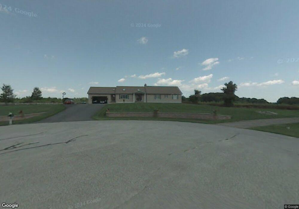
11 Peabody Ln Pelham, NH 03076
Estimated Value: $732,000 - $909,000
3
Beds
3
Baths
3,010
Sq Ft
$280/Sq Ft
Est. Value
About This Home
This home is located at 11 Peabody Ln, Pelham, NH 03076 and is currently estimated at $842,488, approximately $279 per square foot. 11 Peabody Ln is a home with nearby schools including Pelham Elementary School, Pelham Memorial School, and Pelham High School.
Ownership History
Date
Name
Owned For
Owner Type
Purchase Details
Closed on
Apr 19, 2018
Sold by
Diamantopoulos Paul A and Diamantopoulos Helen
Bought by
Diamantopoulos Ft
Current Estimated Value
Purchase Details
Closed on
Apr 18, 2018
Sold by
Diamantopulos Ft
Bought by
Diamantopoulos Paul A and Diamantopulos Helen
Purchase Details
Closed on
Dec 10, 2014
Sold by
Diamntopoulos Paul A and Diamnatopoulos Helen S
Bought by
Diamnatopoulos Ft
Purchase Details
Closed on
Dec 23, 1991
Bought by
Diamantopaoulos Ft
Create a Home Valuation Report for This Property
The Home Valuation Report is an in-depth analysis detailing your home's value as well as a comparison with similar homes in the area
Home Values in the Area
Average Home Value in this Area
Purchase History
| Date | Buyer | Sale Price | Title Company |
|---|---|---|---|
| Diamantopoulos Ft | -- | -- | |
| Diamantopoulos Paul A | -- | -- | |
| Diamnatopoulos Ft | -- | -- | |
| Diamantopaoulos Ft | -- | -- |
Source: Public Records
Tax History
| Year | Tax Paid | Tax Assessment Tax Assessment Total Assessment is a certain percentage of the fair market value that is determined by local assessors to be the total taxable value of land and additions on the property. | Land | Improvement |
|---|---|---|---|---|
| 2024 | $13,540 | $738,300 | $175,200 | $563,100 |
| 2023 | $13,430 | $738,300 | $175,200 | $563,100 |
| 2022 | $12,861 | $738,300 | $175,200 | $563,100 |
| 2021 | $11,783 | $738,300 | $175,200 | $563,100 |
| 2020 | $11,266 | $557,700 | $140,300 | $417,400 |
| 2019 | $10,819 | $557,700 | $140,300 | $417,400 |
| 2018 | $11,168 | $520,400 | $133,500 | $386,900 |
| 2017 | $11,163 | $520,400 | $133,500 | $386,900 |
| 2016 | $10,902 | $520,400 | $133,500 | $386,900 |
| 2015 | $9,841 | $423,100 | $126,800 | $296,300 |
| 2014 | $9,676 | $423,100 | $126,800 | $296,300 |
| 2013 | $9,637 | $421,400 | $126,800 | $294,600 |
Source: Public Records
Map
Nearby Homes
- 28 Bridal Path Rd
- 29 Saddle Rd
- 2 S Shore Dr
- 4 Haystack Cir
- 4 Wilshire Ln Unit 4
- 4 Wilshire Ln
- 6 Wilshire Ln Unit 6
- 6 David Dr
- 19 Esther Way Unit Lot 10
- 9 Cornstalk Ln
- 170 E Richardson Rd
- 40 Westfall Rd
- 7 Little Island Park
- 6 Hemlock Dr
- 10 Oakland Ridge Rd Unit 11
- 23 Frank St Unit 2
- 979 Hildreth St
- 26 Frank St
- Lot 4 Canterbury Rd Unit 4
- 94 Tanager Cir Unit 94
- 9 Peabody Ln
- 14 Peabody Ln
- 54 Thistlewood Dr Unit 42
- 64 Thistlewood Dr Unit 38
- 76 Thistlewood Dr Unit 35
- 70 Thistlewood Dr
- 75 Thistlewood Dr Unit 51
- 67 Thistlewood Dr Unit 49
- 108 Thistlewood Dr Unit lot 25
- 77 Thistlewood Dr Unit 52
- 10 Peabody Ln
- 107 Thistlewood Dr Unit 59
- 24 Loretta Ave
- 86 Thistlewood Dr Unit 32
- 70 Currier Rd
- 58 Currier Rd
- 62 Currier Rd
- 66 Currier Rd
- 4 Peabody Ln
- 22 Loretta Ave
Your Personal Tour Guide
Ask me questions while you tour the home.