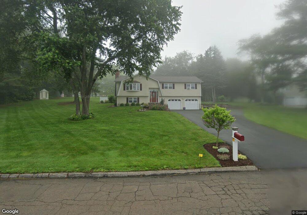
11 Perch Rd Shelton, CT 06484
Estimated Value: $540,886 - $586,000
3
Beds
3
Baths
1,294
Sq Ft
$437/Sq Ft
Est. Value
About This Home
This home is located at 11 Perch Rd, Shelton, CT 06484 and is currently estimated at $565,472, approximately $436 per square foot. 11 Perch Rd is a home located in Fairfield County with nearby schools including Elizabeth Shelton Elementary School, Perry Hill School, and Shelton Intermediate School.
Ownership History
Date
Name
Owned For
Owner Type
Purchase Details
Closed on
Sep 22, 2022
Sold by
Czaplinski Andre L and Czaplinski Lisa A
Bought by
Coleman Jeffrey
Current Estimated Value
Purchase Details
Closed on
Aug 4, 2000
Sold by
Zitnoy Patricia
Bought by
Zitnay Lisa A
Create a Home Valuation Report for This Property
The Home Valuation Report is an in-depth analysis detailing your home's value as well as a comparison with similar homes in the area
Home Values in the Area
Average Home Value in this Area
Purchase History
We collect this data history from publicly available records. To have your information removed, we recommend requesting removal directly through your county’s website.
| Date | Buyer | Sale Price | Title Company |
|---|---|---|---|
| Coleman Jeffrey | $450,000 | None Available | |
| Coleman Jeffrey | $450,000 | None Available | |
| Zitnay Lisa A | $187,500 | -- | |
| Zitnay Lisa A | $187,500 | -- |
Source: Public Records
Mortgage History
We collect this data history from publicly available records. To have your information removed, we recommend requesting removal directly through your county’s website.
| Date | Status | Borrower | Loan Amount |
|---|---|---|---|
| Previous Owner | Zitnay Lisa A | $264,000 | |
| Previous Owner | Zitnay Lisa A | $254,234 | |
| Previous Owner | Zitnay Lisa A | $155,000 |
Source: Public Records
Tax History
| Year | Tax Paid | Tax Assessment Tax Assessment Total Assessment is a certain percentage of the fair market value that is determined by local assessors to be the total taxable value of land and additions on the property. | Land | Improvement |
|---|---|---|---|---|
| 2025 | $5,085 | $270,200 | $98,000 | $172,200 |
| 2024 | $5,182 | $270,200 | $98,000 | $172,200 |
| 2023 | $4,720 | $270,200 | $98,000 | $172,200 |
| 2022 | $4,720 | $270,200 | $98,000 | $172,200 |
| 2021 | $4,304 | $195,370 | $68,600 | $126,770 |
| 2020 | $4,380 | $195,370 | $68,600 | $126,770 |
| 2019 | $4,380 | $195,370 | $68,600 | $126,770 |
| 2017 | $4,339 | $195,370 | $68,600 | $126,770 |
| 2015 | $4,195 | $184,310 | $66,500 | $117,810 |
| 2014 | $4,112 | $184,310 | $66,500 | $117,810 |
Source: Public Records
Map
Nearby Homes
- 44 Monroe Rd
- 220 Beardsley Rd
- 60 Wabuda Place
- 41 Swendsen Dr
- 33 Stendahl Dr
- 39 Golden Hill Ln
- 9 Round Hill Dr
- 35 Golden Hill Ln
- 148 Osborn Ln
- 50 Birdseye Rd
- 30 Block Farm Rd
- 148 Roosevelt Dr
- 30 E Village Rd
- 74 Hillside Ln
- 24 Webb Cir
- 66 Sunset Hill Dr
- 3 Roosevelt Dr
- 40 Walnut St
- 140 Lazy Brook Rd
- 23 Button Rd
Your Personal Tour Guide
Ask me questions while you tour the home.