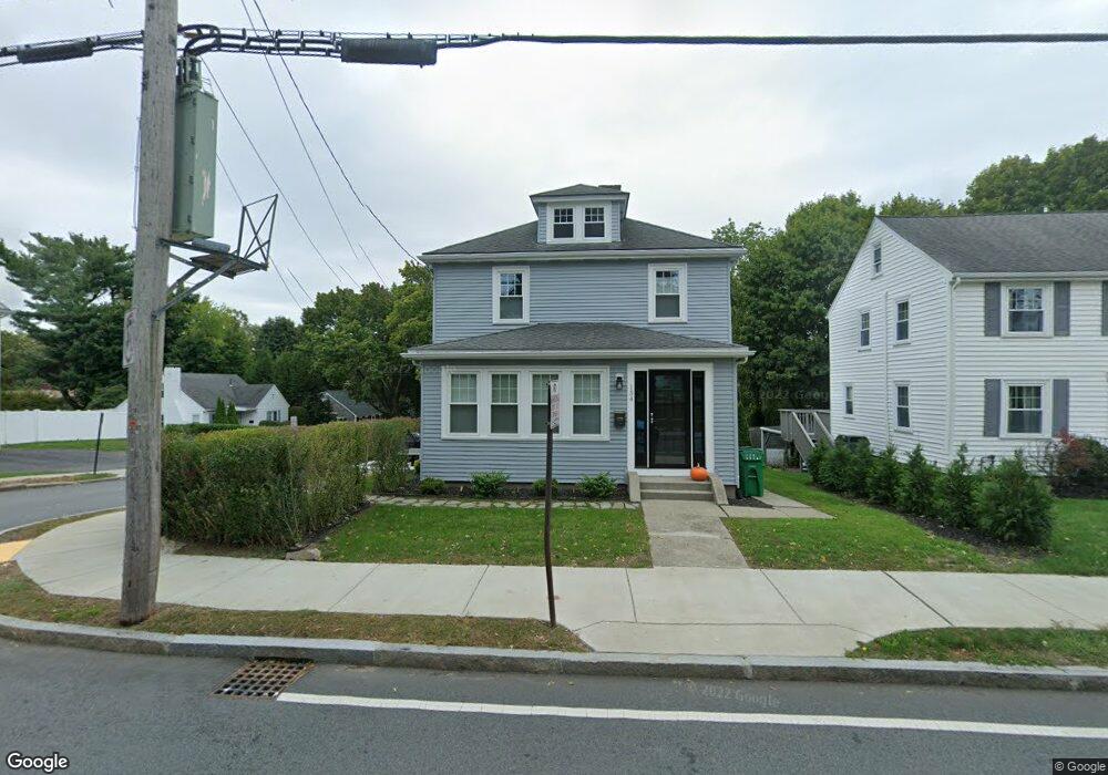
11 Pershing Rd West Newton, MA 02465
West Newton NeighborhoodEstimated Value: $849,380 - $985,000
2
Beds
1
Bath
1,095
Sq Ft
$849/Sq Ft
Est. Value
About This Home
This home is located at 11 Pershing Rd, West Newton, MA 02465 and is currently estimated at $929,845, approximately $849 per square foot. 11 Pershing Rd is a home located in Middlesex County with nearby schools including Franklin Elementary School, F.A. Day Middle School, and Newton North High School.
Ownership History
Date
Name
Owned For
Owner Type
Purchase Details
Closed on
Sep 30, 2004
Sold by
Whelan Laurie A
Bought by
Girouard Claude J and Girouard Dianne M
Current Estimated Value
Home Financials for this Owner
Home Financials are based on the most recent Mortgage that was taken out on this home.
Original Mortgage
$470,250
Outstanding Balance
$233,515
Interest Rate
5.81%
Mortgage Type
Purchase Money Mortgage
Estimated Equity
$696,330
Purchase Details
Closed on
May 28, 2003
Sold by
Treacy Jean C
Bought by
Whelan Laurie A
Home Financials for this Owner
Home Financials are based on the most recent Mortgage that was taken out on this home.
Original Mortgage
$311,000
Interest Rate
5.86%
Mortgage Type
Purchase Money Mortgage
Purchase Details
Closed on
Jun 26, 1998
Sold by
Bianco Joseph
Bought by
Treacy Jean C
Home Financials for this Owner
Home Financials are based on the most recent Mortgage that was taken out on this home.
Original Mortgage
$120,000
Interest Rate
7.09%
Mortgage Type
Purchase Money Mortgage
Create a Home Valuation Report for This Property
The Home Valuation Report is an in-depth analysis detailing your home's value as well as a comparison with similar homes in the area
Home Values in the Area
Average Home Value in this Area
Purchase History
| Date | Buyer | Sale Price | Title Company |
|---|---|---|---|
| Girouard Claude J | $495,000 | -- | |
| Whelan Laurie A | $389,000 | -- | |
| Treacy Jean C | $222,500 | -- |
Source: Public Records
Mortgage History
| Date | Status | Borrower | Loan Amount |
|---|---|---|---|
| Open | Girouard Claude J | $470,250 | |
| Previous Owner | Whelan Laurie A | $311,000 | |
| Previous Owner | Treacy Jean C | $120,000 |
Source: Public Records
Tax History
| Year | Tax Paid | Tax Assessment Tax Assessment Total Assessment is a certain percentage of the fair market value that is determined by local assessors to be the total taxable value of land and additions on the property. | Land | Improvement |
|---|---|---|---|---|
| 2025 | $6,513 | $664,600 | $0 | $0 |
| 2024 | $6,297 | $0 | $0 | $0 |
| 2023 | $5,927 | $582,200 | $567,200 | $15,000 |
| 2022 | $5,671 | $539,100 | $525,200 | $13,900 |
| 2021 | $5,473 | $508,600 | $495,500 | $13,100 |
| 2020 | $5,310 | $508,600 | $495,500 | $13,100 |
| 2019 | $5,160 | $493,800 | $481,100 | $12,700 |
| 2018 | $4,917 | $454,400 | $436,900 | $17,500 |
| 2017 | $4,767 | $428,700 | $412,200 | $16,500 |
| 2016 | $4,560 | $400,700 | $385,200 | $15,500 |
| 2015 | $4,348 | $374,500 | $360,000 | $14,500 |
Source: Public Records
Map
Nearby Homes
- 105 Adams Ave
- 24 Mague Ave Unit 24
- 214 River St Unit 214
- 14 Cottage Place Unit 14
- 60 Lindbergh Ave
- 24 Tolman St Unit 1
- 24 Tolman St Unit 2
- 8 Elm St Unit 8
- 106 River St Unit 18
- 6 Elm St Unit 6
- 16 Elm St Unit 16
- 2 Elm St Unit 2
- 279-281 Ash St
- 40 Dexter St
- 383 Cherry St Unit 383
- 31-37 Washington Ave
- 11 Derby St
- 215 Ash St Unit 3
- 138 Myrtle St Unit 2
- 101-103 Lexington St
- 9 Grant St
- 92 Grant St Unit 2
- 93 Grant St Unit 3
- 9-2 Grant St Unit 2
- 9-3 Grant St Unit 3
- 154 Derby St
- 158 Derby St
- 164 Derby St
- 15 Grant St
- 18 Pershing Rd
- 144 Derby St
- 148 Derby St
- 10 Grant St
- 23 Pershing Rd Unit 25
- 168 Derby St
- 19 Grant St
- 214 Adams Ave
- 214 Adams Ave Unit 1
- 214 Adams Ave
- 20 Grant St
Your Personal Tour Guide
Ask me questions while you tour the home.