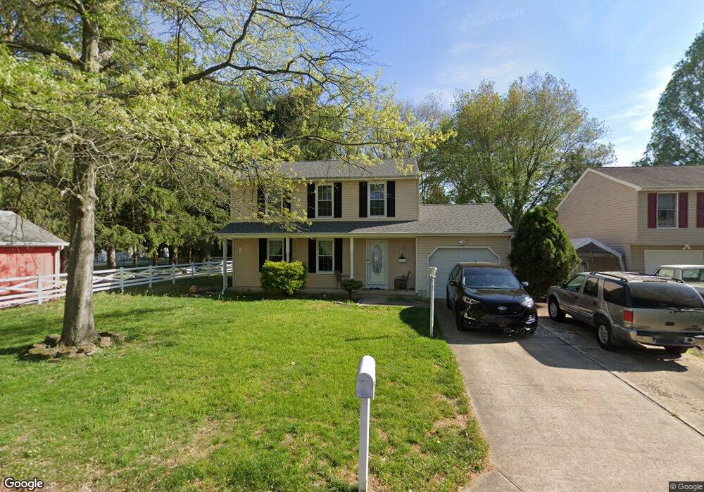
11 Royal Ln Dover, DE 19901
Highland Acres NeighborhoodEstimated Value: $362,000 - $380,533
3
Beds
3
Baths
2,087
Sq Ft
$178/Sq Ft
Est. Value
About This Home
This home is located at 11 Royal Ln, Dover, DE 19901 and is currently estimated at $371,633, approximately $178 per square foot. 11 Royal Ln is a home located in Kent County with nearby schools including Allen Frear Elementary School, F. Niel Postlethwait Middle School, and Caesar Rodney High School.
Ownership History
Date
Name
Owned For
Owner Type
Purchase Details
Closed on
Dec 8, 2016
Sold by
Ozturkoglu Ayhan and Oxturkoglu Ayhan
Bought by
Ozturkoglu Ayhan
Current Estimated Value
Purchase Details
Closed on
Jul 24, 2009
Sold by
Lachance Gerry F and Lachance Lydia M
Bought by
Oxturkoglu Ayhan
Home Financials for this Owner
Home Financials are based on the most recent Mortgage that was taken out on this home.
Original Mortgage
$240,052
Outstanding Balance
$157,942
Interest Rate
5.47%
Mortgage Type
VA
Estimated Equity
$213,691
Create a Home Valuation Report for This Property
The Home Valuation Report is an in-depth analysis detailing your home's value as well as a comparison with similar homes in the area
Home Values in the Area
Average Home Value in this Area
Purchase History
| Date | Buyer | Sale Price | Title Company |
|---|---|---|---|
| Ozturkoglu Ayhan | -- | None Available | |
| Oxturkoglu Ayhan | $235,000 | None Available |
Source: Public Records
Mortgage History
| Date | Status | Borrower | Loan Amount |
|---|---|---|---|
| Open | Oxturkoglu Ayhan | $240,052 |
Source: Public Records
Tax History
| Year | Tax Paid | Tax Assessment Tax Assessment Total Assessment is a certain percentage of the fair market value that is determined by local assessors to be the total taxable value of land and additions on the property. | Land | Improvement |
|---|---|---|---|---|
| 2025 | $545 | $332,700 | $95,300 | $237,400 |
| 2024 | $514 | $332,700 | $95,300 | $237,400 |
| 2023 | $1,880 | $58,700 | $12,400 | $46,300 |
| 2022 | $1,784 | $58,700 | $12,400 | $46,300 |
| 2021 | $1,763 | $58,700 | $12,400 | $46,300 |
| 2020 | $1,723 | $58,700 | $12,400 | $46,300 |
| 2019 | $1,669 | $58,700 | $12,400 | $46,300 |
| 2018 | $1,621 | $58,700 | $12,400 | $46,300 |
| 2017 | $1,604 | $59,600 | $0 | $0 |
| 2016 | $1,521 | $59,600 | $0 | $0 |
| 2015 | $1,320 | $59,600 | $0 | $0 |
| 2014 | $1,317 | $59,600 | $0 | $0 |
Source: Public Records
Map
Nearby Homes
- 555 W Lebanon Rd
- 5 Waterwheel Cir
- 83 Homestead Dr
- 12 S Nace Ln
- 224 Shamrock Ave
- 103 Osprey Ct
- 2043 Highland Ave
- 2158 S State St
- 157 Roundabout Trail
- 1217 Voshells Mill Star Hill Rd
- 1286 Rising Sun Rd
- 55 Boyd Cir
- 464 Orchard Grove Dr
- 128 Peach Blossom Ln
- 142 Carter Ln
- 229 Apple Blossom Dr
- 100 S Shore Dr
- 43 Brookfield Dr
- 45 Brookfield Dr
- 89 S Shore Dr
- 183 Royal Grant Way
- 638 S Old Mill Rd
- 9 Royal Ln
- 10 Royal Ln
- 648 S Old Mill Rd
- 6 Royal Ln
- 7 Squire Cir
- 624 S Old Mill Rd
- 191 Royal Grant Way
- 9 Squire Cir
- 165 Royal Grant Way
- 658 S Old Mill Rd
- 11 Squire Cir
- 159 Royal Grant Way
- 614 S Old Mill Rd
- 188 Royal Grant Way
- 180 Royal Grant Way
- 172 Royal Grant Way
- 192 Royal Grant Way
- 668 S Old Mill Rd
Your Personal Tour Guide
Ask me questions while you tour the home.