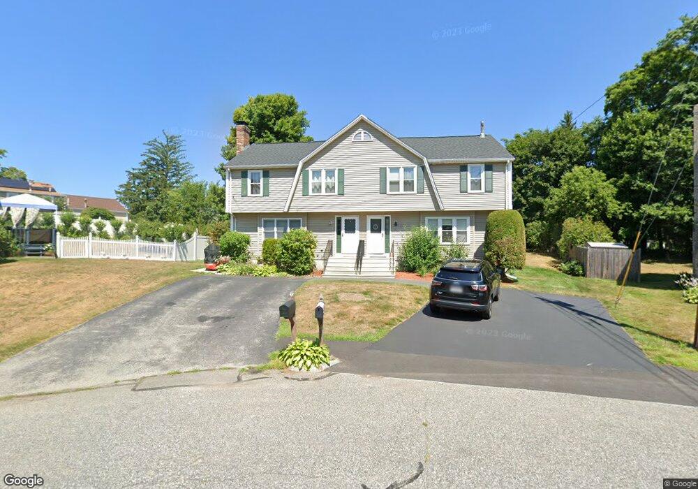
11 Saint John Ln Milford, MA 01757
Estimated Value: $384,393 - $454,000
3
Beds
2
Baths
1,236
Sq Ft
$332/Sq Ft
Est. Value
About This Home
This home is located at 11 Saint John Ln, Milford, MA 01757 and is currently estimated at $410,848, approximately $332 per square foot. 11 Saint John Ln is a home located in Worcester County with nearby schools including Milford High School and Bethany Christian Academy.
Ownership History
Date
Name
Owned For
Owner Type
Purchase Details
Closed on
Feb 14, 2020
Sold by
Archer A Holly
Bought by
11 Saint John Lane Rt
Current Estimated Value
Purchase Details
Closed on
Oct 7, 1993
Sold by
Archer Douglas A and Holly Archer A
Bought by
Archer A Holly
Purchase Details
Closed on
Aug 20, 1990
Sold by
Longo Samuel V
Bought by
Archer Douglas A
Create a Home Valuation Report for This Property
The Home Valuation Report is an in-depth analysis detailing your home's value as well as a comparison with similar homes in the area
Home Values in the Area
Average Home Value in this Area
Purchase History
| Date | Buyer | Sale Price | Title Company |
|---|---|---|---|
| 11 Saint John Lane Rt | -- | None Available | |
| Archer A Holly | $4,000 | -- | |
| Archer Douglas A | $119,000 | -- |
Source: Public Records
Mortgage History
| Date | Status | Borrower | Loan Amount |
|---|---|---|---|
| Previous Owner | Archer Douglas A | $70,601 | |
| Previous Owner | Archer Douglas A | $50,000 | |
| Previous Owner | Archer Douglas A | $10,000 |
Source: Public Records
Tax History Compared to Growth
Tax History
| Year | Tax Paid | Tax Assessment Tax Assessment Total Assessment is a certain percentage of the fair market value that is determined by local assessors to be the total taxable value of land and additions on the property. | Land | Improvement |
|---|---|---|---|---|
| 2025 | $3,892 | $304,100 | $0 | $304,100 |
| 2024 | $4,019 | $302,400 | $0 | $302,400 |
| 2023 | $4,037 | $279,400 | $0 | $279,400 |
| 2022 | $3,583 | $232,800 | $0 | $232,800 |
| 2021 | $3,453 | $216,100 | $0 | $216,100 |
| 2020 | $3,265 | $204,600 | $0 | $204,600 |
| 2019 | $3,194 | $193,100 | $0 | $193,100 |
| 2018 | $2,943 | $177,700 | $0 | $177,700 |
| 2017 | $2,854 | $170,000 | $0 | $170,000 |
| 2016 | $3,072 | $178,800 | $0 | $178,800 |
| 2015 | $3,115 | $177,500 | $0 | $177,500 |
Source: Public Records
Map
Nearby Homes
- 3 Pouliot St Unit 3
- 30 Whitney St
- 29 Forest St
- 7 Ariana Cir Unit 7
- 9 Ariana Cir Unit 9
- 20-22 Chapin St
- 6 1/2 Leonard St
- 48 Claflin St
- 33 Chestnut St
- 318 Main St
- 10-12 Orchard St
- 19 Oliver St
- 116 Adin St
- 106 Adin St
- 3 Birch Cir
- 56 S Bow St
- 102-104 Central St
- 6 Correia Cir Unit B
- 55 Jefferson St
- 7 Howard St
- 9 Saint John Ln
- 15 Saint John Ln
- 7 Saint John Ln
- 84 S Main St
- 84 S Main St Unit 2
- 82 S Main St
- 80 S Main St
- 13 Saint John Ln
- 1 Saint John Ln
- 1 Saint John Ln Unit 1
- 1 Saint John Ln Unit l
- 3 Saint John Ln
- 3 Saint John Ln Unit 3
- 78 S Main St Unit 1
- 78 S Main St
- 14 Saint John Ln
- 14 Saint John Ln Unit 14
- 16 Saint John Ln
- 61 1/2 Fruit Street Extension
- 78 1/2 S Main St