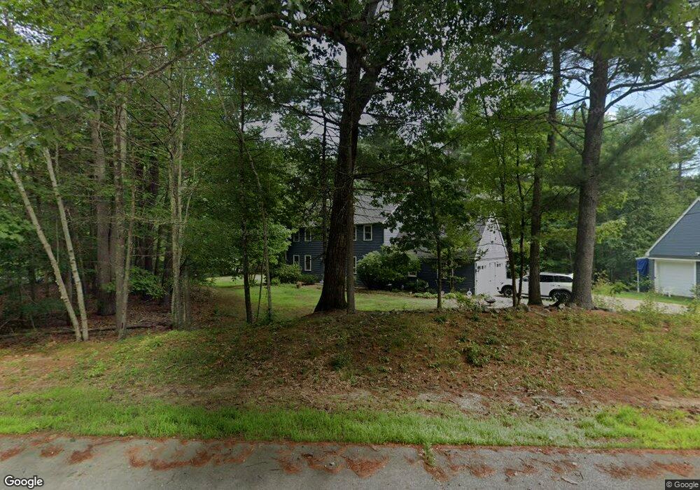
11 Thornton Ln Lee, NH 03861
Estimated Value: $696,411 - $757,000
4
Beds
3
Baths
2,841
Sq Ft
$257/Sq Ft
Est. Value
About This Home
This home is located at 11 Thornton Ln, Lee, NH 03861 and is currently estimated at $729,103, approximately $256 per square foot. 11 Thornton Ln is a home located in Strafford County with nearby schools including Mast Way School, Oyster River Middle School, and Oyster River High School.
Ownership History
Date
Name
Owned For
Owner Type
Purchase Details
Closed on
Aug 21, 2007
Sold by
Davis Ft
Bought by
Brown Cary S and Brown Annette P
Current Estimated Value
Home Financials for this Owner
Home Financials are based on the most recent Mortgage that was taken out on this home.
Original Mortgage
$284,800
Outstanding Balance
$180,413
Interest Rate
6.67%
Mortgage Type
Purchase Money Mortgage
Estimated Equity
$548,690
Purchase Details
Closed on
May 1, 2000
Sold by
Anderson William F and Anderson Barbara F
Bought by
Davis Alan L and Davis Robin L
Home Financials for this Owner
Home Financials are based on the most recent Mortgage that was taken out on this home.
Original Mortgage
$212,000
Interest Rate
8.23%
Purchase Details
Closed on
Aug 17, 1998
Sold by
Monroe Dennis J and Monroe Diana T
Bought by
Anderson William F and Anderson Barbara F
Home Financials for this Owner
Home Financials are based on the most recent Mortgage that was taken out on this home.
Original Mortgage
$160,800
Interest Rate
6.94%
Create a Home Valuation Report for This Property
The Home Valuation Report is an in-depth analysis detailing your home's value as well as a comparison with similar homes in the area
Home Values in the Area
Average Home Value in this Area
Purchase History
| Date | Buyer | Sale Price | Title Company |
|---|---|---|---|
| Brown Cary S | $356,000 | -- | |
| Davis Alan L | $243,500 | -- | |
| Anderson William F | $201,000 | -- |
Source: Public Records
Mortgage History
| Date | Status | Borrower | Loan Amount |
|---|---|---|---|
| Open | Anderson William F | $284,800 | |
| Previous Owner | Anderson William F | $212,000 | |
| Previous Owner | Anderson William F | $160,800 |
Source: Public Records
Tax History Compared to Growth
Tax History
| Year | Tax Paid | Tax Assessment Tax Assessment Total Assessment is a certain percentage of the fair market value that is determined by local assessors to be the total taxable value of land and additions on the property. | Land | Improvement |
|---|---|---|---|---|
| 2024 | $12,908 | $500,900 | $200,300 | $300,600 |
| 2023 | $11,836 | $500,900 | $200,300 | $300,600 |
| 2022 | $10,880 | $500,900 | $200,300 | $300,600 |
| 2021 | $10,889 | $500,200 | $200,300 | $299,900 |
| 2020 | $10,523 | $330,300 | $97,300 | $233,000 |
| 2019 | $10,382 | $329,700 | $97,300 | $232,400 |
| 2018 | $10,079 | $329,700 | $97,300 | $232,400 |
| 2017 | $9,446 | $315,500 | $97,300 | $218,200 |
| 2016 | $9,228 | $315,500 | $97,300 | $218,200 |
| 2015 | $9,185 | $314,000 | $91,100 | $222,900 |
| 2014 | $9,326 | $314,000 | $91,100 | $222,900 |
| 2012 | $9,401 | $314,000 | $91,100 | $222,900 |
Source: Public Records
Map
Nearby Homes
- 8 Earle Dr
- 126 Kelsey Rd
- 373 Calef Hwy
- 1 Mast Rd
- 10 Hobbs Rd
- Map23 Lot 11-18 Fort Hill Rd
- 384 N River Rd
- 32 Stage Rd
- 15 Allens Ave
- 23 Autumn Ln Unit 25
- 21 Autumn Ln Unit 26
- 288 N River Rd
- 2 Little Hook Rd
- 246 Lee Hook Rd
- 464 Wadleigh Falls Rd
- 23 Towle Rd
- 6 Tayla Way
- 2 Toon Ln
- 114 Steppingstones Rd
- 16 Elm Ct
- 4 Thornton Ln
- 16 Thornton Ln
- 14 Thornton Ln
- 6 Thornton Ln
- 26 Thornton Ln
- 20 Thornton Ln
- 8 Thornton Ln
- 28 Thornton Ln
- 28 Thornton Ln
- 3 Thornton Ln
- 10 Thornton Ln
- 2 Thornton Ln
- 19 Demeritt Ave
- 9 Thornton Ln
- 1 Thornton Ln
- 18 Demeritt Ave
- 49 Fox Garrison Rd
- 8 Demeritt Ave
- 21 Demeritt Ave
- 45 Fox Garrison Rd