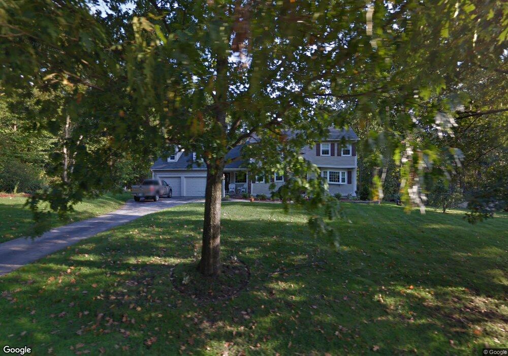
11 Thornton Rd Londonderry, NH 03053
Estimated Value: $765,619 - $831,000
4
Beds
4
Baths
3,331
Sq Ft
$239/Sq Ft
Est. Value
About This Home
This home is located at 11 Thornton Rd, Londonderry, NH 03053 and is currently estimated at $795,405, approximately $238 per square foot. 11 Thornton Rd is a home with nearby schools including Matthew Thornton Elementary School, Londonderry Middle School, and Londonderry Senior High School.
Create a Home Valuation Report for This Property
The Home Valuation Report is an in-depth analysis detailing your home's value as well as a comparison with similar homes in the area
Home Values in the Area
Average Home Value in this Area
Tax History Compared to Growth
Tax History
| Year | Tax Paid | Tax Assessment Tax Assessment Total Assessment is a certain percentage of the fair market value that is determined by local assessors to be the total taxable value of land and additions on the property. | Land | Improvement |
|---|---|---|---|---|
| 2024 | $10,447 | $647,300 | $199,900 | $447,400 |
| 2023 | $10,130 | $647,300 | $199,900 | $447,400 |
| 2022 | $9,477 | $512,800 | $149,800 | $363,000 |
| 2021 | $9,425 | $512,800 | $149,800 | $363,000 |
| 2020 | $8,895 | $442,300 | $112,400 | $329,900 |
| 2019 | $8,576 | $442,300 | $112,400 | $329,900 |
| 2018 | $8,125 | $372,700 | $93,700 | $279,000 |
| 2017 | $7,715 | $357,000 | $93,700 | $263,300 |
| 2016 | $7,676 | $357,000 | $93,700 | $263,300 |
| 2015 | $6,422 | $305,500 | $93,700 | $211,800 |
| 2014 | $6,443 | $305,500 | $93,700 | $211,800 |
| 2011 | -- | $308,200 | $93,700 | $214,500 |
Source: Public Records
Map
Nearby Homes
- 90 High Range Rd
- 88 High Range Rd
- 6 Wiley Hill Rd
- 12 Wiley Hill Rd
- 17 Lily Ln
- 19 Lily Ln
- 31 Midridge Cir
- 27 Midridge Cir
- 1 Lily Ln
- 5 Delphi Way
- 3 Delphi Way
- 7 Delphi Way
- 4 Delphi Way
- 1 Delphi Way
- 1 Delphi Way Unit 10
- 3 Chandler Dr
- 111 Winterwood Dr
- 214 Winding Pond Rd
- 11 Elise Ave Unit Lot 91
- 47 Winding Pond Rd