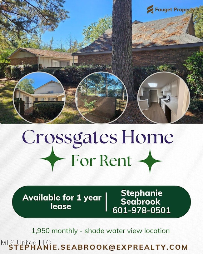
11 Timber Ridge Dr Brandon, MS 39042
Highlights
- Private Pool
- Waterfront
- Cul-De-Sac
- Rouse Elementary School Rated A-
- Breakfast Area or Nook
- Woodwork
About This Home
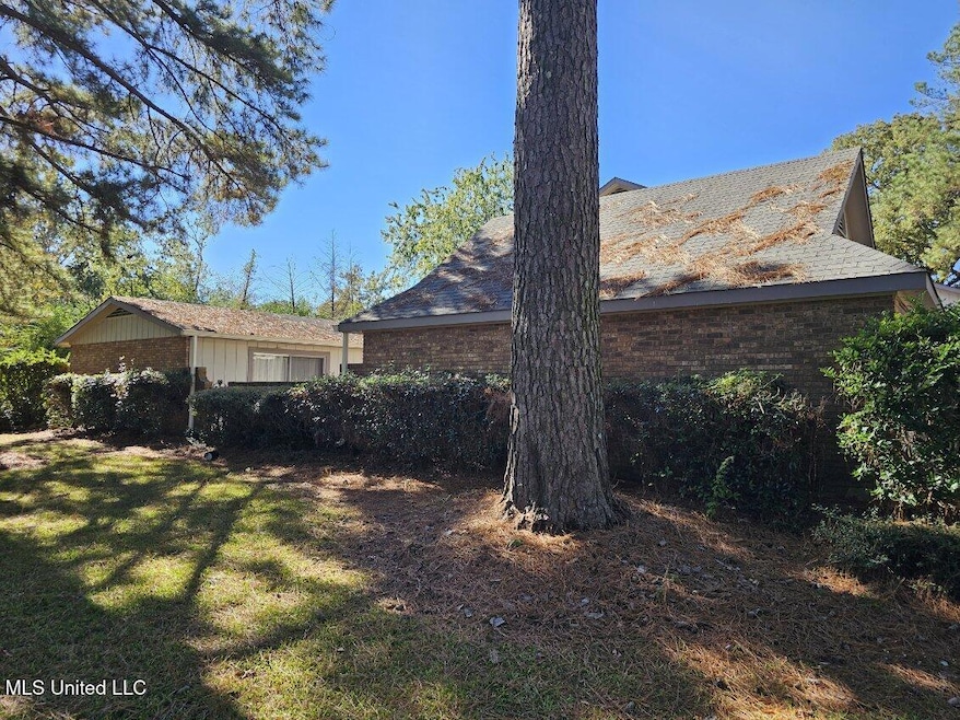
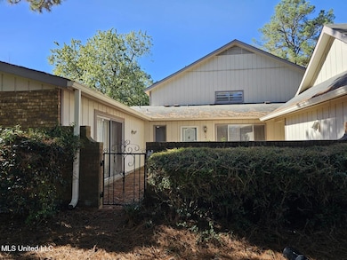
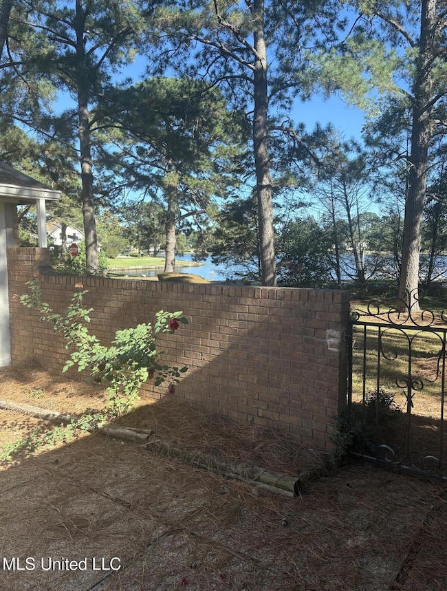
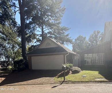
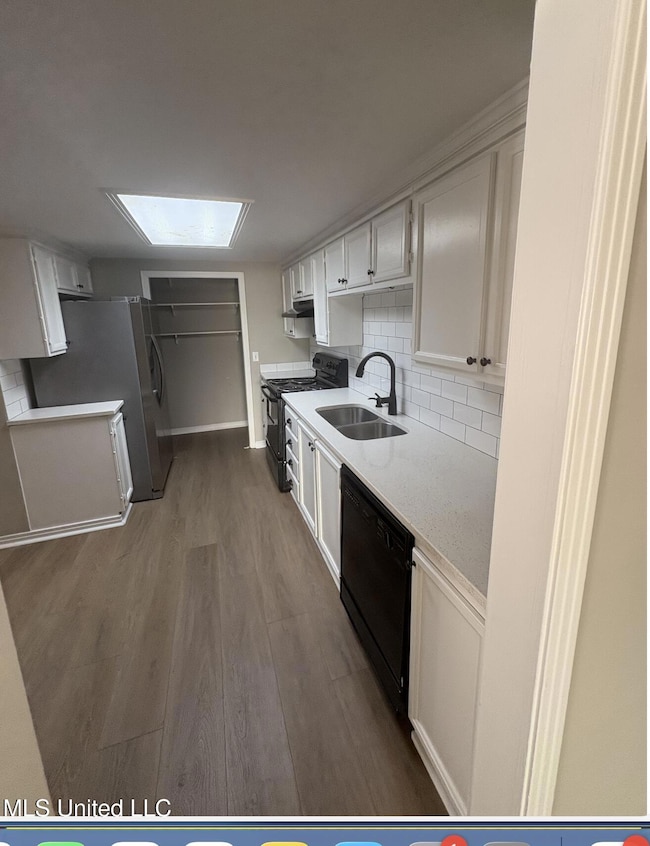
Great floor plan, spacious, updated, perfect location. . . The entry hallway has a large pantry and linen closet. The kitchen w/breakfast area has all new appliances, countertops, double stainless sink and Vinyl flooring. The laundry area is adjacent to the kitchen. Huge living/dining room combined. Updated master bath is very tastefully decorated with single vanity. The double glass doors look out onto the large shaded courtyard with a view of the lake. The two guest bedrooms are nice sized. The guest bathroom warm, decorated and has a single vanity. Natural light flows throughout. The large patio/courtyard has a brick wall with wrought-iron gate provides additonal view of Crossgates Lake. The garden area within the patio area has roses among other perennials. The two-car garage has a storage room that extends the width of the garage. A great location convenient to churches, schools, shopping, restaurants, the library, Post Office, banks, medical facilities, the Jackson-Evers Airport and Interstate 20.

Home Details
Home Type
- Single Family
Est. Annual Taxes
- $2,579
Year Built
- Built in 1973
Lot Details
- 0.5 Acre Lot
- Waterfront
- Cul-De-Sac
- Wrought Iron Fence
- Landscaped
- Many Trees
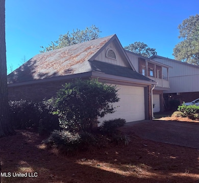
Parking
- 2 Car Garage
- Front Facing Garage
- Garage Door Opener
Home Design
- Patio Home
- Brick Exterior Construction
- Slab Foundation
- Asphalt Roof
Interior Spaces
- 1,519 Sq Ft Home
- 1-Story Property
- Woodwork
- Water Views
Kitchen
- Breakfast Area or Nook
- Free-Standing Electric Range
Bedrooms and Bathrooms
- 3 Bedrooms
- Walk-In Closet
- 2 Full Bathrooms
Outdoor Features
- Private Pool
- Uncovered Courtyard
- Patio
Schools
- Northwest Elementry Elementary School
- Northwest Rankin Middle School
- Northwest High School
Utilities
- Central Heating and Cooling System
- High Speed Internet
- Cable TV Available
Community Details
- Property has a Home Owners Association
- Crossgates Subdivision
- The community has rules related to covenants, conditions, and restrictions
Listing and Financial Details
- 12 Month Lease Term
- Assessor Parcel Number H09a000011 00480
Map
Source: MLS United
MLS Number: 4129195
APN: H09A-000011-00480
Disclaimer: Certain information contained herein is derived from information provided by parties other than Homes.com. All information provided is deemed reliable, but is not guaranteed to be accurate and should be independently verified.
![]() Information is deemed to be reliable but not guaranteed. Copyright 2025 MLS United, LLC.
Information is deemed to be reliable but not guaranteed. Copyright 2025 MLS United, LLC.
- 63 Sycamore Ln
- 426 Lakebend Place
- 406 Lakebend Place
- 69 Terrapin Dr
- 623 Corbett Dr
- 26 Woodgate Dr
- 225 Burnham Rd
- 26 Rockford Ct
- 28 Rockford Ct
- 70 Crossgates Dr
- 000 Boyce Thompson Dr
- 67 Summit Ridge Dr
- 301 Belvedere Dr
- 123 Woodgate Dr
- 248 La Gail Dr
- 14 Eastgate Ct
- 703 Tower Ridge Cove
- 442 Piney Dr
- 444 Piney Dr
- 0 La Gail Dr
- 167 Lakebend Cir
- 455 Crossgates Blvd
- 220 Cross Park Dr
- 330 Cross Park Dr
- 23 Fox Glen Cir
- 100 Windsor Lake Blvd
- 107 Woodgate Dr
- 126 Oak Hill Place
- 121 Fern Valley Rd
- 157 Fern Valley Rd
- 603 Stillwater Cove
- 1290 W Government St
- 410 Lake Forest Rd
- 1500 Chapelridge Way
- 505 Edgewater Branch Dr
- 3007 Willow Dr
- 525 Stonecreek Dr
- 990 Clubhouse Dr
- 411 Mississippi 468
- 204 Chinkapin Ct