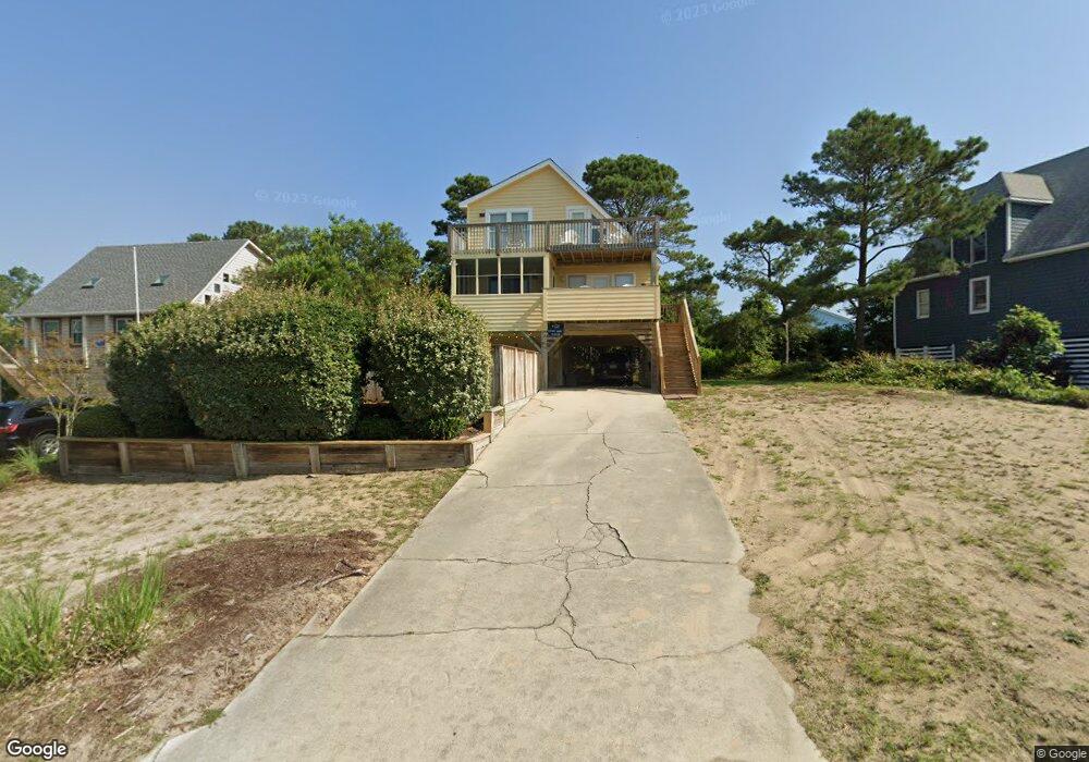
110 Christopher Dr Unit 52 Kitty Hawk, NC 27949
Estimated Value: $633,383 - $916,000
3
Beds
2
Baths
1,101
Sq Ft
$710/Sq Ft
Est. Value
About This Home
This home is located at 110 Christopher Dr Unit 52, Kitty Hawk, NC 27949 and is currently estimated at $781,346, approximately $709 per square foot. 110 Christopher Dr Unit 52 is a home with nearby schools including Kitty Hawk Elementary School, First Flight Middle School, and First Flight High School.
Ownership History
Date
Name
Owned For
Owner Type
Purchase Details
Closed on
Aug 29, 2005
Sold by
Lagrua James C and Lagrua Tricia D
Bought by
Bowman Ii Ronald W and Bowman Ann Marie
Current Estimated Value
Home Financials for this Owner
Home Financials are based on the most recent Mortgage that was taken out on this home.
Original Mortgage
$400,000
Outstanding Balance
$209,479
Interest Rate
5.71%
Mortgage Type
New Conventional
Estimated Equity
$571,867
Create a Home Valuation Report for This Property
The Home Valuation Report is an in-depth analysis detailing your home's value as well as a comparison with similar homes in the area
Home Values in the Area
Average Home Value in this Area
Purchase History
| Date | Buyer | Sale Price | Title Company |
|---|---|---|---|
| Bowman Ii Ronald W | $500,000 | None Available |
Source: Public Records
Mortgage History
| Date | Status | Borrower | Loan Amount |
|---|---|---|---|
| Open | Bowman Ii Ronald W | $400,000 |
Source: Public Records
Map
Nearby Homes
- 102 Winauk Ct Unit 71
- 103 Duck Landing Ln Unit Lot 49
- 134 Scarborough Ln Unit 50
- 102 Plover Dr Unit Lot 8
- 102 Settlers Ln Unit Lot 7R
- 101 Georgetown Sands Rd Unit 47
- 119 Osprey Ridge Rd Unit Lot 11
- 123 Georgetown Sands Rd Unit 24
- 123 Georgetown Sands Rd Unit 19
- 123 Georgetown Rd Unit 19
- 102 Sea Hawk Dr E Unit Lot 19
- 120 Tuckahoe Dr W Unit 75
- 117 Sea Colony Dr Unit B-211
- 117 Sea Colony Dr Unit A-201
- 117 Sea Colony Dr Unit B111
- 117 Sea Colony Dr Unit 211 B
- 131 Brandon Ct Unit Lot 35
- 1245 Duck Rd Unit 210
- 1245 Duck Rd Unit 205
- 1245 Duck Rd Unit 213
- 110 Christopher Dr
- 112 Christopher Dr
- 108 Christopher Dr
- 107 Uppowoc Ct Unit 5
- 107 Uppowoc Ct
- 106 Christopher Dr Unit 54
- 106 Christopher Dr
- 114 Christopher Dr
- 101 Poteskeet Dr
- 103 Poteskeet Dr
- 101 Pamela Ct Unit 32
- 101 Pamela Ct
- 109 Uppowoc Ct
- 104 Christopher Dr Unit 55
- 104 Christopher Dr
- 105 Uppowoc Ct
- 113 Christopher Dr
- 116 Christopher Dr
- 111 Uppowoc Ct Unit 7
- 111 Uppowoc Ct
Your Personal Tour Guide
Ask me questions while you tour the home.