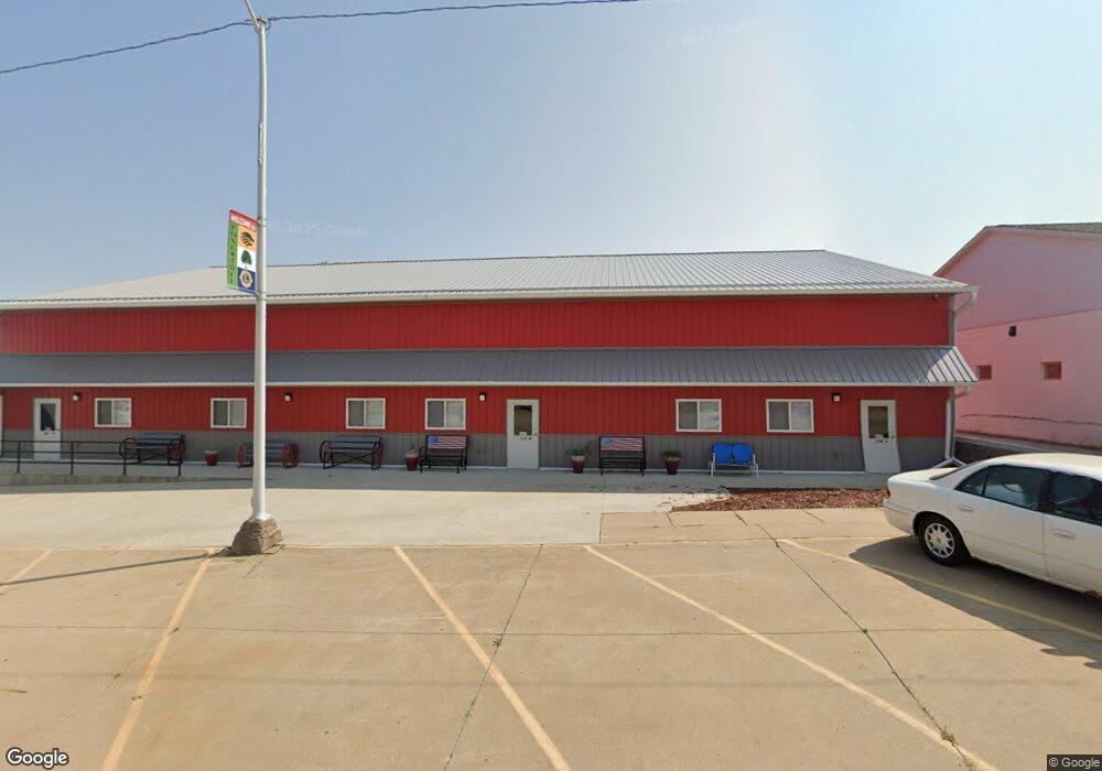
110 N Devoe St Unit 112, 114 Lone Tree, IA 52755
Estimated Value: $189,000 - $213,000
2
Beds
2
Baths
1,760
Sq Ft
$113/Sq Ft
Est. Value
About This Home
This home is located at 110 N Devoe St Unit 112, 114, Lone Tree, IA 52755 and is currently estimated at $198,931, approximately $113 per square foot. 110 N Devoe St Unit 112, 114 is a home located in Johnson County with nearby schools including Lone Tree Elementary School and Lone Tree Junior/Senior High School.
Ownership History
Date
Name
Owned For
Owner Type
Purchase Details
Closed on
Jan 13, 2012
Sold by
Mattheis Joshua A and Mattheis Amber M
Bought by
Dorsman Jon and Dorsman Jessica
Current Estimated Value
Home Financials for this Owner
Home Financials are based on the most recent Mortgage that was taken out on this home.
Original Mortgage
$90,000
Interest Rate
4.5%
Mortgage Type
New Conventional
Purchase Details
Closed on
Jul 5, 2005
Sold by
Brooks Lori Storm and Brooks Harry
Bought by
Mattheis Joshua A and Matteis Amber M
Home Financials for this Owner
Home Financials are based on the most recent Mortgage that was taken out on this home.
Original Mortgage
$123,830
Interest Rate
5.68%
Mortgage Type
FHA
Create a Home Valuation Report for This Property
The Home Valuation Report is an in-depth analysis detailing your home's value as well as a comparison with similar homes in the area
Home Values in the Area
Average Home Value in this Area
Purchase History
| Date | Buyer | Sale Price | Title Company |
|---|---|---|---|
| Dorsman Jon | $100,000 | None Available | |
| Mattheis Joshua A | $126,500 | None Available |
Source: Public Records
Mortgage History
| Date | Status | Borrower | Loan Amount |
|---|---|---|---|
| Previous Owner | Dorsman Jon | $90,000 | |
| Previous Owner | Mattheis Joshua A | $123,830 |
Source: Public Records
Tax History Compared to Growth
Tax History
| Year | Tax Paid | Tax Assessment Tax Assessment Total Assessment is a certain percentage of the fair market value that is determined by local assessors to be the total taxable value of land and additions on the property. | Land | Improvement |
|---|---|---|---|---|
| 2025 | $2,192 | $182,100 | $20,900 | $161,200 |
| 2024 | $2,126 | $168,800 | $20,900 | $147,900 |
| 2023 | $1,920 | $168,800 | $20,900 | $147,900 |
| 2022 | $1,876 | $130,700 | $16,500 | $114,200 |
| 2021 | $1,906 | $129,300 | $16,500 | $112,800 |
| 2020 | $1,906 | $125,500 | $16,500 | $109,000 |
| 2019 | $1,714 | $126,300 | $16,500 | $109,800 |
| 2018 | $1,680 | $111,700 | $16,500 | $95,200 |
| 2017 | $1,746 | $111,700 | $16,500 | $95,200 |
| 2016 | $1,668 | $108,900 | $16,600 | $92,300 |
| 2015 | $1,668 | $108,900 | $16,600 | $92,300 |
| 2014 | $1,846 | $100,600 | $16,600 | $84,000 |
Source: Public Records
Map
Nearby Homes
- 201 N Devoe St
- 221 W Commercial St
- 407 E Elm St
- 500 S Center St
- 745 N Perkins St
- 106 Dorothy Ln
- 5888 Sand Rd SE
- 25840 Golden Oak Ln Lot 1
- 25838 Golden Oak Ln Lot 7
- 25836 Golden Oak Ln Lot 8
- 25832 Golden Oak Ln Lot 12
- 25736 Golden Pond Ln Se Lot 17
- 25738 Golden Pond Ln Se Lot 16
- 25824 Golden Oak Ln Lot 9
- 1092 Walnut Ave Unit 209
- 1092 Walnut Ave Unit 114 Bld D
- Lot 2 116th Cir
- Lot 39 Walter Mapp Dr
- 2 Commercial Dr
- 1436 Vine Ave
- 110 N Devoe St
- 116 N Devoe St
- 118 N Devoe St
- 106 E Jayne St
- 105 N Center St
- 101 Devoe St
- 110 E Jayne St
- 107 N Devoe St
- 103 N Center St
- 111 N Center St
- 113 N Devoe St
- 117 Devoe St
- 117 N Devoe St
- 109 N Devoe St
- 113 S Devoe St
- 109 E Jayne St
- 106 W Jayne St
- 102 E Commercial St
- 122 Commercial St
- 111 E Jayne St