Estimated Value: $353,606 - $391,000
3
Beds
2
Baths
1,474
Sq Ft
$251/Sq Ft
Est. Value
About This Home
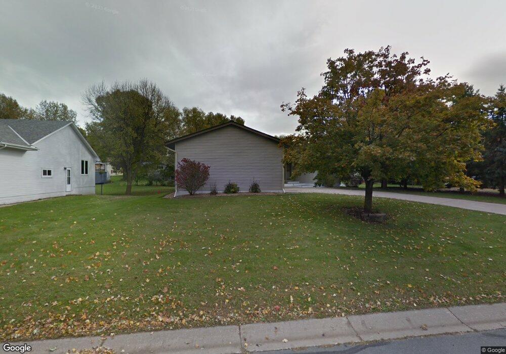
This home is located at 110 W Ridge Rd, Mayer, MN 55360 and is currently estimated at $369,652, approximately $250 per square foot. 110 W Ridge Rd is a home located in Carver County with nearby schools including Watertown-Mayer Elementary School, Watertown-Mayer Middle School, and Watertown Mayer High School.
Ownership History
Date
Name
Owned For
Owner Type
Purchase Details
Closed on
Sep 9, 2011
Sold by
Taylor Myron E and Taylor Lois M
Bought by
Franck Daniel J
Current Estimated Value
Home Financials for this Owner
Home Financials are based on the most recent Mortgage that was taken out on this home.
Original Mortgage
$146,600
Outstanding Balance
$100,678
Interest Rate
4.32%
Mortgage Type
New Conventional
Estimated Equity
$268,974
Purchase Details
Closed on
Jul 26, 2000
Sold by
Thompson Gary A and Thompson Elizabeth J
Bought by
Taylor Myron E and Zaske Lois M
Purchase Details
Closed on
Jun 5, 1998
Sold by
Hoekstra Donald D
Bought by
Thompson Gary A
Create a Home Valuation Report for This Property
The Home Valuation Report is an in-depth analysis detailing your home's value as well as a comparison with similar homes in the area
Home Values in the Area
Average Home Value in this Area
Purchase History
| Date | Buyer | Sale Price | Title Company |
|---|---|---|---|
| Franck Daniel J | $162,900 | -- | |
| Taylor Myron E | $158,600 | -- | |
| Thompson Gary A | $134,500 | -- |
Source: Public Records
Mortgage History
| Date | Status | Borrower | Loan Amount |
|---|---|---|---|
| Open | Franck Daniel J | $146,600 |
Source: Public Records
Tax History
| Year | Tax Paid | Tax Assessment Tax Assessment Total Assessment is a certain percentage of the fair market value that is determined by local assessors to be the total taxable value of land and additions on the property. | Land | Improvement |
|---|---|---|---|---|
| 2025 | $3,472 | $328,200 | $55,000 | $273,200 |
| 2024 | $3,554 | $328,200 | $55,000 | $273,200 |
| 2023 | $3,618 | $325,500 | $57,200 | $268,300 |
| 2022 | $3,332 | $315,400 | $57,200 | $258,200 |
| 2021 | $3,332 | $249,400 | $47,700 | $201,700 |
| 2020 | $3,400 | $249,400 | $47,700 | $201,700 |
| 2019 | $3,158 | $237,500 | $45,400 | $192,100 |
| 2018 | $3,060 | $237,500 | $45,400 | $192,100 |
| 2017 | $2,728 | $220,100 | $41,300 | $178,800 |
| 2016 | $2,802 | $172,400 | $0 | $0 |
| 2015 | $2,612 | $170,200 | $0 | $0 |
| 2014 | $2,612 | $146,000 | $0 | $0 |
Source: Public Records
Map
Nearby Homes
- 337 2nd St NW
- 190 Morning Dr
- 2083 River Bend Trail
- 2091 River Bend Trail
- 2095 River Bend Trail
- 1518 Hidden Trail
- 2103 River Bend Trail
- 2102 River Bend Trail
- XXX 62nd St
- 2107 River Bend Trail
- 1379 Birch Dr
- 2119 River Bend Trail
- 2127 River Bend Trail
- 2146 River Bend Trail
- 2200 Timber Dr
- 5875 Highway 25
- 7250 Rutz Lake Rd
- 127XX 58th St
- 14680 County Road 32
- 5225 Upland Ave
Your Personal Tour Guide
Ask me questions while you tour the home.