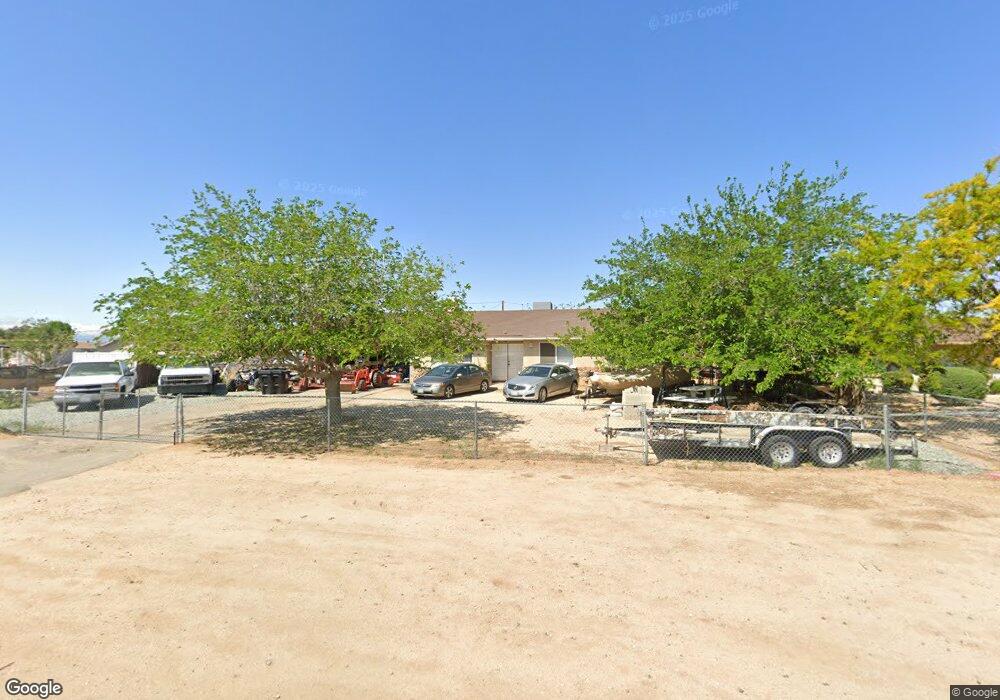
11006 Mohawk Rd Apple Valley, CA 92308
High Desert NeighborhoodEstimated Value: $361,000 - $381,253
3
Beds
2
Baths
1,302
Sq Ft
$288/Sq Ft
Est. Value
About This Home
This home is located at 11006 Mohawk Rd, Apple Valley, CA 92308 and is currently estimated at $374,563, approximately $287 per square foot. 11006 Mohawk Rd is a home located in San Bernardino County with nearby schools including Sandia Elementary School and Apple Valley High School.
Ownership History
Date
Name
Owned For
Owner Type
Purchase Details
Closed on
Jul 16, 2025
Sold by
Campos Gloria
Bought by
Gloria Campos Living Trust and Campos
Current Estimated Value
Purchase Details
Closed on
Jan 11, 2007
Sold by
Campos Gloria
Bought by
Campos Gloria
Home Financials for this Owner
Home Financials are based on the most recent Mortgage that was taken out on this home.
Original Mortgage
$174,500
Interest Rate
6.09%
Mortgage Type
New Conventional
Create a Home Valuation Report for This Property
The Home Valuation Report is an in-depth analysis detailing your home's value as well as a comparison with similar homes in the area
Home Values in the Area
Average Home Value in this Area
Purchase History
| Date | Buyer | Sale Price | Title Company |
|---|---|---|---|
| Gloria Campos Living Trust | -- | None Listed On Document | |
| Campos Gloria | -- | Stewart Title Of Sacramento |
Source: Public Records
Mortgage History
| Date | Status | Borrower | Loan Amount |
|---|---|---|---|
| Previous Owner | Campos Gloria | $174,500 |
Source: Public Records
Tax History
| Year | Tax Paid | Tax Assessment Tax Assessment Total Assessment is a certain percentage of the fair market value that is determined by local assessors to be the total taxable value of land and additions on the property. | Land | Improvement |
|---|---|---|---|---|
| 2025 | $2,440 | $164,136 | $41,124 | $123,012 |
| 2024 | $3,193 | $160,918 | $40,318 | $120,600 |
| 2023 | $3,805 | $157,762 | $39,527 | $118,235 |
| 2022 | $4,061 | $154,669 | $38,752 | $115,917 |
| 2021 | $1,782 | $151,636 | $37,992 | $113,644 |
| 2020 | $2,081 | $150,081 | $37,602 | $112,479 |
| 2019 | $1,726 | $147,139 | $36,865 | $110,274 |
| 2018 | $1,682 | $144,254 | $36,142 | $108,112 |
| 2017 | $1,912 | $141,425 | $35,433 | $105,992 |
| 2016 | $1,570 | $138,652 | $34,738 | $103,914 |
| 2015 | -- | $136,569 | $34,216 | $102,353 |
| 2014 | $1,803 | $133,894 | $33,546 | $100,348 |
Source: Public Records
Map
Nearby Homes
- 21305 Wren St
- 11135 Truchas Rd
- 21019 Wren St
- 21055 Valencia St
- 26585 Del Oro Rd
- 11020 Viento Place
- 20997 Valencia St
- 21533 Del Oro Rd
- 20489 Wren St
- 11182 Caribou Ave
- 3 Del Oro Rd
- 0 Viento Rd Unit CV22206473
- 10616 Jamul Rd
- 21044 Wisteria St
- 21259 Rosewood St
- 21637 Del Oro Rd
- 43431107 Kiowa Place
- 21390 Tussing Ranch Rd
- 22109 Tussing Ranch Rd
- 1 Tussing Ranch Rd
- 11016 Mohawk Rd
- 21240 Neola Rd
- 21224 Neola Rd
- 11005 Truchas Rd
- 11030 Mohawk Rd
- 11015 Truchas Rd
- 21210 Neola Rd
- 11009 Mohawk Rd
- 11031 Truchas Rd
- 10993 Mohawk Rd
- 11050 Mohawk Rd
- 11021 Mohawk Rd
- 10975 Mohawk Rd
- 11051 Truchas Rd
- 11037 Mohawk Rd
- 21235 Neola Rd
- 21225 Neola Rd
- 11070 Mohawk Rd
- 21255 Neola Rd Unit S
- 21255 Neola Rd
Your Personal Tour Guide
Ask me questions while you tour the home.