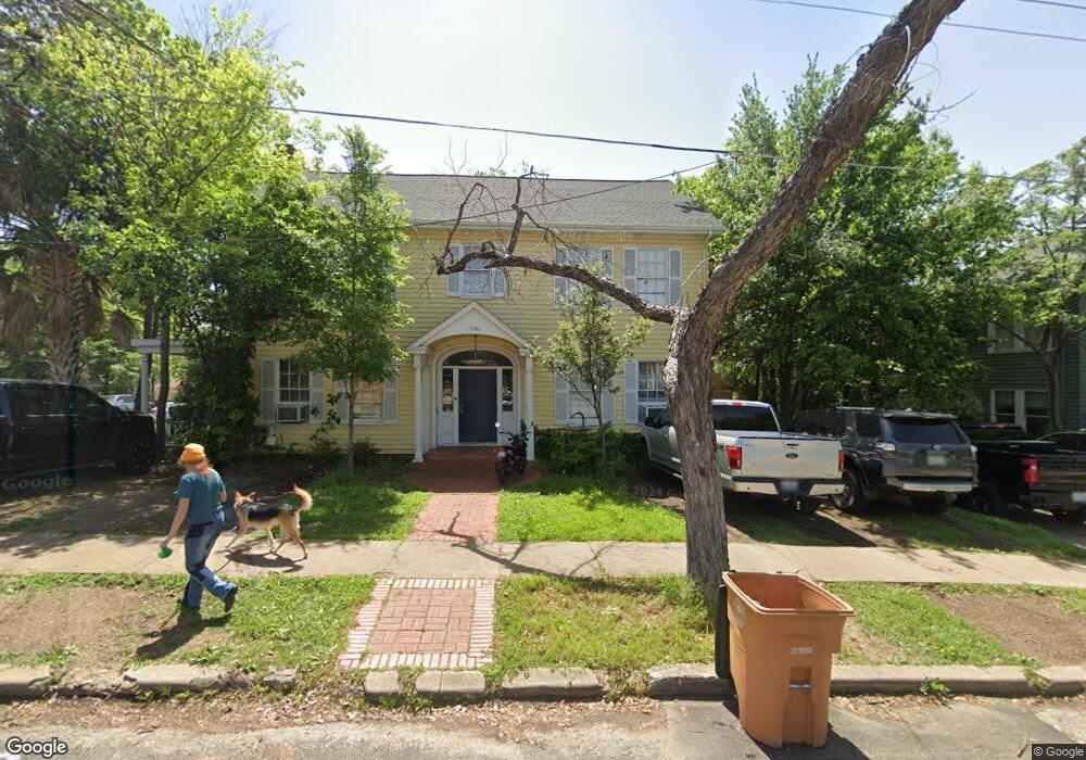
1101 W 22nd St Unit B Austin, TX 78705
West Campus NeighborhoodEstimated Value: $1,069,000
1
Bed
1
Bath
440
Sq Ft
$2,430/Sq Ft
Est. Value
About This Home
This home is located at 1101 W 22nd St Unit B, Austin, TX 78705 and is currently estimated at $1,069,000, approximately $2,429 per square foot. 1101 W 22nd St Unit B is a home located in Travis County with nearby schools including Bryker Woods Elementary School, Austin High School, and University High School.
Ownership History
Date
Name
Owned For
Owner Type
Purchase Details
Closed on
Feb 9, 2018
Sold by
Debbie Outlaw Properties Llc
Bought by
1918 Robbins Place Llc
Current Estimated Value
Purchase Details
Closed on
Jan 27, 2017
Sold by
Sjrjdh Llc
Bought by
Debbie Outlaw Properties Llc
Home Financials for this Owner
Home Financials are based on the most recent Mortgage that was taken out on this home.
Original Mortgage
$2,100,000
Interest Rate
4.16%
Mortgage Type
Purchase Money Mortgage
Purchase Details
Closed on
Dec 21, 2011
Sold by
Hirsh Joe Douglas
Bought by
Hirsh Joe Douglas
Create a Home Valuation Report for This Property
The Home Valuation Report is an in-depth analysis detailing your home's value as well as a comparison with similar homes in the area
Home Values in the Area
Average Home Value in this Area
Purchase History
| Date | Buyer | Sale Price | Title Company |
|---|---|---|---|
| 1918 Robbins Place Llc | -- | None Available | |
| Debbie Outlaw Properties Llc | -- | Heritage Title Co | |
| Hirsh Joe Douglas | -- | None Available |
Source: Public Records
Mortgage History
| Date | Status | Borrower | Loan Amount |
|---|---|---|---|
| Previous Owner | Debbie Outlaw Properties Llc | $2,100,000 |
Source: Public Records
Tax History Compared to Growth
Tax History
| Year | Tax Paid | Tax Assessment Tax Assessment Total Assessment is a certain percentage of the fair market value that is determined by local assessors to be the total taxable value of land and additions on the property. | Land | Improvement |
|---|---|---|---|---|
| 2025 | $68,451 | $3,717,200 | $3,379,385 | $337,815 |
| 2023 | $55,378 | $3,060,828 | $3,060,828 | $0 |
| 2022 | $42,578 | $2,155,922 | $1,802,338 | $353,584 |
| 2021 | $45,456 | $2,088,325 | $1,802,338 | $285,987 |
| 2020 | $43,625 | $2,033,941 | $1,802,338 | $231,603 |
| 2018 | $13,110 | $592,126 | $381,213 | $210,913 |
| 2017 | $13,415 | $601,520 | $390,000 | $211,520 |
| 2016 | $15,206 | $681,829 | $350,000 | $331,829 |
| 2015 | $11,143 | $500,000 | $310,000 | $190,000 |
| 2014 | $11,143 | $468,238 | $320,000 | $148,238 |
Source: Public Records
Map
Nearby Homes
- 1910 Robbins Place Unit 207
- 1910 Robbins Place Unit 301
- 1909 David St
- 1110 W 22nd St Unit 16
- 1110 W 22nd St Unit 2
- 1818 Vance Cir
- 912 W 22nd St Unit 201
- 2216 San Gabriel St Unit 108
- 1010 W 23 St Unit 15
- 914 W 22nd 1 2 St Unit 304
- 1010 W 23rd St Unit 4
- 1905 San Gabriel St Unit 105
- 915 W 23rd St Unit 108
- 2401 Leon St Unit 306
- 2401 Leon St Unit 110
- 2404 Longview St Unit 105
- 902 W 18th St Unit B
- 706 W 22nd St Unit 204
- 2110 Rio Grande St Unit 107
- 2408 Longview St Unit 112
- 1101 W 22nd St
- 1101 W 22nd St
- 1916 Robbins Place Unit B
- 1916 Robbins Place
- 1916 Robbins Place
- 1918 Robbins Place Unit B
- 1918 Robbins Place Unit A
- 1918 Robbins Place
- 1918 Robbins Place
- 1103 W 22nd St Unit C
- 1103 W 22nd St Unit B
- 1103 W 22nd St Unit A
- 1910 Robbins Place Unit 210
- 1910 Robbins Place Unit 201
- 1910 Robbins Place Unit 307
- 1910 Robbins Place Unit 302
- 1910 Robbins Place Unit 106
- 1910 Robbins Place Unit 105
- 1910 Robbins Place Unit 312
- 1910 Robbins Place Unit 212