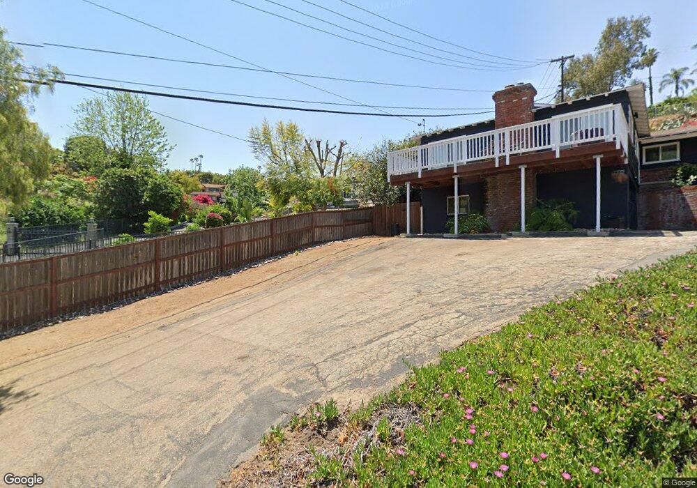
11017 Fuerte Dr La Mesa, CA 91941
Rancho Park NeighborhoodEstimated Value: $1,171,658 - $1,362,000
3
Beds
2
Baths
1,908
Sq Ft
$644/Sq Ft
Est. Value
About This Home
This home is located at 11017 Fuerte Dr, La Mesa, CA 91941 and is currently estimated at $1,229,165, approximately $644 per square foot. 11017 Fuerte Dr is a home located in San Diego County with nearby schools including Fuerte Elementary School, Hillsdale Middle School, and Valhalla High.
Ownership History
Date
Name
Owned For
Owner Type
Purchase Details
Closed on
Jun 24, 2019
Sold by
Sapp William D and Sapp Allyson H
Bought by
Sapp William D and Sapp Allyson H
Current Estimated Value
Purchase Details
Closed on
Nov 8, 2013
Sold by
Hello Sunshine Llc
Bought by
Sapp William D and Sapp Allyson H
Home Financials for this Owner
Home Financials are based on the most recent Mortgage that was taken out on this home.
Original Mortgage
$500,000
Outstanding Balance
$370,645
Interest Rate
4.08%
Mortgage Type
New Conventional
Estimated Equity
$858,520
Purchase Details
Closed on
Apr 25, 2013
Sold by
Hurt John Robert
Bought by
Hello Sunshine Llc
Create a Home Valuation Report for This Property
The Home Valuation Report is an in-depth analysis detailing your home's value as well as a comparison with similar homes in the area
Home Values in the Area
Average Home Value in this Area
Purchase History
| Date | Buyer | Sale Price | Title Company |
|---|---|---|---|
| Sapp William D | -- | None Available | |
| Sapp William D | $625,000 | First American Title Company | |
| Hello Sunshine Llc | $440,000 | First American Title San Die |
Source: Public Records
Mortgage History
| Date | Status | Borrower | Loan Amount |
|---|---|---|---|
| Open | Sapp William D | $500,000 |
Source: Public Records
Tax History Compared to Growth
Tax History
| Year | Tax Paid | Tax Assessment Tax Assessment Total Assessment is a certain percentage of the fair market value that is determined by local assessors to be the total taxable value of land and additions on the property. | Land | Improvement |
|---|---|---|---|---|
| 2025 | $9,168 | $774,810 | $294,200 | $480,610 |
| 2024 | $9,168 | $759,619 | $288,432 | $471,187 |
| 2023 | $8,931 | $744,726 | $282,777 | $461,949 |
| 2022 | $8,792 | $730,125 | $277,233 | $452,892 |
| 2021 | $8,671 | $715,810 | $271,798 | $444,012 |
| 2020 | $8,481 | $700,554 | $269,012 | $431,542 |
| 2019 | $8,375 | $686,819 | $263,738 | $423,081 |
| 2018 | $8,239 | $673,353 | $258,567 | $414,786 |
| 2017 | $590 | $660,151 | $253,498 | $406,653 |
| 2016 | $7,810 | $647,208 | $248,528 | $398,680 |
| 2015 | $7,770 | $637,487 | $244,795 | $392,692 |
| 2014 | $7,618 | $625,000 | $240,000 | $385,000 |
Source: Public Records
Map
Nearby Homes
- 11078 Puebla Dr
- 4620 Panchoy Dr
- 4511 Taft Ave
- 4331 Nabal Dr
- 10744 Anaheim Dr
- 182 Dewitt Ct
- 10880 Hess Dr
- 243 Horizon Hills Dr
- 10743 Flambeau Place
- 4726 Lorena Place
- 4251 Nabal Dr
- 10549 Queen Ave
- 4816 Redondo Dr
- 4333 Calavo Dr
- 10629 Challenge Blvd
- 10979 Skywood Dr
- 4029 Carpenter Ln
- 10509 Challenge Blvd
- 11656 Altoona Dr
- 4551 Peak Ct
- 11011 Fuerte Dr
- 10966 Puebla Dr
- 4605 Mayapan Dr
- 11016 Puebla Dr
- 4612 Mayapan Dr
- 4635 Mayapan Dr (One Way St)
- 4635 Mayapan Dr
- 11025 Fuerte Dr
- 11026 Puebla Dr
- 4635 Mayapan Dr
- 4650 Mayapan Dr
- 11002 Fuerte Dr
- 10945 Puebla Dr
- 10924 Puebla Dr
- 11010 Fuerte Dr
- 10957 Puebla Dr
- 11013 Puebla Dr
- 11045 Puebla Dr
- 11036 Puebla Dr
- 4598 Mayapan Dr