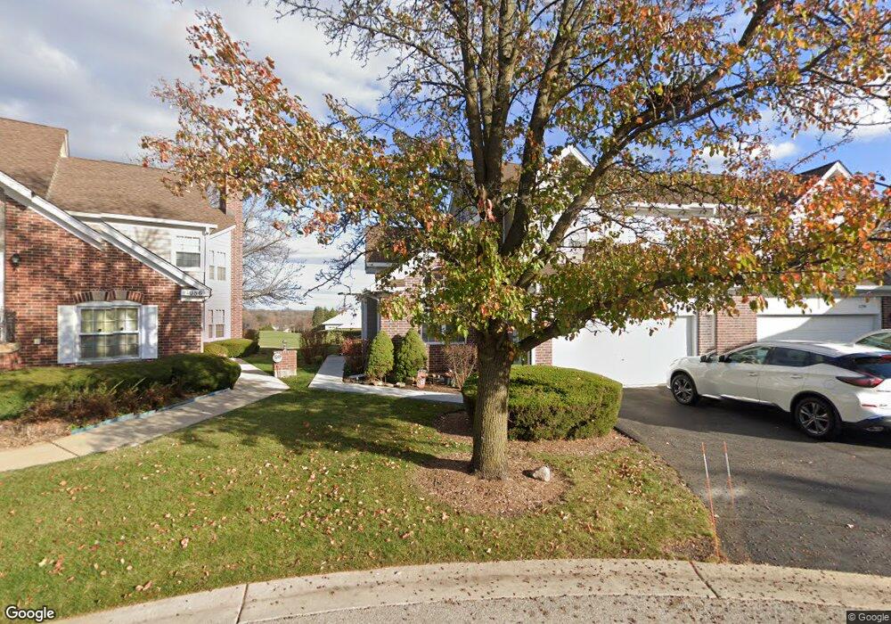
1102 Saint Andrews Ct Unit 204 Algonquin, IL 60102
Estimated Value: $278,005 - $343,000
3
Beds
3
Baths
2,156
Sq Ft
$143/Sq Ft
Est. Value
About This Home
This home is located at 1102 Saint Andrews Ct Unit 204, Algonquin, IL 60102 and is currently estimated at $307,751, approximately $142 per square foot. 1102 Saint Andrews Ct Unit 204 is a home located in McHenry County with nearby schools including Westfield Community School, Kenneth E Neubert Elementary School, and Harry D Jacobs High School.
Ownership History
Date
Name
Owned For
Owner Type
Purchase Details
Closed on
Jan 24, 2019
Sold by
Chicago Title Land Trust Company
Bought by
Walton Camille and The Camille Walton Living Trus
Current Estimated Value
Purchase Details
Closed on
Jan 21, 1997
Sold by
Walton John C and Walton Camille I
Bought by
Harris Bank Palatine
Purchase Details
Closed on
Dec 7, 1995
Sold by
State Bank Of Countryside
Bought by
Walton John C and Walton Camille I
Home Financials for this Owner
Home Financials are based on the most recent Mortgage that was taken out on this home.
Original Mortgage
$139,000
Interest Rate
7.45%
Create a Home Valuation Report for This Property
The Home Valuation Report is an in-depth analysis detailing your home's value as well as a comparison with similar homes in the area
Home Values in the Area
Average Home Value in this Area
Purchase History
| Date | Buyer | Sale Price | Title Company |
|---|---|---|---|
| Walton Camille | -- | Chicago Title Land Trust Co | |
| Harris Bank Palatine | -- | -- | |
| Walton John C | $212,500 | Chicago Title |
Source: Public Records
Mortgage History
| Date | Status | Borrower | Loan Amount |
|---|---|---|---|
| Previous Owner | Walton John C | $139,000 |
Source: Public Records
Tax History Compared to Growth
Tax History
| Year | Tax Paid | Tax Assessment Tax Assessment Total Assessment is a certain percentage of the fair market value that is determined by local assessors to be the total taxable value of land and additions on the property. | Land | Improvement |
|---|---|---|---|---|
| 2024 | $5,610 | $87,719 | $15,898 | $71,821 |
| 2023 | $5,228 | $78,454 | $14,219 | $64,235 |
| 2022 | $5,350 | $73,387 | $22,849 | $50,538 |
| 2021 | $5,091 | $68,369 | $21,287 | $47,082 |
| 2020 | $4,934 | $65,948 | $20,533 | $45,415 |
| 2019 | $4,786 | $63,121 | $19,653 | $43,468 |
| 2018 | $5,046 | $63,937 | $18,155 | $45,782 |
| 2017 | $4,903 | $60,233 | $17,103 | $43,130 |
| 2016 | $4,784 | $56,493 | $16,041 | $40,452 |
| 2013 | -- | $70,092 | $14,965 | $55,127 |
Source: Public Records
Map
Nearby Homes
- 1405 Surrey Ln
- 1820 Crofton Dr
- 1 N Hubbard St
- SWC Talaga and Algonquin Rd
- 741 Regal Ln
- 2043 Peach Tree Ln Unit 4122
- 700 Fairfield Ln
- 000 County Line Rd
- 1801 Arbordale Ln
- 1900 Waverly Ln
- 2233 Dawson Ln Unit 312
- 30 Arbordale Ct Unit 4284
- 710 Braewood Dr
- 1235 Fairmont Ct
- 710 Sprucetree Ln
- 615 Harper Dr
- Adams Plan at Algonquin Meadows - Single Family
- Sequoia Plan at Algonquin Meadows - Single Family
- Bryce Plan at Algonquin Meadows - Single Family
- Rainier Plan at Algonquin Meadows - Single Family
- 1148 Saint Andrews Ct Unit 221
- 1104 Saint Andrews Ct Unit 203
- 1146 Saint Andrews Ct Unit 222
- 1104 St Andrews Ct
- 1106 Saint Andrews Ct Unit 202
- 1108 Saint Andrews Ct Unit 201
- 1126 Saint Andrews Ct Unit 211
- 1128 Saint Andrews Ct
- 1122 Saint Andrews Ct Unit 212
- 1122 St Andrews Ct Unit 1122
- 1122 Saint Andrews Ct Unit 1122
- 1124 Saint Andrews Ct Unit 215
- 1124 Saint Andrews Ct Unit 1
- 1086 Saint Andrews Ct Unit 191
- 1082 Saint Andrews Ct Unit 192
- 1084 Saint Andrews Ct Unit 193
- 1088 Saint Andrews Ct
- 1142 Saint Andrews Ct Unit 223
- 1144 Saint Andrews Ct Unit 224
- 1113 Saint Andrews Ct Unit 283