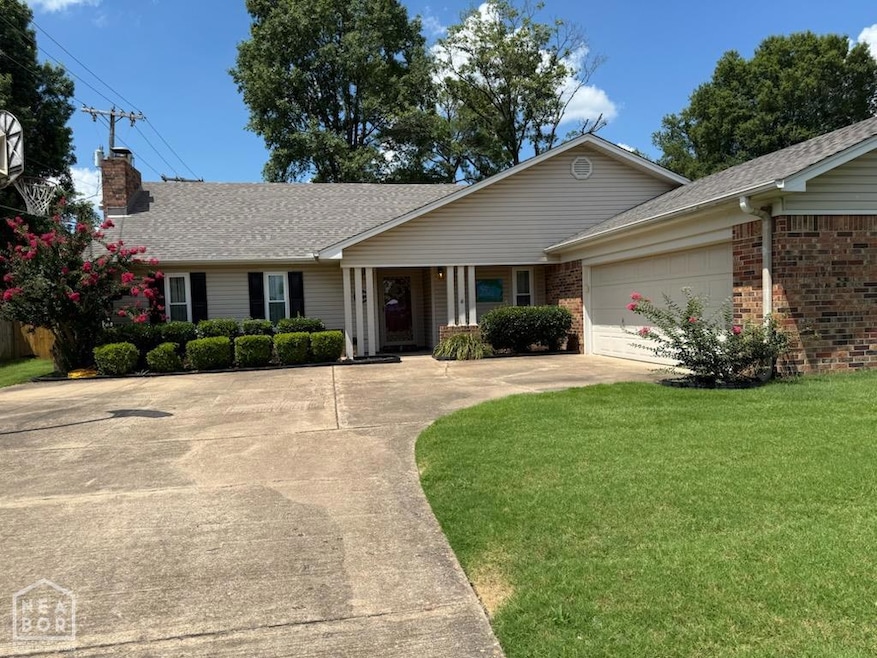
1103 Oakdale Dr West Memphis, AR 72301
Estimated payment $1,435/month
Highlights
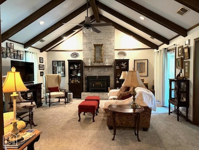
- Wood Burning Stove
- Wood Flooring
- 2 Car Attached Garage
- Traditional Architecture
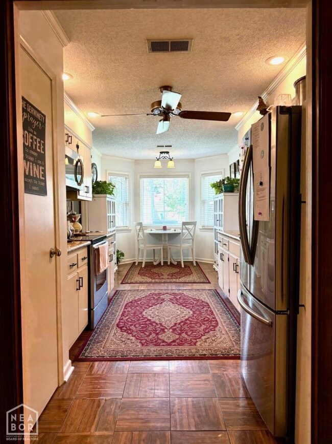
- Breakfast Area or Nook
- 1-Story Property
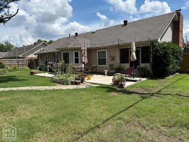
About This Home
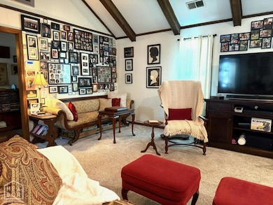
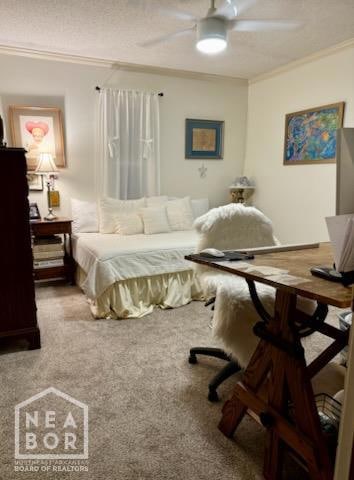
Welcome to this beautifully maintained 3-bedroom, 2-bath home offering comfort, style, and modern upgrades throughout. Step inside to an inviting layout featuring a formal dining room perfect for gatherings, a cozy breakfast nook for everyday meals, and a spacious living area filled with natural light. The kitchen boasts elegant granite countertops and ample cabinetryideal for cooking and entertaining. Enjoy peace of mind with both the interior and exterior HVAC units recently replaced, ensuring year-round comfort. The primary suite provides a relaxing retreat with its own private bath, while two additional bedrooms offer versatility for family, guests, or a home office. Outside, you'll find a 2-car attached garage and a well-kept yard ready for your personal touch. Move-in ready and full of charm, this home is the perfect blend of convenience and qualityschedule your showing today!
Home Details
Home Type
- Single Family
Est. Annual Taxes
- $858
Parking
- 2 Car Attached Garage
Home Design
- Traditional Architecture
- Brick Exterior Construction
- Slab Foundation
- Architectural Shingle Roof
- Vinyl Siding
Interior Spaces
- 1,761 Sq Ft Home
- 1-Story Property
- Wood Burning Stove
- Breakfast Area or Nook
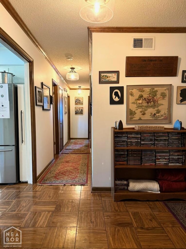
Flooring
- Wood
- Carpet
- Ceramic Tile
Bedrooms and Bathrooms
- 3 Bedrooms
- 2 Full Bathrooms
Schools
- West Memphis Elementary And Middle School
- West Memphis High School
Utilities
- Central Heating and Cooling System
Map
Home Values in the Area
Average Home Value in this Area
Tax History
| Year | Tax Paid | Tax Assessment Tax Assessment Total Assessment is a certain percentage of the fair market value that is determined by local assessors to be the total taxable value of land and additions on the property. | Land | Improvement |
|---|---|---|---|---|
| 2024 | $858 | $28,250 | $5,600 | $22,650 |
| 2023 | $933 | $28,250 | $5,600 | $22,650 |
| 2022 | $983 | $28,250 | $5,600 | $22,650 |
| 2021 | $983 | $28,250 | $5,600 | $22,650 |
| 2020 | $1,280 | $28,250 | $5,600 | $22,650 |
| 2019 | $971 | $26,250 | $5,600 | $20,650 |
| 2018 | $692 | $26,250 | $5,600 | $20,650 |
| 2017 | $692 | $26,250 | $5,600 | $20,650 |
| 2016 | $692 | $26,250 | $5,600 | $20,650 |
| 2015 | $703 | $26,250 | $5,600 | $20,650 |
| 2014 | $703 | $25,680 | $5,200 | $20,480 |
Property History
| Date | Event | Price | List to Sale | Price per Sq Ft |
|---|---|---|---|---|
| 12/02/2025 12/02/25 | For Sale | $259,900 | -- | $148 / Sq Ft |
Purchase History
| Date | Type | Sale Price | Title Company |
|---|---|---|---|
| Warranty Deed | -- | Homestead Title & Closing | |
| Deed | $159,900 | Stewart Title | |
| Deed | $52,000 | -- |
Mortgage History
| Date | Status | Loan Amount | Loan Type |
|---|---|---|---|
| Previous Owner | $147,000 | New Conventional |
Source: Northeast Arkansas Board of REALTORS®
MLS Number: 10126281
APN: 379-271000-000
Disclaimer: Certain information contained herein is derived from information provided by parties other than Homes.com. All information provided is deemed reliable, but is not guaranteed to be accurate and should be independently verified.
![]() IDX information is provided exclusively for personal, non-commercial use, and may not be used for any purpose other than to identify prospective properties consumers may be interested in purchasing. Information is deemed reliable but not guaranteed.
IDX information is provided exclusively for personal, non-commercial use, and may not be used for any purpose other than to identify prospective properties consumers may be interested in purchasing. Information is deemed reliable but not guaranteed.
- 1106 W Barton Ave
- 402 Brentwood Dr
- 205 Clement Rd
- 406 Cedar Chase Dr
- 1500 W Barton Ave
- 302 Georgetown Dr
- 1505 Evergreen Dr
- 909 Rosewood Dr
- 1503 Oaklawn Dr
- 1504 W Barton Ave
- 1002 Clement Rd
- 807 W Barton Ave
- 1302 Windover Ln
- 823 S Roselawn Dr
- 1042 W Roselawn Dr
- 101 Country Club Rd
- 1108 Richland Cove
- 1405 Ashwood Cir
- 1709 Pine Ridge Dr
- 1409 Ashwood Cir
- 700 S Avalon St
- 1101 S Avalon St
- 228 S 8th St Unit 228
- 606 Weaver Rd
- 501 Par Dr
- 2411 Talonwood Dr Unit 419
- 2416 E Barton Ave
- 2911 Church St
- 324 Block St Unit R
- 318 Gannt St
- 71 Harvard Rd
- 62 Harvard Rd
- 48 S Bristol Rd
- 717 S Riverside Dr Unit 405
- 717 S Riverside Dr Unit 401
- 4 Riverview Dr W
- 589 Madewood Dr
- 604 Madewood Dr
- 359 W Dison Ave
- 374 W Person Ave