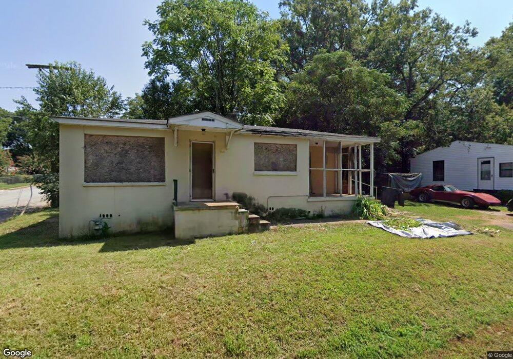
1103 Scott Dr Anderson, SC 29624
Estimated Value: $138,000 - $152,000
2
Beds
1
Bath
809
Sq Ft
$181/Sq Ft
Est. Value
About This Home
This home is located at 1103 Scott Dr, Anderson, SC 29624 and is currently estimated at $146,303, approximately $180 per square foot. 1103 Scott Dr is a home located in Anderson County with nearby schools including Varennes Elementary School, Robert Anderson Middle School, and Westside High School.
Ownership History
Date
Name
Owned For
Owner Type
Purchase Details
Closed on
Mar 25, 2024
Sold by
Bell Michael Jason and Bell Brandy B
Bought by
Village House Properties Llc
Current Estimated Value
Purchase Details
Closed on
Apr 21, 2017
Sold by
Swann Freddie B
Bought by
Bell Michael Jason
Purchase Details
Closed on
Jan 30, 2008
Sold by
Swann Freddie B
Bought by
Swann Freddie B and Freddie Swann Living Trust
Purchase Details
Closed on
Aug 1, 2002
Sold by
Bank Of Ny
Bought by
Clay Pitt Props Llc
Create a Home Valuation Report for This Property
The Home Valuation Report is an in-depth analysis detailing your home's value as well as a comparison with similar homes in the area
Home Values in the Area
Average Home Value in this Area
Purchase History
| Date | Buyer | Sale Price | Title Company |
|---|---|---|---|
| Village House Properties Llc | $105,000 | South Carolina Title | |
| Bell Michael Jason | $8,000 | None Available | |
| Swann Freddie B | -- | None Available | |
| Clay Pitt Props Llc | $15,000 | -- |
Source: Public Records
Tax History Compared to Growth
Tax History
| Year | Tax Paid | Tax Assessment Tax Assessment Total Assessment is a certain percentage of the fair market value that is determined by local assessors to be the total taxable value of land and additions on the property. | Land | Improvement |
|---|---|---|---|---|
| 2024 | $739 | $680 | $300 | $380 |
| 2023 | $356 | $680 | $300 | $380 |
| 2022 | $322 | $680 | $300 | $380 |
| 2021 | $299 | $520 | $210 | $310 |
| 2020 | $294 | $520 | $210 | $310 |
| 2019 | $294 | $520 | $210 | $310 |
| 2018 | $292 | $520 | $210 | $310 |
| 2017 | -- | $1,940 | $210 | $1,730 |
| 2016 | $733 | $1,970 | $150 | $1,820 |
| 2015 | $736 | $1,970 | $150 | $1,820 |
| 2014 | $724 | $1,970 | $150 | $1,820 |
Source: Public Records
Map
Nearby Homes
- 0 W Reed St
- 0 W Franklin St
- 311 Johnson St
- 310 W Hampton St
- 701 Delia St Unit B
- 701 Delia St Unit A
- 701 Delia St
- 309 Johnson St
- 702 Posey St
- 720 722 Gary St
- 509 Rose Hill St
- Lot 1 S Towers St
- 00 Ila St
- 719 Dora Dr
- 505 Cathcart Dr
- 406 Cunningham Dr
- 1105 W Franklin St
- 413 W Market St
- 1002 S Main St
- 604 W Market St
- 415 Carver St
- 1105 Scott Dr
- 0930103009 Scott Dr
- 414 Carver St
- 503 Carver St
- 1107 Scott Dr
- 502 W Hampton St
- 500 Carver St
- 411 Carver St
- 426 W Hampton St
- 412 Carver St
- 504 W Hampton St
- 505 Carver St
- 502 Carver St
- 424 W Hampton St
- 409 Carver St
- 506 W Hampton St
- 415 Johnson St
- 504 Carver St
- 422 W Hampton St