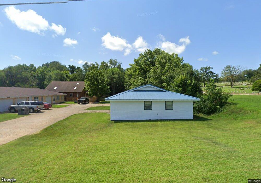
1104 Lambert Ln West Plains, MO 65775
Estimated Value: $153,839 - $229,000
--
Bed
--
Bath
2,346
Sq Ft
$82/Sq Ft
Est. Value
About This Home
This home is located at 1104 Lambert Ln, West Plains, MO 65775 and is currently estimated at $193,210, approximately $82 per square foot. 1104 Lambert Ln is a home located in Howell County with nearby schools including West Plains Senior High School, Ozarks Christian Academy, and Faith Assembly Christian School.
Ownership History
Date
Name
Owned For
Owner Type
Purchase Details
Closed on
Feb 15, 2013
Sold by
Gray Susan
Bought by
Macoke Llc
Current Estimated Value
Home Financials for this Owner
Home Financials are based on the most recent Mortgage that was taken out on this home.
Original Mortgage
$78,000
Interest Rate
3.38%
Mortgage Type
Future Advance Clause Open End Mortgage
Purchase Details
Closed on
Oct 28, 2011
Sold by
Caruthers Yancy W and Caruthers Melody G
Bought by
Gray Susan
Create a Home Valuation Report for This Property
The Home Valuation Report is an in-depth analysis detailing your home's value as well as a comparison with similar homes in the area
Home Values in the Area
Average Home Value in this Area
Purchase History
| Date | Buyer | Sale Price | Title Company |
|---|---|---|---|
| Macoke Llc | -- | Btc | |
| Gray Susan | -- | Briel Title Co |
Source: Public Records
Mortgage History
| Date | Status | Borrower | Loan Amount |
|---|---|---|---|
| Closed | Macoke Llc | $78,000 |
Source: Public Records
Tax History Compared to Growth
Tax History
| Year | Tax Paid | Tax Assessment Tax Assessment Total Assessment is a certain percentage of the fair market value that is determined by local assessors to be the total taxable value of land and additions on the property. | Land | Improvement |
|---|---|---|---|---|
| 2025 | $1,139 | $27,510 | $1,420 | $26,090 |
| 2024 | $1,133 | $24,560 | -- | -- |
| 2023 | $1,133 | $24,560 | $0 | $0 |
| 2022 | $1,062 | $23,070 | $0 | $0 |
| 2021 | $831 | $23,070 | $0 | $0 |
| 2020 | $831 | $17,630 | $0 | $0 |
| 2019 | $863 | $17,630 | $0 | $0 |
| 2018 | $863 | $17,630 | $0 | $0 |
| 2017 | $860 | $17,630 | $0 | $0 |
| 2015 | -- | $17,380 | $0 | $0 |
| 2014 | -- | $17,380 | $0 | $0 |
| 2013 | -- | $17,380 | $0 | $0 |
Source: Public Records
Map
Nearby Homes
- 1236 Aldridge St
- 620 Johnson St
- 000 S Thayer Ave
- 426 S Thayer Ave
- 000 Tanglewood Place
- 000 Bill Virdon
- 315 Walker St
- 130 N Howell Ave
- 639 Lanton Rd
- 312 E Maple St
- 209 S Aid Ave
- 203 S Aid Ave
- 742 Olive St
- 101 W Main St
- 413 Cherry St
- 1029 S Aid Ave
- 000 Us Highway 63
- 204 Bartley St
- 1021A N College St
- 609 Woodland Ave
- 1106 Lambert Lane #4-6
- 1110 Lambert Ln
- 1108 Lambert Ln
- 426 Lanton Rd
- 1114 Lambert Ln
- 434 Lanton Rd
- 317 S Thayer Ave
- 436 Lanton Rd
- 325 S Thayer Ave
- 331 S Thayer Ave
- 446 Lanton Rd
- 1213 Aldridge St
- 261 S Thayer Ave
- 1233 Aldridge St
- 1227 Aldridge St
- 314 S Thayer Ave
- 316 S Thayer Ave
- 253 S Thayer Ave
- 1237 Aldridge St
- 245 S Thayer Ave