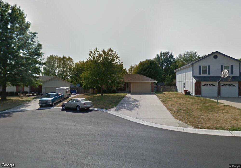
1108 NE Banner Dr Lees Summit, MO 64086
Estimated Value: $319,362 - $326,000
3
Beds
3
Baths
1,256
Sq Ft
$256/Sq Ft
Est. Value
About This Home
This home is located at 1108 NE Banner Dr, Lees Summit, MO 64086 and is currently estimated at $321,591, approximately $256 per square foot. 1108 NE Banner Dr is a home located in Jackson County with nearby schools including Underwood Elementary School, Bernard C. Campbell Middle School, and Lee's Summit North High School.
Ownership History
Date
Name
Owned For
Owner Type
Purchase Details
Closed on
Jan 15, 2019
Sold by
Bank Of America Na
Bought by
Cunningham Mark Alan and Cunningham Linda Diane
Current Estimated Value
Purchase Details
Closed on
Oct 3, 2016
Sold by
Wells Fargo Bank Na
Bought by
Cunningham Mark Alan and Cunningham Linda Diane
Purchase Details
Closed on
Jan 19, 2006
Sold by
Heller Ruth A and Johnson Timothy L
Bought by
Cunningham Mark Alan and Cunningham Linda D
Home Financials for this Owner
Home Financials are based on the most recent Mortgage that was taken out on this home.
Original Mortgage
$50,000
Interest Rate
6.22%
Mortgage Type
Purchase Money Mortgage
Purchase Details
Closed on
Jul 1, 2002
Sold by
Hayton Charles W and Hayton Julie A
Bought by
Heller Ruth A
Home Financials for this Owner
Home Financials are based on the most recent Mortgage that was taken out on this home.
Original Mortgage
$93,500
Interest Rate
6.12%
Mortgage Type
Purchase Money Mortgage
Create a Home Valuation Report for This Property
The Home Valuation Report is an in-depth analysis detailing your home's value as well as a comparison with similar homes in the area
Home Values in the Area
Average Home Value in this Area
Purchase History
| Date | Buyer | Sale Price | Title Company |
|---|---|---|---|
| Cunningham Mark Alan | -- | Stewart Title Co | |
| Cunningham Mark Alan | -- | Stewart Title | |
| Cunningham Mark Alan | -- | Multiple | |
| Heller Ruth A | -- | Kansas City Title |
Source: Public Records
Mortgage History
| Date | Status | Borrower | Loan Amount |
|---|---|---|---|
| Previous Owner | Cunningham Mark Alan | $50,000 | |
| Previous Owner | Heller Ruth A | $93,500 |
Source: Public Records
Tax History
| Year | Tax Paid | Tax Assessment Tax Assessment Total Assessment is a certain percentage of the fair market value that is determined by local assessors to be the total taxable value of land and additions on the property. | Land | Improvement |
|---|---|---|---|---|
| 2025 | $3,058 | $42,715 | $6,851 | $35,864 |
| 2024 | $3,058 | $42,351 | $4,695 | $37,656 |
| 2023 | $3,036 | $42,351 | $5,244 | $37,107 |
| 2022 | $2,607 | $32,300 | $4,978 | $27,322 |
| 2021 | $2,444 | $32,300 | $4,978 | $27,322 |
| 2020 | $2,444 | $29,367 | $4,978 | $24,389 |
| 2019 | $2,377 | $29,367 | $4,978 | $24,389 |
| 2018 | $985,564 | $28,297 | $4,138 | $24,159 |
| 2017 | $2,431 | $28,297 | $4,138 | $24,159 |
| 2016 | $2,431 | $27,588 | $4,332 | $23,256 |
| 2014 | $2,452 | $27,285 | $4,048 | $23,237 |
Source: Public Records
Map
Nearby Homes
- 1213 NE Ball Dr
- 1118 NE Deerbrook Terrace
- 1412 NE Ernest Way
- 1345 NE Foxwood Dr
- 905 NE Country Ln
- 928 NE Mulberry St
- 1325 NE Foxwood Dr
- 1138 NE Mulberry St
- 1700 NE Bluff St
- 1708 NE Bluff St
- 1704 NE Bluff St
- 812 NE Mulberry St
- 1300 NE Browning Ln
- 617 NE Birchwood Dr
- 1104 NE Columbus St
- 809 NE Cedar St
- 705 NE Noeleen Ln
- 1000 NE Brookfield Dr
- 1029 NE Brookfield Dr
- 1028 NE Brookfield Dr
- 1104 NE Banner Dr
- 1112 NE Banner Dr
- 1100 NE Banner Dr
- 1116 NE Banner Dr
- 1111 NE Banner Dr
- 1107 NE Banner Dr
- 1103 NE Banner Dr
- 1107 NE Richardson Place
- 1111 NE Richardson Place
- 1115 NE Banner Dr
- 1120 NE Banner Dr
- 1103 NE Richardson Place
- 1115 NE Richardson Place
- 1100 NE Richardson Place
- 1119 NE Banner Dr
- 1119 NE Richardson Place
- 1110 NE Richardson Place
- 1106 NE Richardson Place
- 1104 NE Ball Dr
- 1102 NE Richardson Place
Your Personal Tour Guide
Ask me questions while you tour the home.