Estimated Value: $79,000 - $108,000
1
Bed
1
Bath
464
Sq Ft
$195/Sq Ft
Est. Value
About This Home
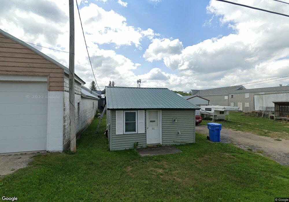
This home is located at 111 1st St SW, Utica, MN 55979 and is currently estimated at $90,370, approximately $194 per square foot. 111 1st St SW is a home located in Winona County with nearby schools including St. Charles Elementary School, St. Charles Secondary School, and St. John's Lutheran School.
Ownership History
Date
Name
Owned For
Owner Type
Purchase Details
Closed on
Aug 9, 2018
Sold by
Denzer David A and Denzer Joanne E
Bought by
Blace Donald P
Current Estimated Value
Home Financials for this Owner
Home Financials are based on the most recent Mortgage that was taken out on this home.
Original Mortgage
$30,000
Outstanding Balance
$10,180
Interest Rate
4.5%
Mortgage Type
Future Advance Clause Open End Mortgage
Estimated Equity
$80,190
Create a Home Valuation Report for This Property
The Home Valuation Report is an in-depth analysis detailing your home's value as well as a comparison with similar homes in the area
Home Values in the Area
Average Home Value in this Area
Purchase History
| Date | Buyer | Sale Price | Title Company |
|---|---|---|---|
| Blace Donald P | $40,000 | Town N Country Title Llc |
Source: Public Records
Mortgage History
| Date | Status | Borrower | Loan Amount |
|---|---|---|---|
| Open | Blace Donald P | $30,000 |
Source: Public Records
Tax History Compared to Growth
Tax History
| Year | Tax Paid | Tax Assessment Tax Assessment Total Assessment is a certain percentage of the fair market value that is determined by local assessors to be the total taxable value of land and additions on the property. | Land | Improvement |
|---|---|---|---|---|
| 2025 | $190 | $24,600 | $1,900 | $22,700 |
| 2024 | $190 | $25,000 | $1,900 | $23,100 |
| 2023 | $168 | $21,900 | $1,900 | $20,000 |
| 2022 | $170 | $21,600 | $1,900 | $19,700 |
| 2021 | $126 | $19,900 | $1,900 | $18,000 |
| 2020 | $132 | $14,000 | $1,900 | $12,100 |
| 2019 | $126 | $14,000 | $1,900 | $12,100 |
| 2018 | $104 | $14,300 | $1,900 | $12,400 |
| 2017 | $120 | $0 | $0 | $0 |
| 2016 | $108 | $0 | $0 | $0 |
| 2015 | $108 | $0 | $0 | $0 |
| 2014 | $76 | $0 | $0 | $0 |
Source: Public Records
Map
Nearby Homes
- 0 Cherokee Rd
- 1955 Brownell St
- TBD30 Cherokee Rd
- 225 S 1st St
- 140 W Main St
- 1542 Rimrock Rd
- 205 Nicholas Dr
- 336 Whispering Hills Dr
- 570 Harrison St
- 11349 Equine Dr
- 240 Northern Hills Dr
- 1397 Soppa Dr
- 413 Northern Hills Ct
- 701 Bluff Ave
- xx Tbd
- 416 Brubaker Dr
- 533 Manheim Ave
- 633 Manheim Ave
- 260 E 15th St
- 113 E 7th St
- 118 W Main St N
- 116 W Main St N
- 124 E Main St
- 109 2nd Ave NW
- 120 W Main St
- 221 Center St S
- 103 2nd Ave NW
- 128 E Main St
- 202 1st Ave NW
- 116 Center St S
- 110 E Main St
- 111 2nd Ave NW
- 220 Center St S
- 220 S Center St
- 311 N Center St
- 120 E Main St
- 120 Main St E
- 200 W Main St N
- 201 1st Ave NW
- 212 W Main St