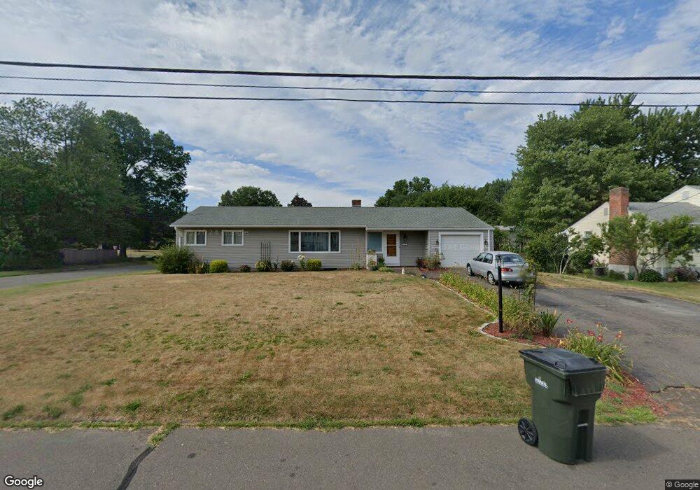
111 Amherst St Wethersfield, CT 06109
Estimated Value: $336,072 - $364,000
2
Beds
2
Baths
1,450
Sq Ft
$241/Sq Ft
Est. Value
About This Home
This home is located at 111 Amherst St, Wethersfield, CT 06109 and is currently estimated at $348,768, approximately $240 per square foot. 111 Amherst St is a home located in Hartford County with nearby schools including Emerson-Williams School, Silas Deane Middle School, and Wethersfield High School.
Ownership History
Date
Name
Owned For
Owner Type
Purchase Details
Closed on
Nov 29, 2023
Sold by
Letoile Frank R
Bought by
Letoile Frank R and Thibodeau Nathalie
Current Estimated Value
Purchase Details
Closed on
Jul 16, 1998
Sold by
Leblanc Marie B Est and Branchard
Bought by
Letoile Frank R and Letoile Beth A
Home Financials for this Owner
Home Financials are based on the most recent Mortgage that was taken out on this home.
Original Mortgage
$84,900
Interest Rate
6.98%
Mortgage Type
Purchase Money Mortgage
Create a Home Valuation Report for This Property
The Home Valuation Report is an in-depth analysis detailing your home's value as well as a comparison with similar homes in the area
Home Values in the Area
Average Home Value in this Area
Purchase History
| Date | Buyer | Sale Price | Title Company |
|---|---|---|---|
| Letoile Frank R | -- | None Available | |
| Letoile Frank R | $85,000 | -- |
Source: Public Records
Mortgage History
| Date | Status | Borrower | Loan Amount |
|---|---|---|---|
| Previous Owner | Letoile Frank R | $141,000 | |
| Previous Owner | Letoile Frank R | $100,000 | |
| Previous Owner | Letoile Frank R | $84,900 |
Source: Public Records
Tax History
| Year | Tax Paid | Tax Assessment Tax Assessment Total Assessment is a certain percentage of the fair market value that is determined by local assessors to be the total taxable value of land and additions on the property. | Land | Improvement |
|---|---|---|---|---|
| 2025 | $8,589 | $208,380 | $69,970 | $138,410 |
| 2024 | $6,401 | $148,100 | $71,380 | $76,720 |
| 2023 | $6,188 | $148,100 | $71,380 | $76,720 |
| 2022 | $6,084 | $148,100 | $71,380 | $76,720 |
| 2021 | $6,023 | $148,100 | $71,380 | $76,720 |
| 2020 | $6,026 | $148,100 | $71,380 | $76,720 |
| 2019 | $6,034 | $148,100 | $71,380 | $76,720 |
| 2018 | $6,260 | $153,500 | $70,100 | $83,400 |
| 2017 | $6,105 | $153,500 | $70,100 | $83,400 |
| 2016 | $5,916 | $153,500 | $70,100 | $83,400 |
| 2015 | $5,862 | $153,500 | $70,100 | $83,400 |
| 2014 | $5,640 | $153,500 | $70,100 | $83,400 |
Source: Public Records
Map
Nearby Homes
- 55 Rutledge Rd
- 269 Pine Ln
- 144 Brown St
- 295 Ridge Rd Unit 8
- 63 Wells Farm Dr
- 1 Bristol St
- 19 Albert Ave
- 173 Timber Trail
- 1 Brussels Ave
- 764 Ridge Rd
- 192 Wolcott Hill Rd
- 43 Edward St
- 129 Goff Rd
- 158 Dix Rd
- 124 Midwell Rd
- 219-221 Jordan Ln
- 31 Somerset St
- 146 Dudley Rd
- 23 Hillcrest Ave
- 15 Potter Crossing
Your Personal Tour Guide
Ask me questions while you tour the home.