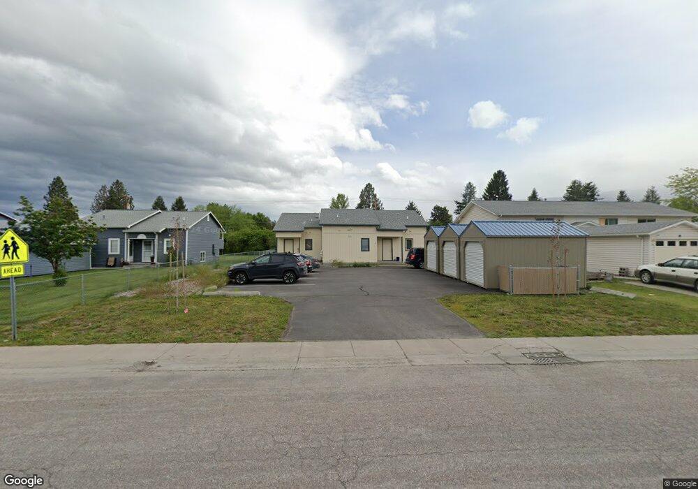
111 Tyler Way Unit A-B-C Lolo, MT 59847
Lolo NeighborhoodEstimated Value: $588,000 - $621,177
18
Beds
12
Baths
3,240
Sq Ft
$186/Sq Ft
Est. Value
About This Home
This home is located at 111 Tyler Way Unit A-B-C, Lolo, MT 59847 and is currently estimated at $603,059, approximately $186 per square foot. 111 Tyler Way Unit A-B-C is a home located in Missoula County with nearby schools including Lolo Elementary School, Lolo Middle School, and Sentinel High School.
Ownership History
Date
Name
Owned For
Owner Type
Purchase Details
Closed on
Mar 15, 2021
Sold by
Mcgowen Kiley
Bought by
Jim And Diane Big Sky Llc
Current Estimated Value
Purchase Details
Closed on
Mar 11, 2019
Sold by
Champion Group 1 Llc
Bought by
Mcgowan Kiley
Home Financials for this Owner
Home Financials are based on the most recent Mortgage that was taken out on this home.
Original Mortgage
$246,200
Interest Rate
4.4%
Mortgage Type
New Conventional
Purchase Details
Closed on
Oct 18, 2013
Sold by
Bartle John P and Bartle Sandra O
Bought by
Champion Group Llc
Create a Home Valuation Report for This Property
The Home Valuation Report is an in-depth analysis detailing your home's value as well as a comparison with similar homes in the area
Home Values in the Area
Average Home Value in this Area
Purchase History
| Date | Buyer | Sale Price | Title Company |
|---|---|---|---|
| Jim And Diane Big Sky Llc | -- | Stewart Title | |
| Mcgowan Kiley | -- | Stewart Title | |
| Champion Group Llc | -- | Title Services Inc |
Source: Public Records
Mortgage History
| Date | Status | Borrower | Loan Amount |
|---|---|---|---|
| Previous Owner | Mcgowan Kiley | $246,200 |
Source: Public Records
Tax History Compared to Growth
Tax History
| Year | Tax Paid | Tax Assessment Tax Assessment Total Assessment is a certain percentage of the fair market value that is determined by local assessors to be the total taxable value of land and additions on the property. | Land | Improvement |
|---|---|---|---|---|
| 2025 | $5,432 | $573,300 | $448,411 | $124,889 |
| 2024 | $4,867 | $420,600 | $267,355 | $153,245 |
| 2023 | $4,780 | $420,600 | $267,355 | $153,245 |
| 2022 | $4,954 | $367,200 | $0 | $0 |
| 2021 | $3,689 | $349,500 | $0 | $0 |
| 2020 | $3,842 | $294,100 | $0 | $0 |
| 2019 | $3,821 | $294,100 | $0 | $0 |
| 2018 | $3,480 | $267,800 | $0 | $0 |
| 2017 | $2,715 | $267,800 | $0 | $0 |
| 2016 | $3,186 | $249,800 | $0 | $0 |
| 2015 | $3,039 | $249,800 | $0 | $0 |
| 2014 | $2,990 | $137,222 | $0 | $0 |
Source: Public Records
Map
Nearby Homes
- 117 Tyler Way
- 11305 Napton Way
- NHN Dundee Rd
- 333 Cap de Villa
- 101 Ridgeway Dr
- 5702 Lonesome Dove Ln
- 11021 Coulter Pine St
- 10011 Bitterroot Gateway Unit 3
- 159 Highmore St
- NHN Hughes Ct
- 11385 Trillium Ln
- 10613 Coulter Pine St
- 246 Saint Johns St
- 10487 Coulter Pine St
- 6896 Jack Pine Ct
- TBD Kester Ln
- 10291 Coulter Pine St
- 0 U S 93 Unit Lot 4 30025598
- 0 U S 93 Unit Lot 1 30025579
- 9430 U S 93
- 111 Tyler Way
- 109B Tyler Way
- 109 Tyler Way
- 109 Tyler Way Unit A&B
- 109 Tyler Way Unit A
- 109 Tyler Way Unit C
- 115 Tyler Way
- 115 Tyler Way
- 115 Tyler Way Unit C
- 113 Tyler Way Unit B
- 113 Tyler Way
- 113 Tyler Way Unit C
- 113 C Tyler Way
- 107 Tyler Way
- 105 Tyler Way
- 116 Tyler Way
- 178 Ann's Ln
- 174 Ann's Ln
- 103 Tyler Way
- 119 Tyler Way